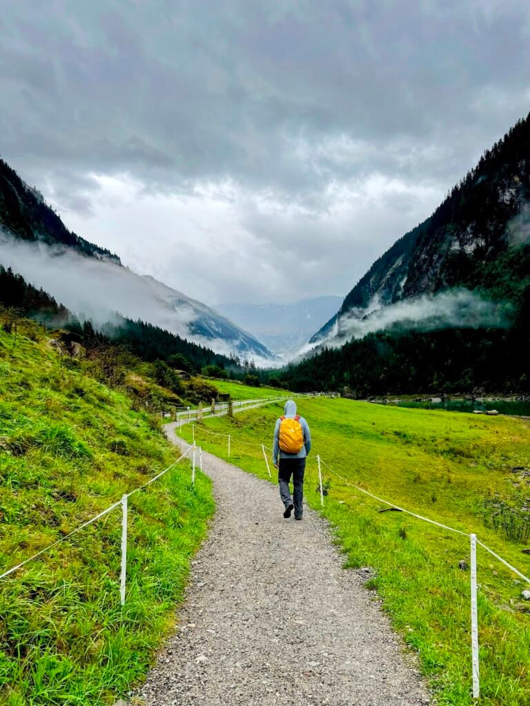
Austria is the perfect base for hiking adventures with the stunning Alps offering well-marked trails among breathtaking peaks, glittering lakes, and lush valleys. We love the balance of nature and infrastructure such as cable cars and fully-serviced mountain huts that make the time on trail a joy.
Here, we outline some of the best day hikes on offer in Austria, as well as some bonus adventures in the surrounding areas.
Trip Overview & Tips
Based on our larger trip itinerary, we flew in and out of Munich, Germany, and stayed in the following towns as part of our road trip route:
Bad Goisern | 5 nights
Kaprun | 2 nights
Mayrhofen | 2 nights
Schröcken | 4 nights
Driving on Austrian Motorways
To drive on Austrian motorways (Autobahn) and expressways (S-roads), you need a vignette linked to your license plate before you start driving. We found it easiest to purchase a digital vignette online via the official ASFINAG website. Once we had our rental car, before leaving the parking garage in Munich we were easily able to purchase a 10-day vignette online within minutes for around €5.
Austria also charges an extra section toll (Streckenmaut) for specific, costly alpine tunnels and passes. These are separate from the standard vignette, and generally cost between €10-€18 for single trips. The toll is payable by cash or credit card at the toll booth.
Austria Hiking & Adventure Map
Salzburg & Carinthia Regions
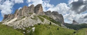
5 Huts Trail (5 Hüttenweg)
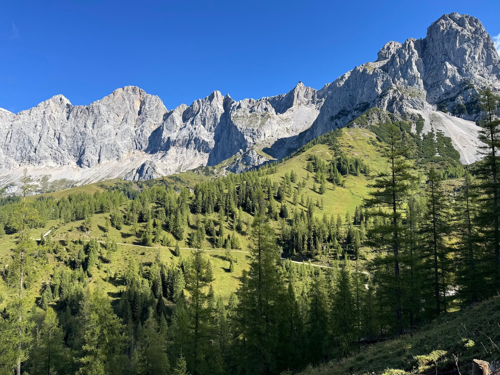
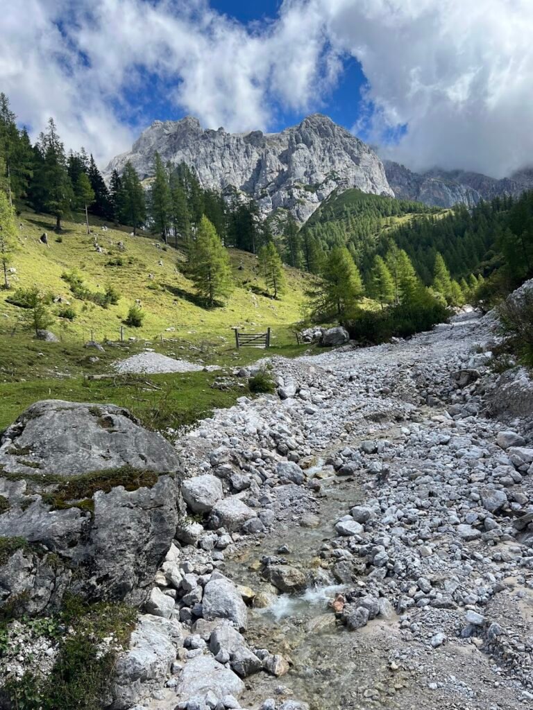
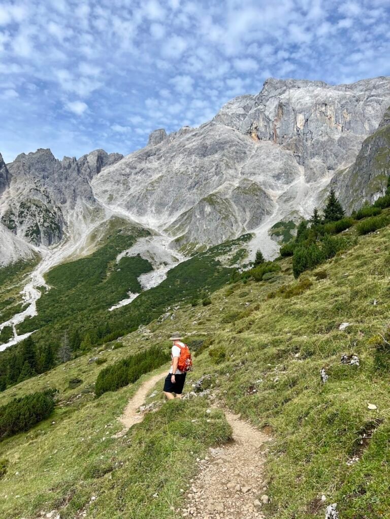
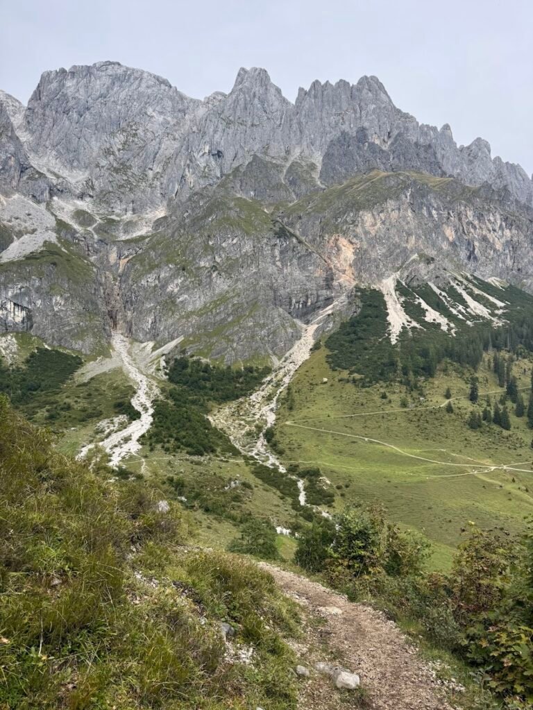
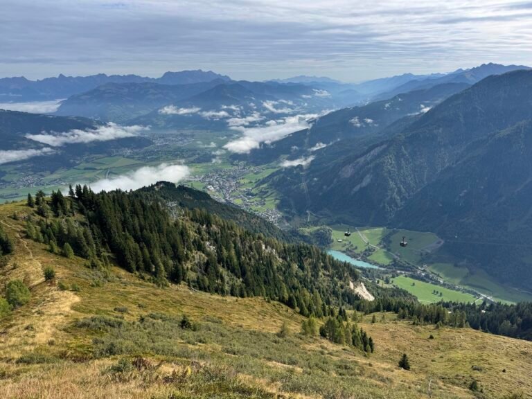
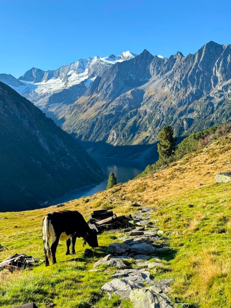
This was the first hike we did in Austria and we found it to be the perfect introductory hike given it required relatively little effort, yet had amazing views of the Dachstein mountains. We saw mountain peaks, cows, cute mountain huts, a cable car, and even heard a yodeler!
The hike begins counterclockwise with the first part of the hike up a wide, gravel road. You will pass through the scenic Brandalm with its tiny chapel and then continue on through a meadow before reaching the Dachstein Glacier Cable Car valley station.
Up until this point we had seen very few people, but the cable car station was very crowded. This is a great place to stop and use the bathroom before continuing on the steep climb to the Dachstein Südwandhütte. The views from this mountain hut, the highest point along this hiking loop, are spectacular! If you are’t up for the hike, taking the cable car here instead would be a great option.
We think the views from this point on are some of the best of the whole hike. The trail descends sharply via a set of switchbacks through alpine pastures (watch for grazing cows!) and a patch of forest, eventually passing over the winding toll road that leads to the cable car station, before re-joining the path where you began your day.
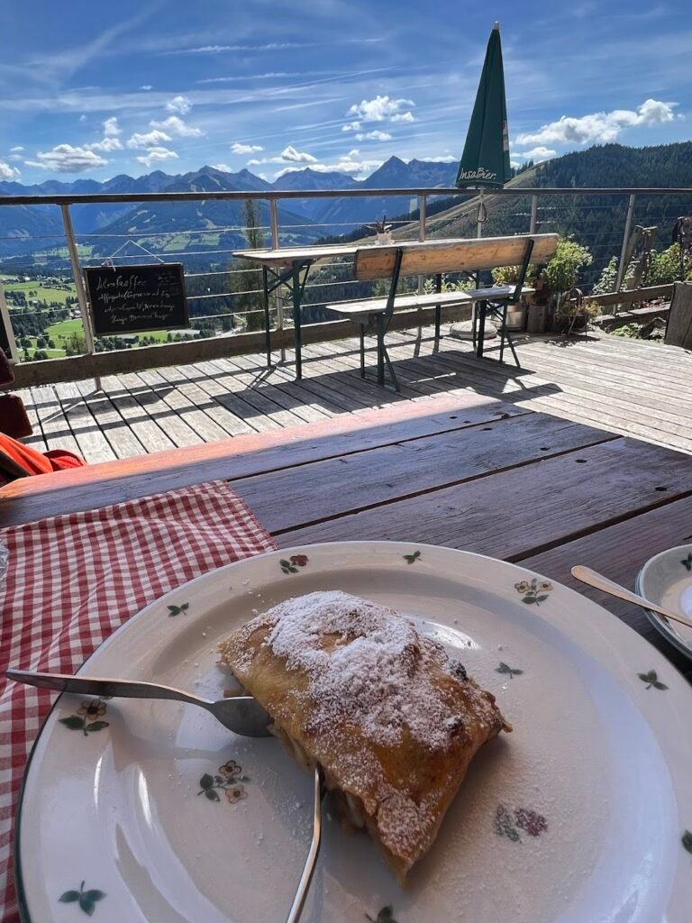
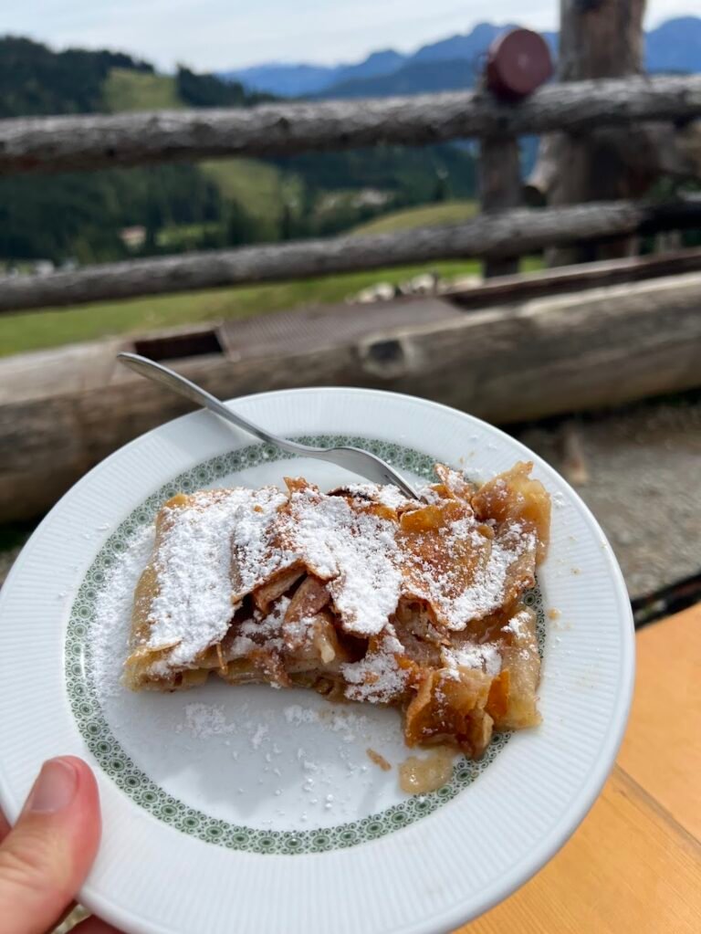
There were so many huts along this hike, but we chose to stop at Dachsteinhaus near the very end. We celebrated our hike with an affogato, cappuccino, and slice of apfelstrudel. From the patio of Dachsteinhaus diners are treated to views of the farmland covering the Ramsau plateau below.
One final note: To complete this trail as outlined here, we recommend downloading and following the AllTrails map, as simply following the 5 Hüttenweg signs along the way will result in a slightly different, less scenic route.
Hike Details
10.2 miles | 2,700 feet elevation gain | 5 hours to complete
Drive to the location listed as "Alpengasthaus Edelbrunn" on your map.
There are several parking options including a cash coin-only set of spots close to the Alpengasthaus Edelbrunn for €4, or there is a parking lot just below for €8 where you park and pay upon exiting, based on your license plate.
No fee for trail use, but you may want to bring along some cash for a snack at one of the huts.
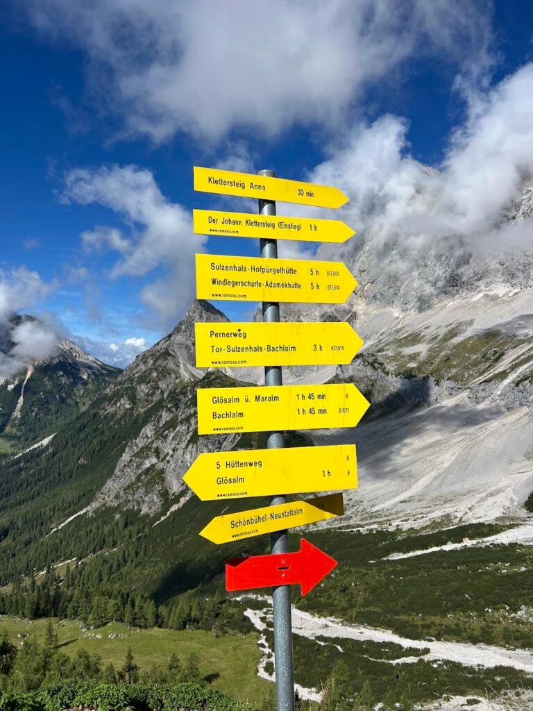
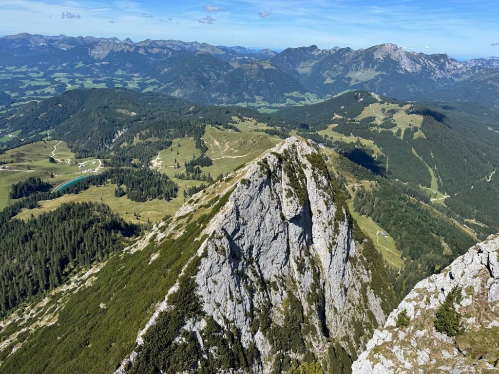
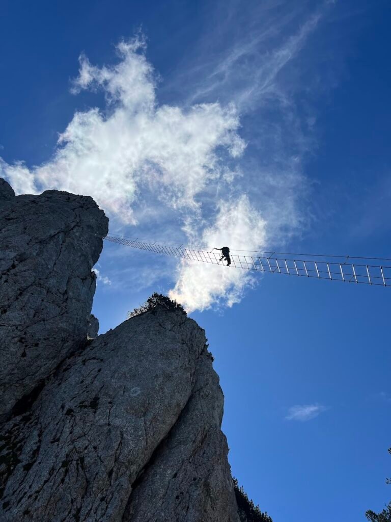
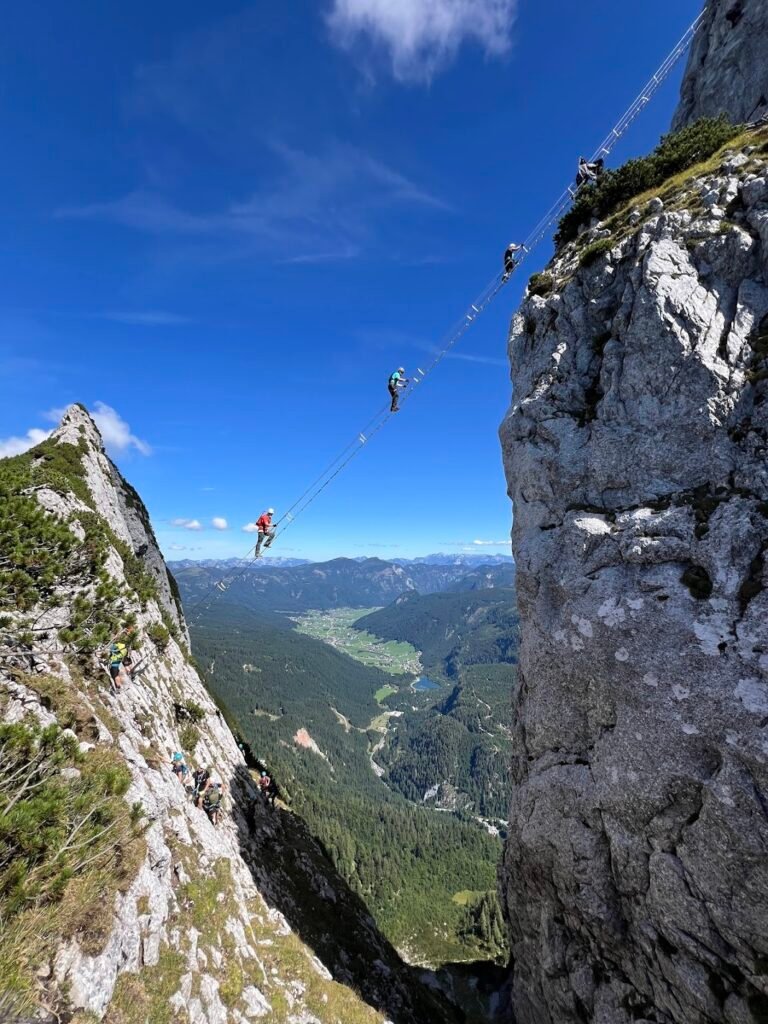
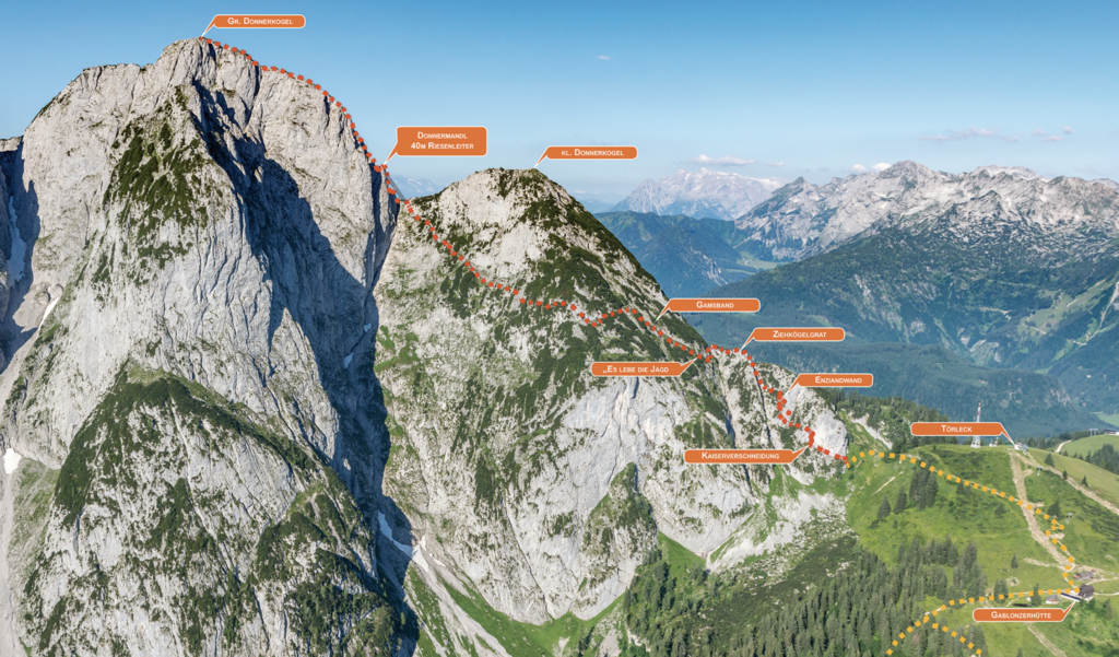
Sky Ladder | Stairway to Heaven (Via Ferrata on the Großer Donnerkogel)
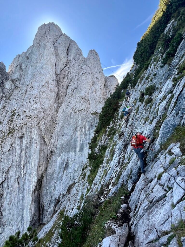
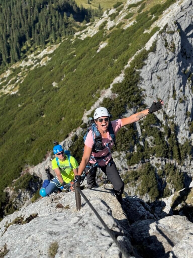
The via ferrata route on the Großer Donnerkogel is famous thanks to the 130-foot long Sky Ladder which helps climbers cross a massive gorge below. Using the Stairway to Heaven, as its otherwise known, is fun but the views along the way of the Dachstein mountains and Lake Gosausee below are some of the best parts of the adventure.
We rented via ferrata gear (harness, via ferrata lanyard, and helmet) from the Sport Jirka shop located in the valley station of the Gosaukammbahn and had a fantastic experience.
To get to the start of the via ferrata route, take the Gosaukammbahn cable car from Lake Gosausee up to the Zwieselalm. Cable cars start running at 8am. Complete the 20-minute hike past Gablonzer Hütte and up trail 611 to the start of the via ferrata route.
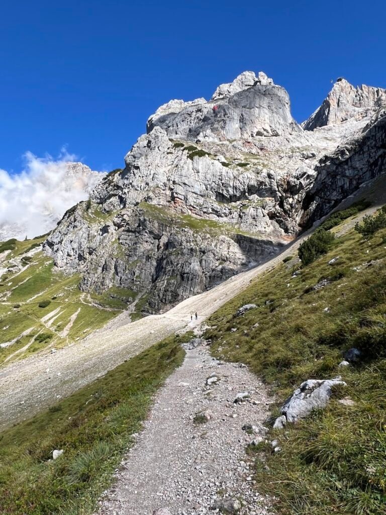
The overall rating for this via ferrata is C/D on the A-E difficulty scale, meaning it’s moderate to difficult. We found the initial portions of the route to be fairly straightforward. The Sky Ladder is reached approximately 2/3 into the climb and is itself rated “B”. The hardest part of the route for most people is directly after exiting the ladder as it is very exposed and requires a lot of upper body strength to make the scramble to the top of the rock formation.
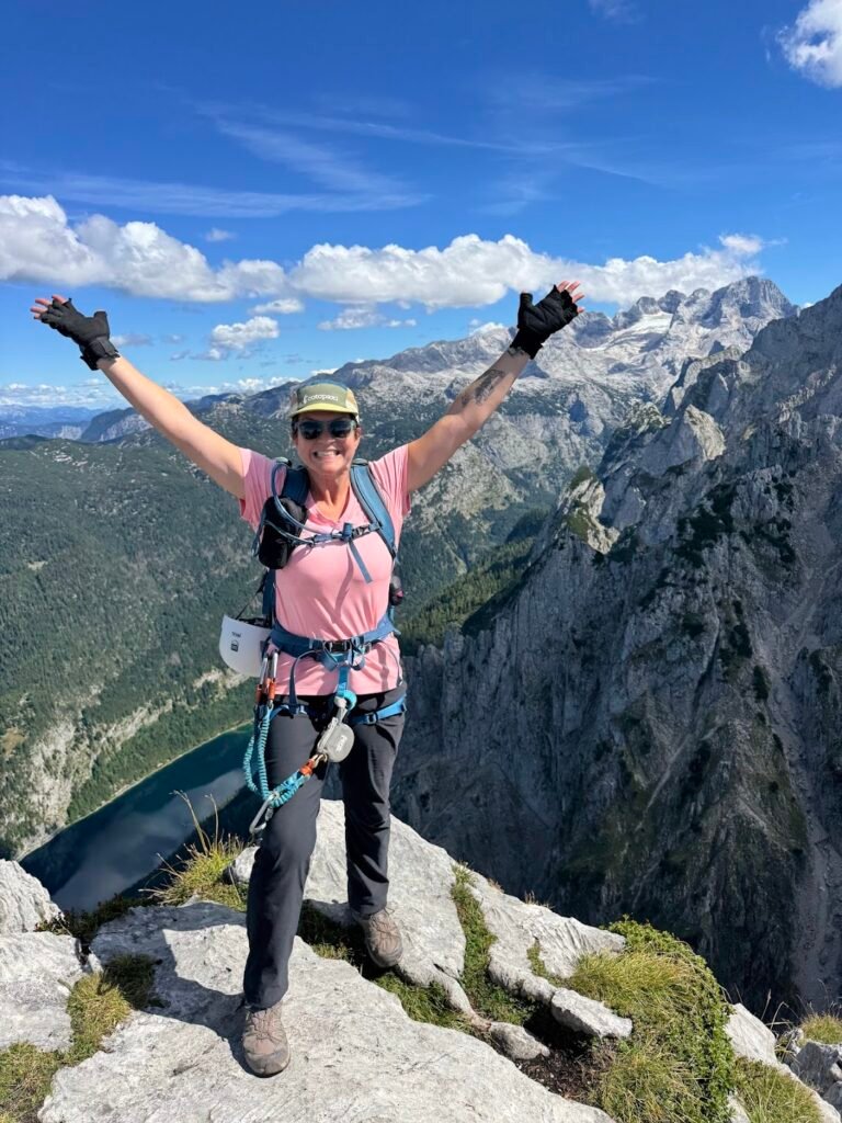
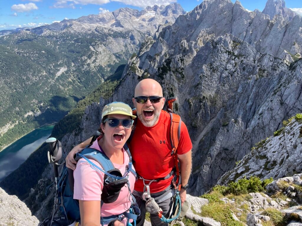
After the Sky Ladder there are a few more pushes before reaching the cross marking the summit of Großer Donnerkogel, standing at 6,739 feet of elevation. From the summit there are views of the Dachstein Glacier, the surrounding mountains, and the entire Gosau Valley far below. This is the perfect place to eat lunch while soaking in the views before starting the trek down.
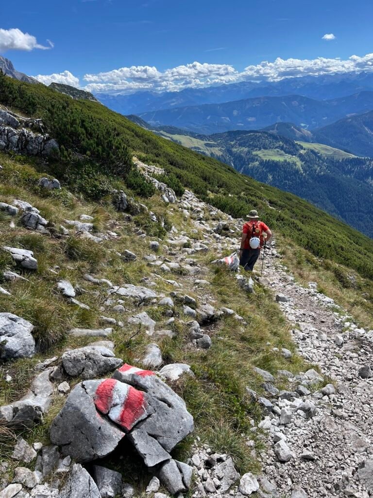
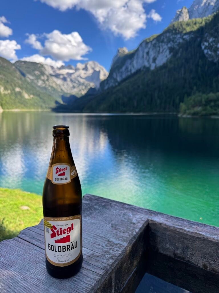
Some people say the hike down the other side of the mountain is the toughest part of the day. You’ll probably be exhausted by this point and the descent is a slog down steep rocks and loose scree to reach the trail you began at earlier in the morning. After taking the cable car down, we highly recommend enjoying a beer at the lake to celebrate a successful day!
A note on our experience: Our entire adventure took over 7 hours to complete, when the norm is likely closer to 5 hours. Despite taking an 8:30am cable car up, we got stuck behind an extremely slow group of climbers, resulting in it taking us 5 hours just to reach the summit. While we are ultimately happy to have completed this via ferrata (it was a dream for over five years), this a very popular, crowded route. Bring your patience and lots of water and snacks, preparing for a long day out.
Check out the video below for a first-person POV along the via ferrata.
Map credit: Dachstein west (https://www.dachstein.at/en/summer/via-ferrata-donnerkogel)
Hike Details
3.8 miles | 1,860 feet elevation gain | 7 hours, 15 mins to complete
Drive to the location listed as "Gosausee Parking Lot" on your map. This is the closest parking area to the Gosaukammbahn and lake.
There is a large parking area here for €10 per day, payable by credit card at automated kiosks. If you are getting an early start, there should be plenty of parking, but if it's full there are other lots along the road.
No fee for trail use. A roundtrip ticket on the Gosaukammbahn was €25 with the first run up of the day at 8am. We paid €29 to rent via ferrata gear for the day from Sport Jirka.
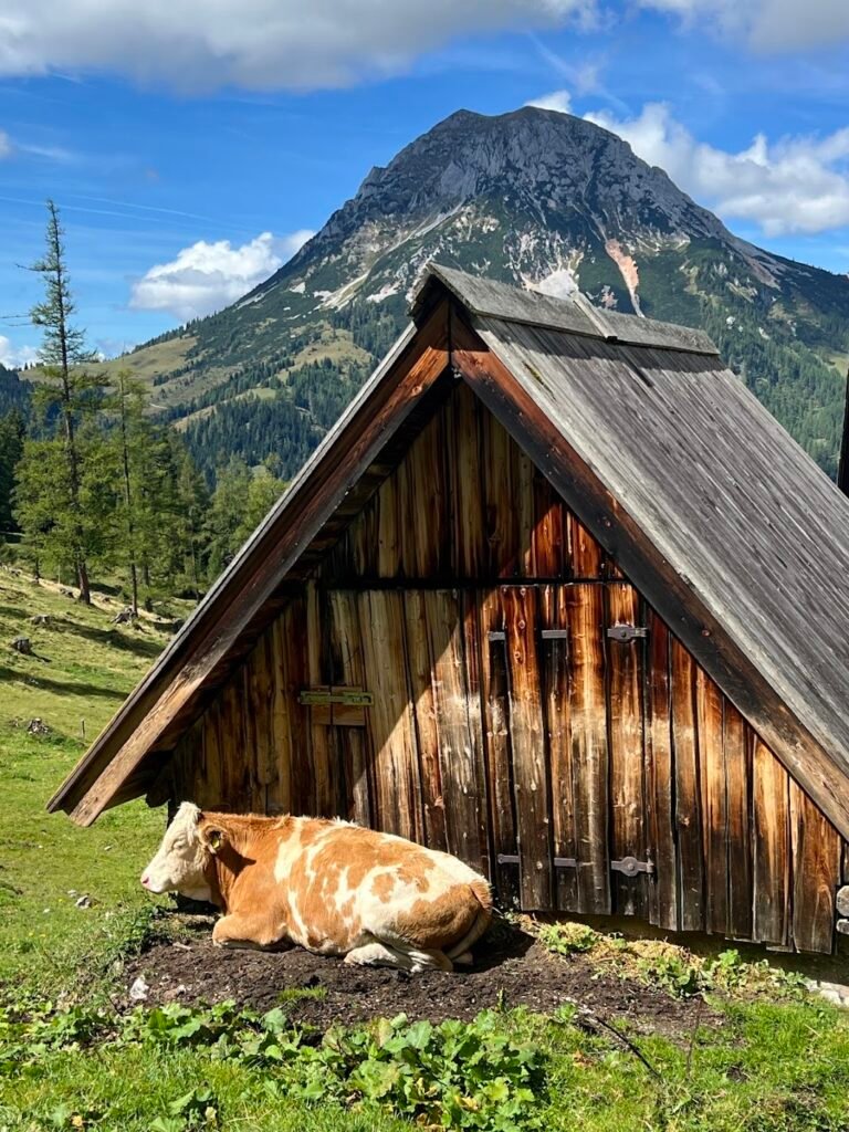
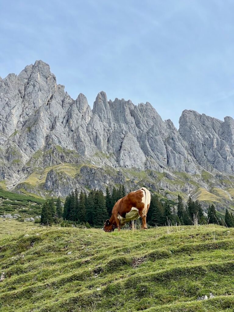
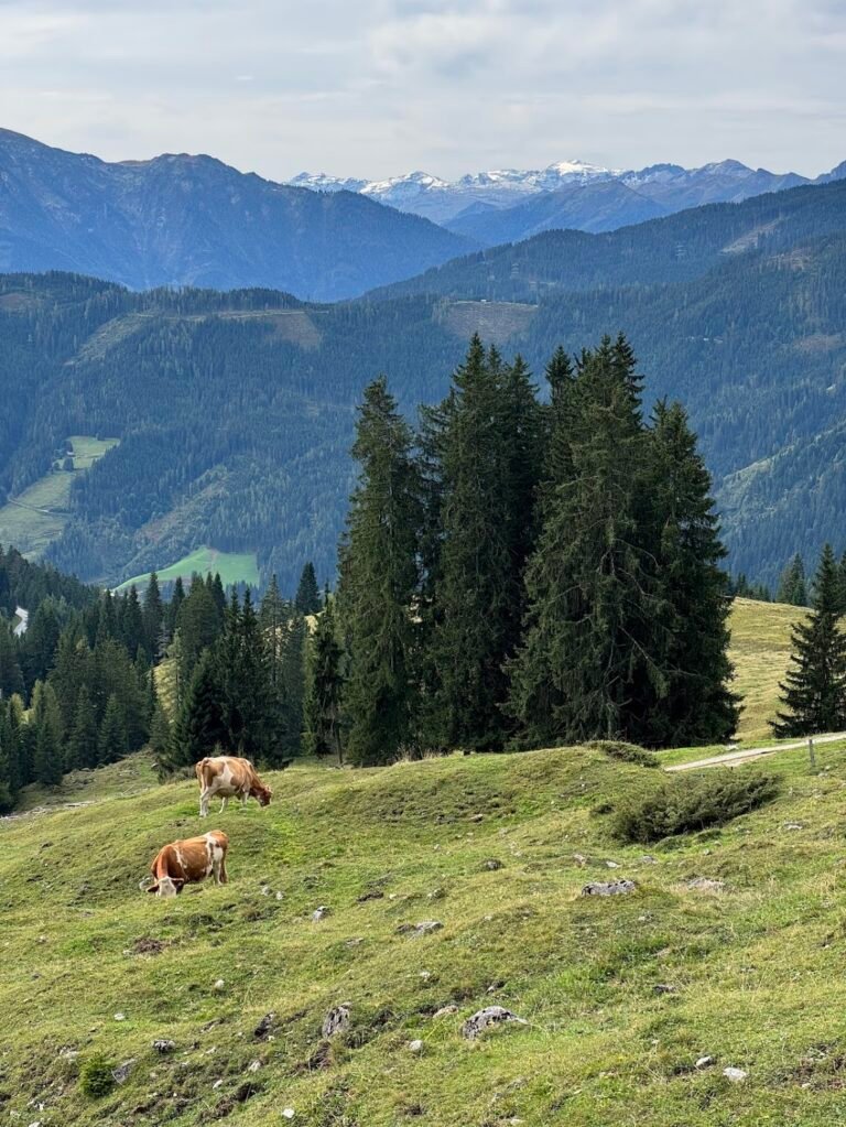
Hochkeil & Mühlbach High Trail: Arthurhaus to Erichhütte (Hochkönig)
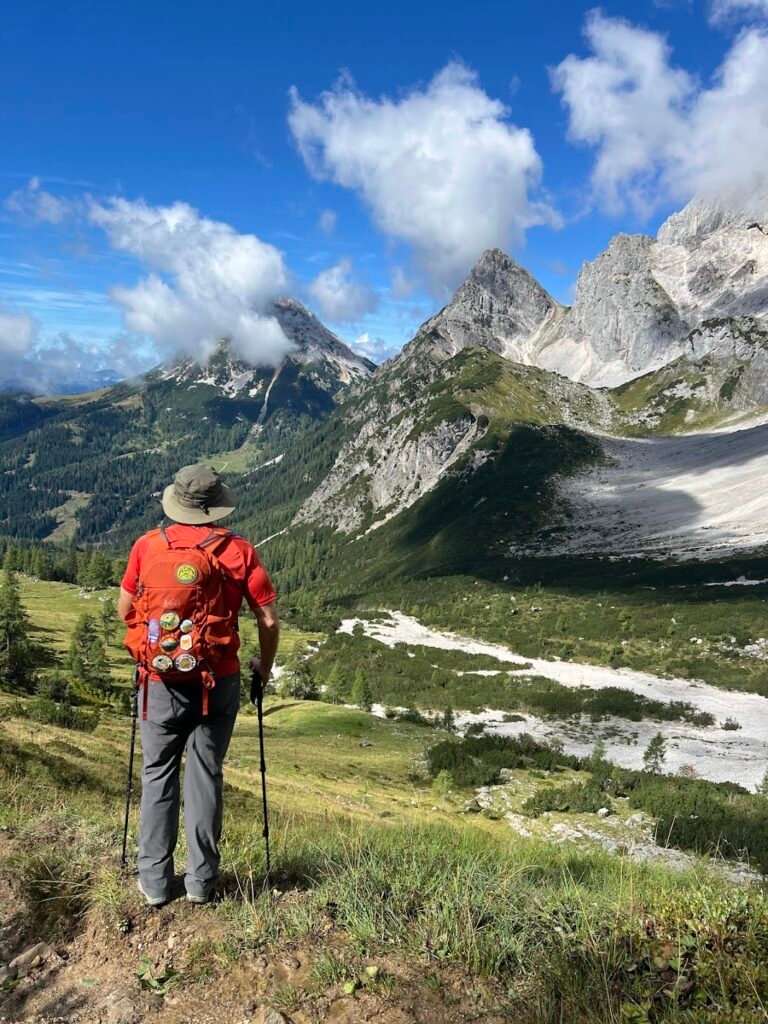
Skirting around the foot of the Hochkönig Mountains, this hiking trail is part of the long-distance Salzburg Almenweg. It makes for a beautiful day out visiting idyllic alpine pastures and passing by several mountain huts, all in the shadow of the impressive Hochkönig formations.
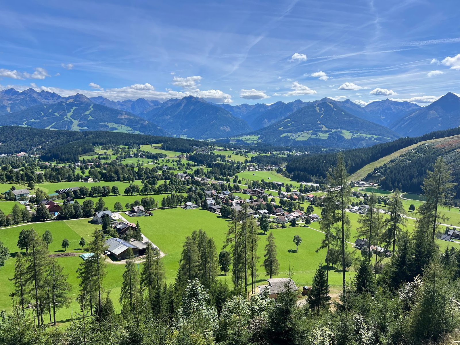
If you like, you can begin the day by making the short climb up to Hochkeil which departs from the same parking area. This trail gains nearly 1,000 feet of elevation, but it’s all done via a wide, old forest road, so it’s easy going. To be honest, the scenery along this gravel track is not interesting, but trust us, the views at the top are worth it! At the summit there are amazing views of the Hochkönig directly to the north, as well as distant mountains covered in snow and glaciers. The wide plateau of the summit area has a summit cross, benches, and even a vintage gondola.
Retrace your steps back down to Arthurhaus and set off on trail towards Erichhütte. Here the trail will wind through pastures filled with grazing cows, patches of forest, and gorgeous meadows. It’s hard not to get distracted by the towering limestone peaks that remain in your field of vision.
The trail passes by the Riedingtal Waterfalls and crosses a few streams before reaching the Vier Hütten (4 Huts) area. Here there are plenty of choices to stop and take a rest with a view. When we were hiking we passed through a celebration of locals who were herding sheep, which was quite rowdy and fun. We chose to eat our packed lunch on a bench and turn around at the 4-mile point. Though by using public transportation you can complete this as a 6.1-mile one way hike.
On our way back to Arthurhaus we stopped at Windrauchegg Alm, a charming 135-year-old hut known for serving delicious, homemade alpine products. We opted for cappuccinos and warm apfelstrudel to fortify ourselves for the rest of the hike.
Hike Details
13.5 miles | 2,210 feet elevation gain | 6 hours, 20 mins to complete
Drive to the location listed as "Arthurhaus" on your map.
There is a large, paid parking area near the trailhead. We paid €8 to park for the day. This is payable via cash only at an automated kiosk located in the parking lot. Pay before exiting.
No fee for trail use.
Alexander Enzinger Weg
The Alexander Enzinger Weg is a high-altitude panoramic hike. It can be done as an out-and-back, as we did, or one-way, thanks to the area’s network of cable cars. We chose to begin our hike by taking the MK Maiskogelbahn cable car from Kaprun to the upper terminus.
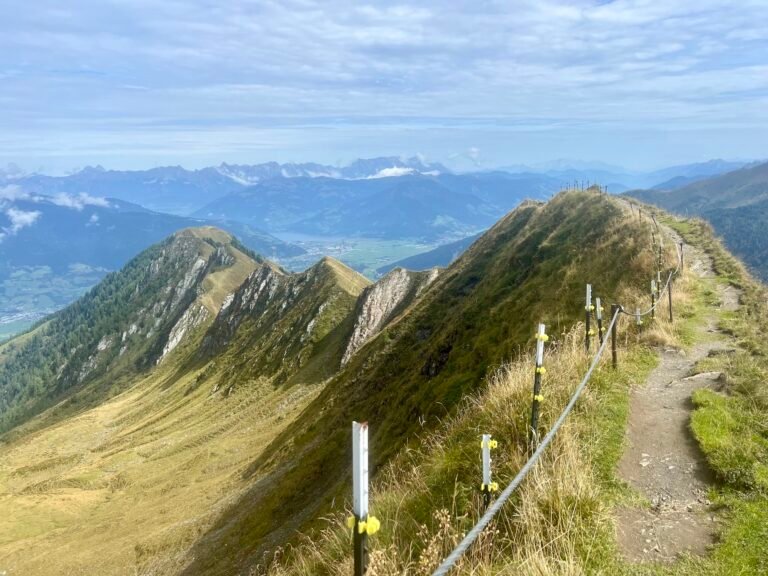
Initially the trail climbs steeply along a gravel road used by the ski area, underneath cable cars whisking visitors up towards the glaciers of Kitzsteinhorn. This makes the first 1/2 mile feel kind of “meh”, but the trail gets infinitely better as it climbs straight up a mountainside and onto an exposed ridgeline where there are valley views below on either side.
There are several more narrow, exposed ridgelines and as you continue to hike the views of Kitzsteinhorn get better and better. There are also lush green pastures and rushing waterfalls, making the trail feel almost Icelandic. You can continue on to Alpine Centre on the Kitzsteinhorn, or simply turn around when you’ve had enough. We ate our lunch on a picturesque rock 3.5 miles into the hike and then turned around.
Pro tip!: Don’t miss the alpine coaster, Maisi Flitzer, at the bottom of the cable car station in Kaprun. A ride on it is a great way to end the day. Check out our video below!
Hike Details
7.3 miles | 2,860 feet elevation gain | 4 hours, 20 mins to complete
Drive to the location listed as "MK Maiskogelbahn Talstation" on your map which is the base station for the cable car. This is essentially in downtown Kaprun.
There is a large, free parking lot.
No fee for trail use. Riding the MK Maiskogelbahn cable car was free as part of the Summer Card provided by our accommodation in Kaprun. Be sure to check the website for current operating hours and pricing.
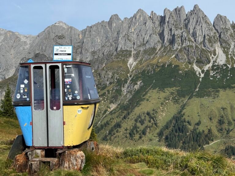
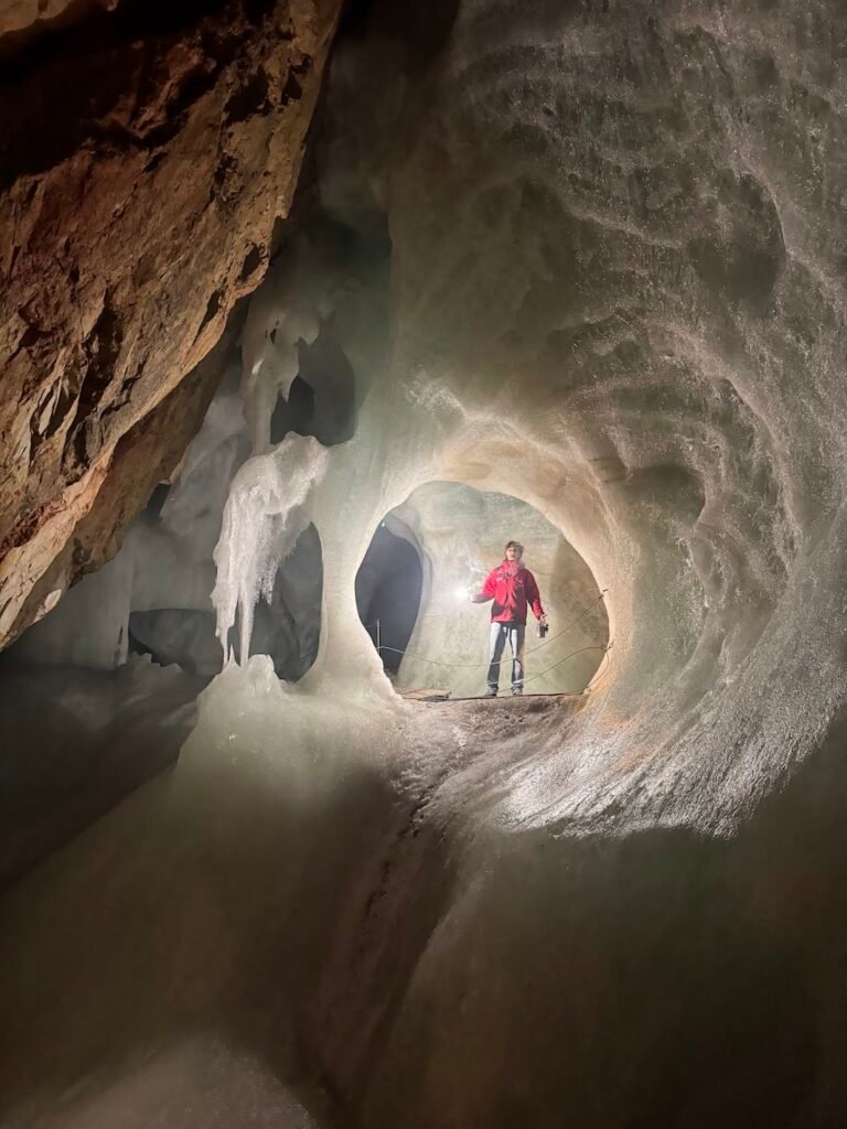
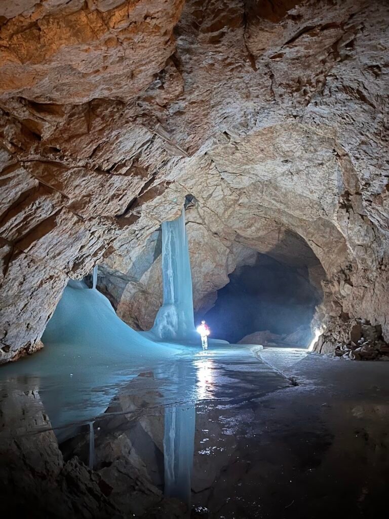
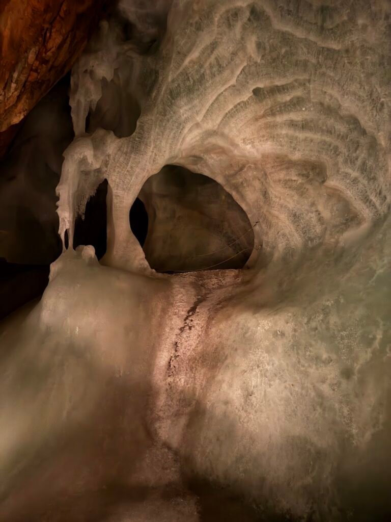
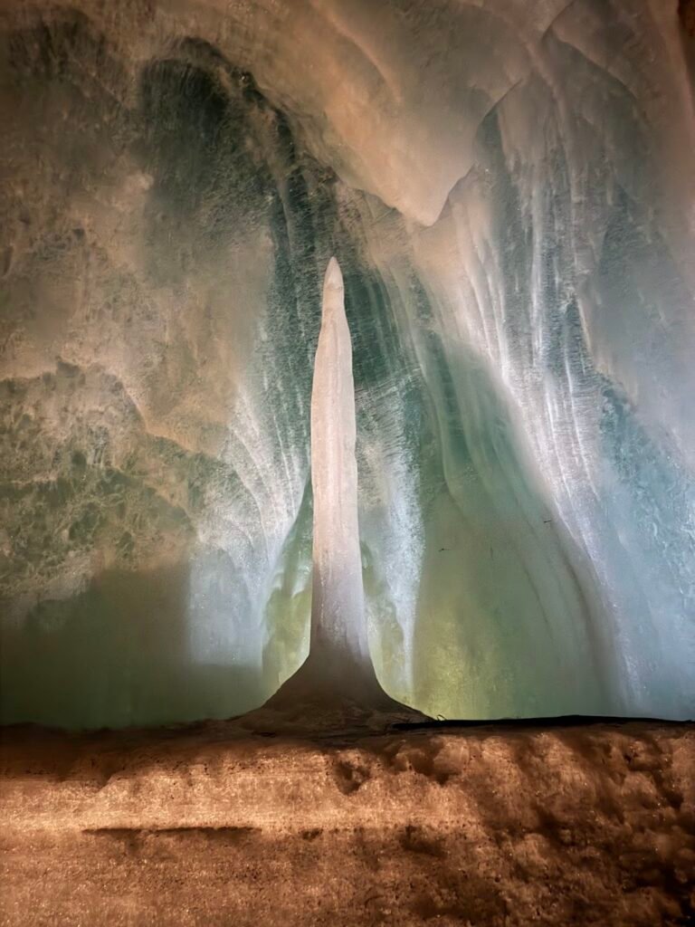
Bonus Adventure: Eisriesenwelt (The World's Largest Ice Cave)
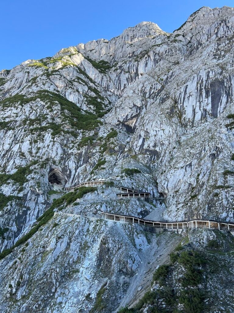
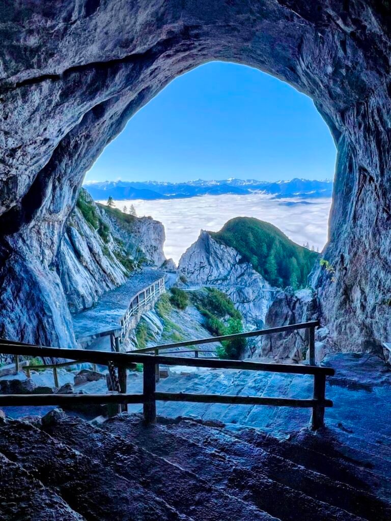
Eisriesenwelt, meaning “World of Ice Giants”, is the world’s largest ice cave, extending over 25 miles deep into the mountain. The first section is open for visitors to explore on a guided tour. But getting to the mouth of the cave is an adventure itself!
First, you must complete a 20-minute walk up a paved path to the gondola station. In under 5 minutes the steepest gondola lift in all of Austria whisks you up into the Tennengebirge Mountains. And finally, there is a further 20-minute hike up a steep set of switchbacks that had us sweating. Be sure to savor the views along the way!
Guided tours in various languages are offered and last about 1.5 hours. We learned both scientific information and historical facts about the cave and passed by amazing formations carved into the ice. They were pretty unbelievable and this experience is one we highly recommend if you’re in the area. Eisriesenwelt is open seasonally, so it’s best to check hours and make an advance booking on their website.
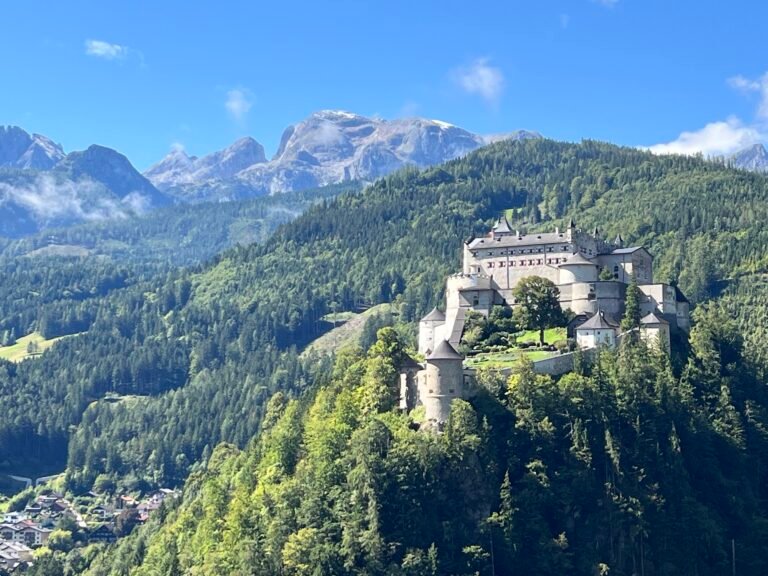
Pro tip!: There is a fantastic view of the Hohenwerfen Castle castle on the drive up the 3-mile long access road to the ice caves. It’s a great photo opportunity!
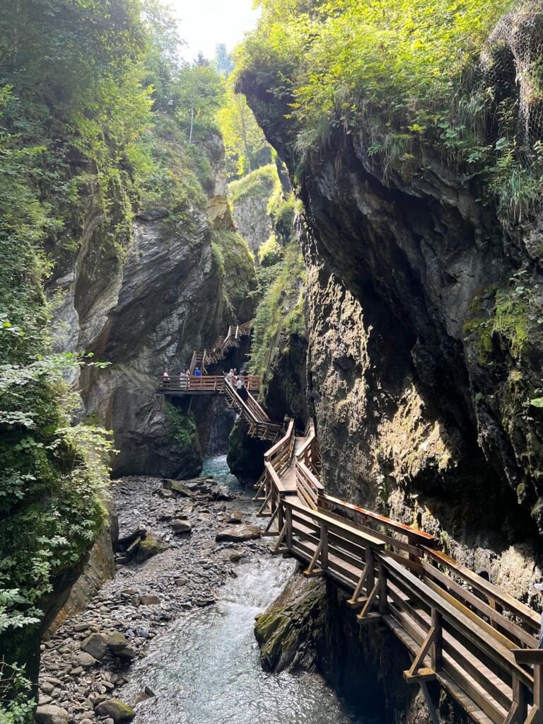
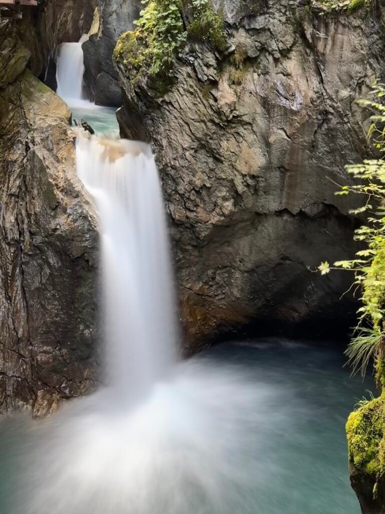
Bonus Adventure: Sigmund Thun Klamm
Sigmund Thun Klamm is a narrow gorge carved by glacial meltwater located in the town of Kaprun. As a visitor, you traverse the gorge via a one-way path along wooden boardwalks. The trail is less than one mile in length and based on our experience, the time will fly by as you marvel at the cascading water. Once finished, you exit and simply walk back to your car.
Sigmund Thun Klamm is open seasonally, so it’s best to check hours on their website. We visited for free as part of the Summer Card provided by our accommodation in Kaprun.
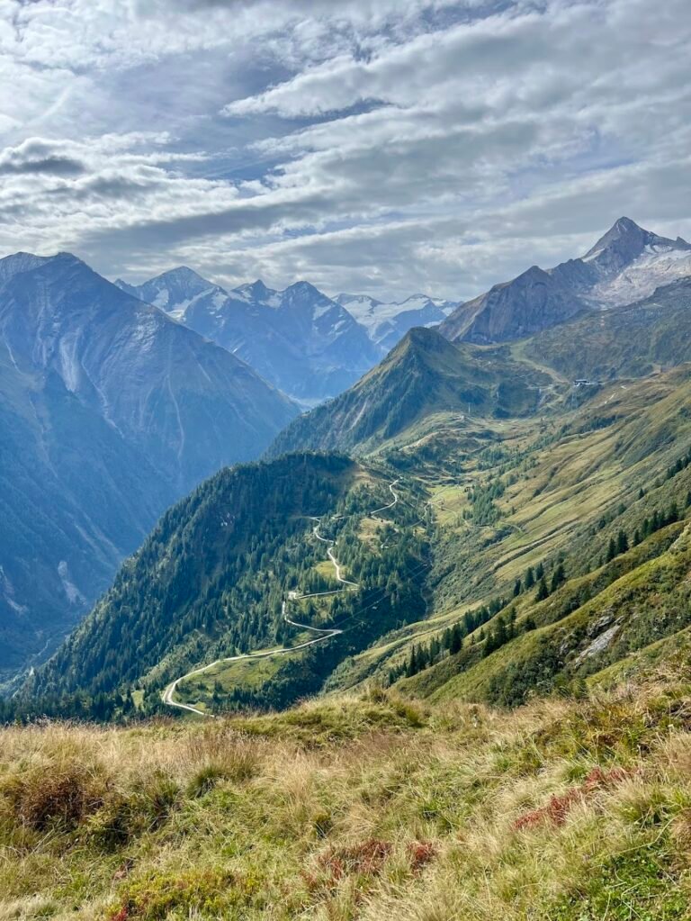
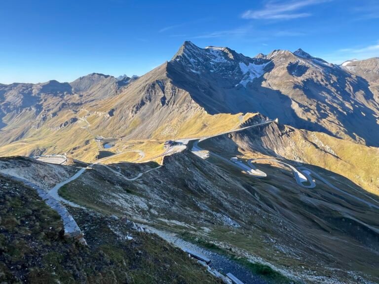
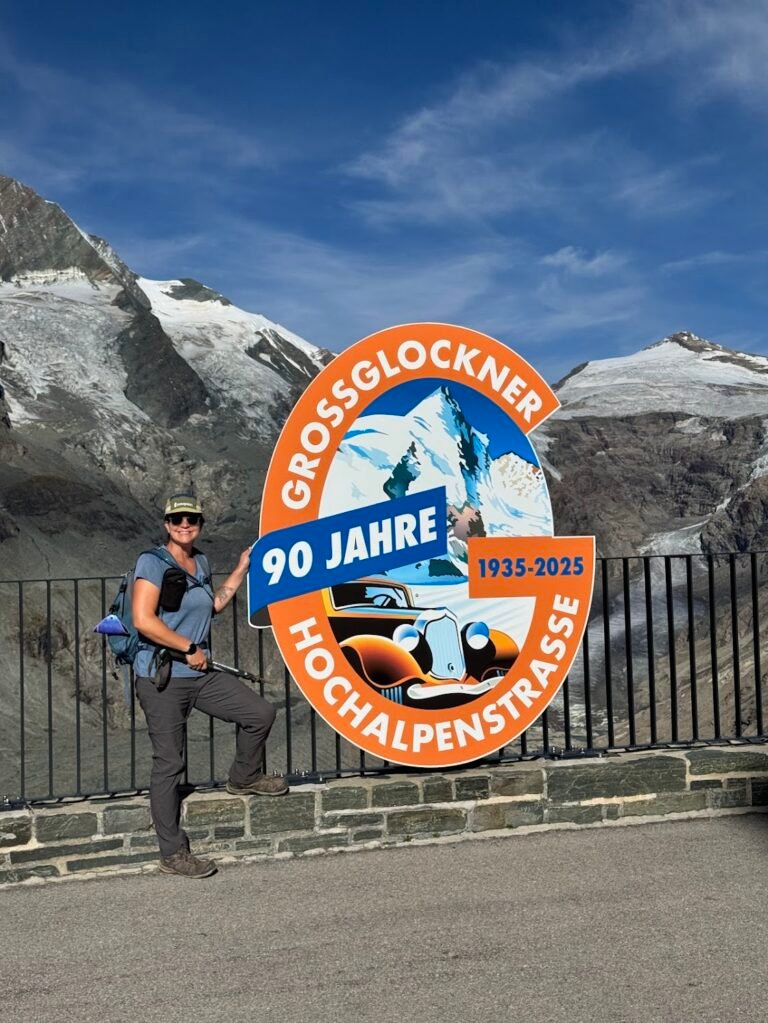
Bonus Adventure: Grossglockner High Alpine Road (Großglockner Hochalpenstraße)
Grossglockner High Alpine Road is a 30-mile road with 36 hairpin turns leading straight into the heart of the Hohe Tauern National Park. Paved its entire length, the road is very accessible by car, motorcycle, or even bicycle. It is pricey, with a day pass for a car costing €45 when we visited. The ticket price includes unlimited use of the road for one day, parking, exhibitions, and museums.
We entered and exited via the north entrance (Fusch an der Großglocknerstraße) in Salzburg and drove towards the south entrance (Heiligenblut am Großglockner) in Carinthia. You can easily spend one whole day driving the road, marveling at the views, and doing a hike or two.
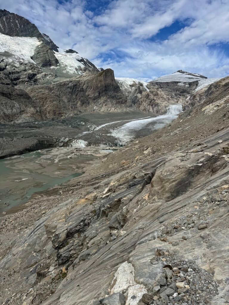
We really enjoyed stopping at Edelweiss-Spitze, the highest point along the road, and Kaiser Franz Josefs Höhe, which has a visitor center, lookout point, and trails. At Kaiser-Franz-Josefs-Höhe, don’t miss the short uphill walk to the Wilhelm Swarovski Observatory. The inside is beautiful and there are telescopes pointed at Grossglockner. We could clearly see the climbers, and even one person standing victorious at the summit of Austria’s tallest mountain. So cool!
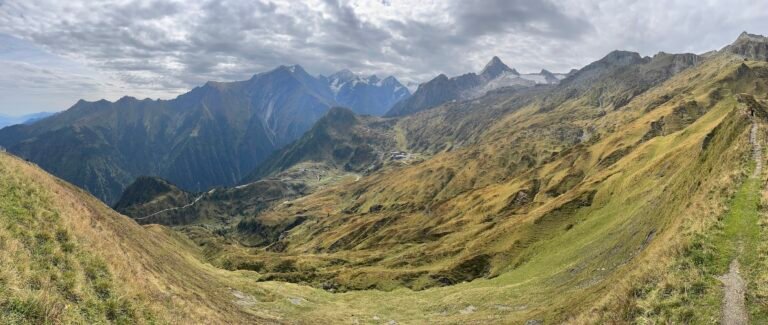
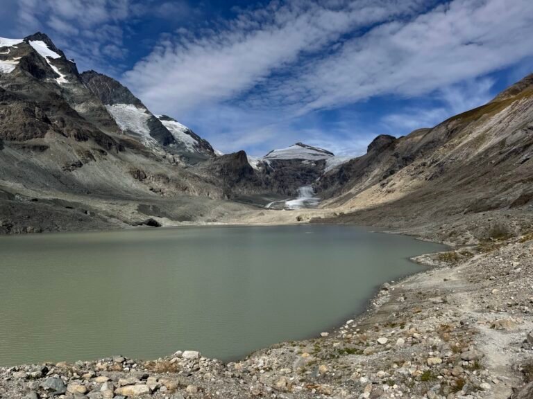
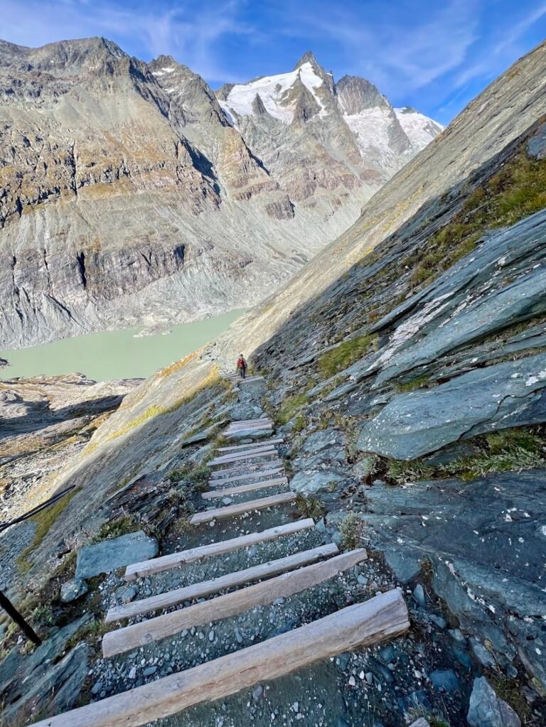
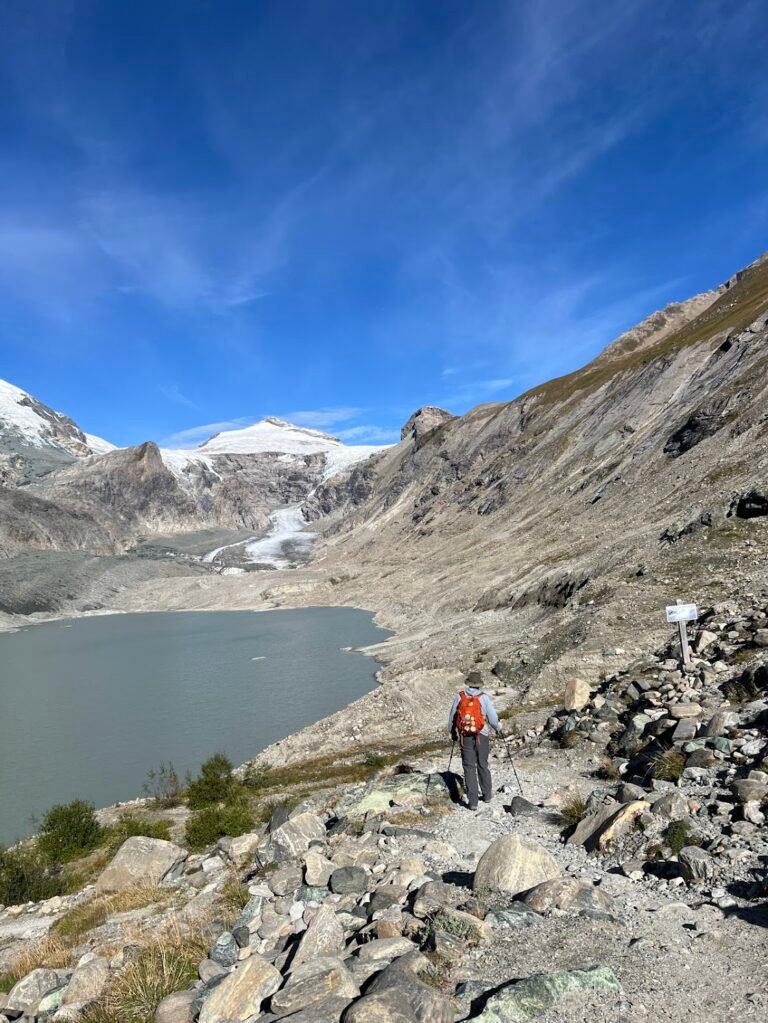
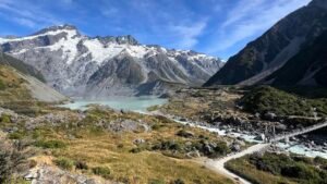
Pasterze Glacier Trail
To get a closer look at Pasterze Glacier, the largest remaining glacier in the Eastern Alps, we recommend this hike. Departing from Kaiser-Franz-Josefs-Höhe, the trail descends very steeply down a set of stairs, eventually reaching Lake Sandersee.
While you can stop your hike here, we recommend traveling even further along the shore towards Pasterze Glacier. Along the way, you’ll feel as if you’re in the shadow of Grossglockner, Austria’s tallest mountain peak standing at 12,461 feet. We followed the trail which was well-marked by tall poles placed periodically in the rocks. Simply turn around whenever you feel you’ve had enough. We ended our hike 1.75 miles in, which was where the pole markings ceased.
Hike Details
3.5 miles | 1,160 feet elevation gain | 2 hours, 20 mins to complete
Drive to the location listed as "Kaiser-Franz-Josefs-Höhe" on your map.
There is a large parking garage, free to park at as it is included in your road toll.
No fee for trail use.
Tyrol Region
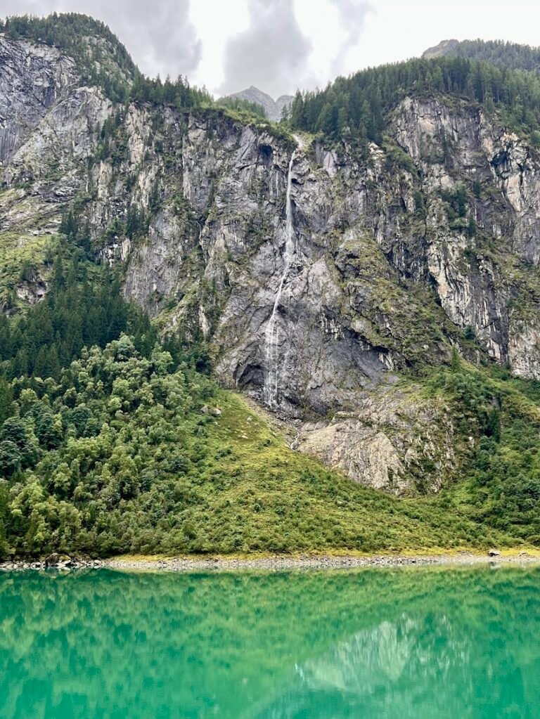
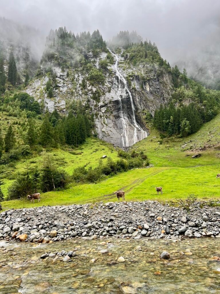
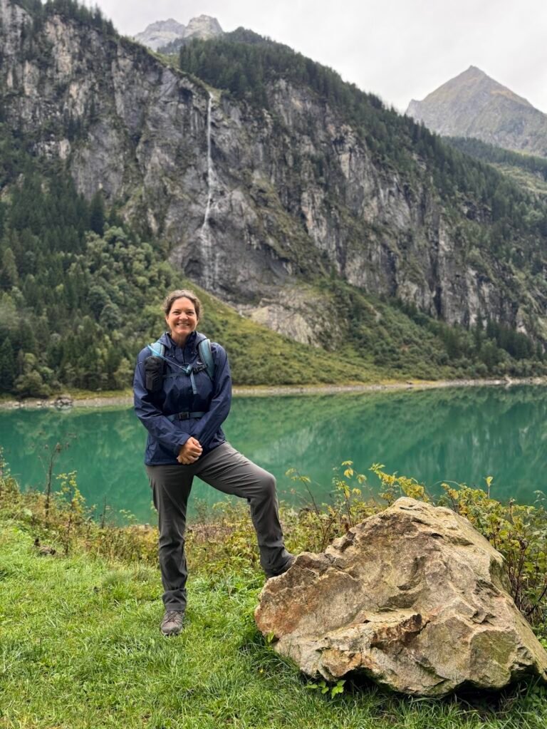
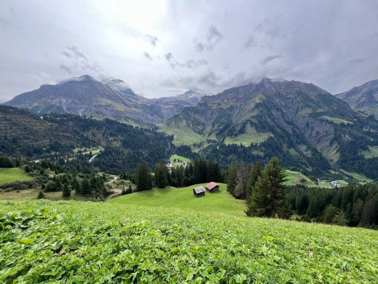
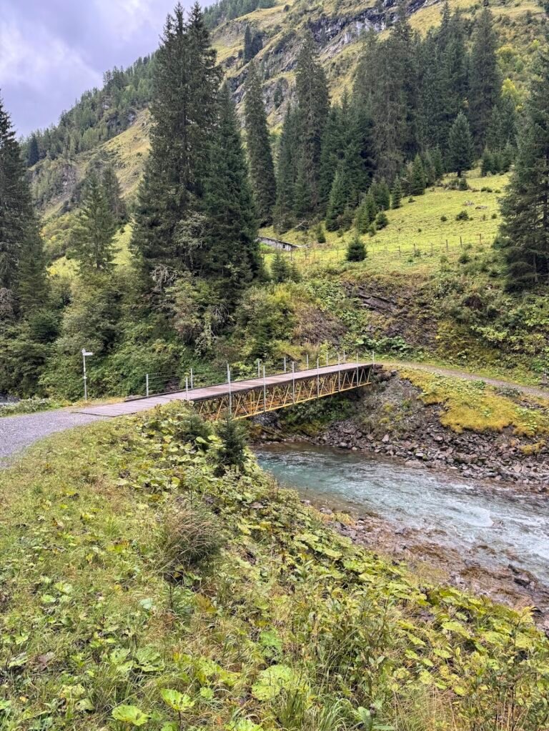
Wasserfallweg at Stillup Reservoir (Alpengasthaus Wasserfall ---> Grüne Wand Hütte)
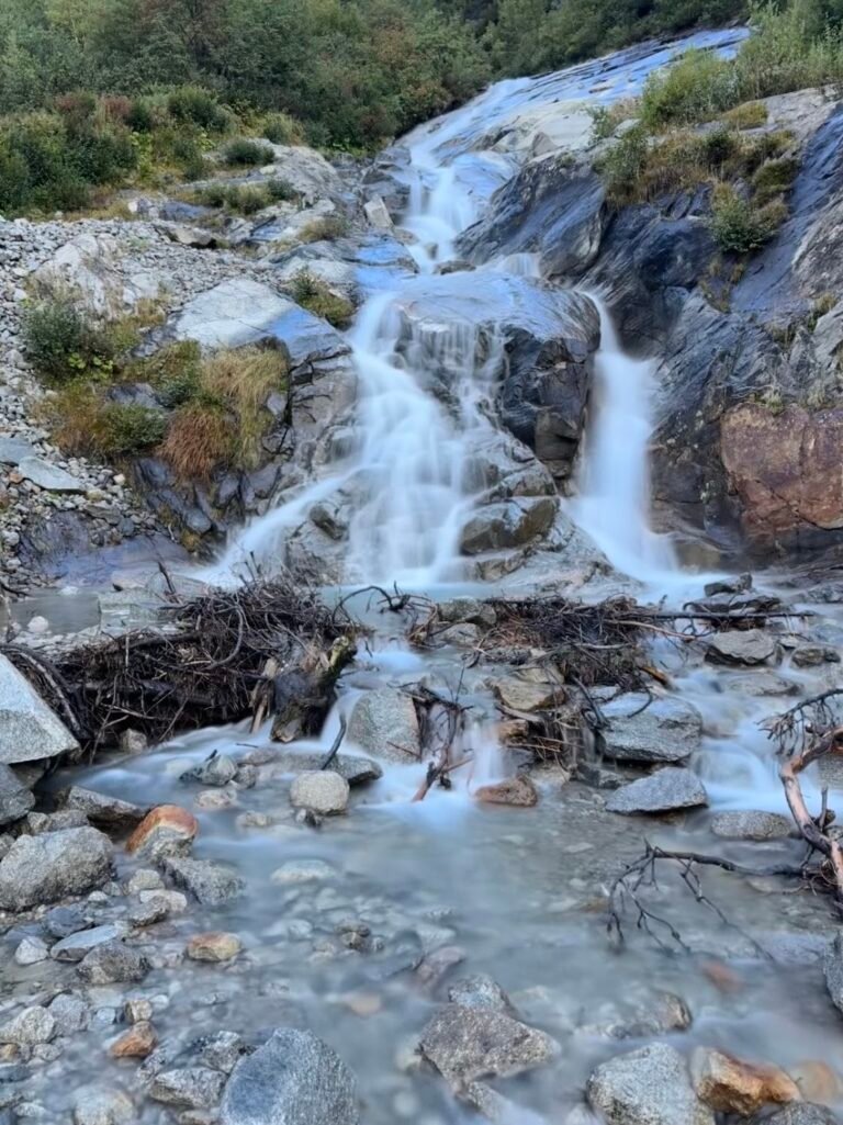
The Wasserfallweg near the Stillup Reservoir is the perfect rainy day hike. The watertfalls and views of the lush Stilluptal Valley, part of the Zillertal Alps, are only enhanced by additional water. The trail is undemanding yet beautiful, and starts at the Gasthaus Wasserfall continuing in the direction of the Grüne Wand Hütte.
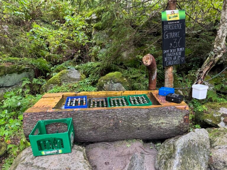
The undulating path hugs the shores of the reservoir, then passes through alpine pastures filled with grazing cows. You’ll become very adept at opening and closing all the cattle gates along the way! Of course, the waterfalls tumbling down the cliffs from high above are the star of the show. A fun and unique offering we encountered along the way were self-serve beer bars fit into holzbrunnen!
On this trail, you can walk as far as you are interested and return the way you came. We did not go all the way to Grüne Wand Hütte as the rain started coming down hard, but we did hike in 3.6 miles.
Hike Details
7.3 miles | 800 feet elevation gain | 2 hours, 45 mins to complete
Drive to the location listed as "Alpengasthaus Wasserfall" on your map.
There are several large, free, parking pullout areas near the guest house.
No fee for trail use. To get to the Stillup Reservoir, you need to drive along a steep, narrow, and winding 5-mile long private toll road. When we visited the toll was €12, payable in cash only.
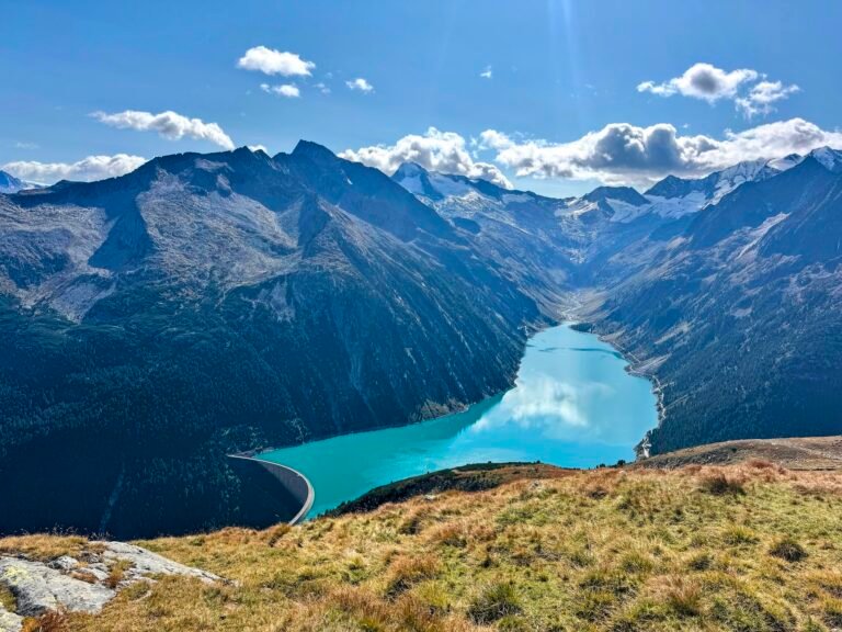
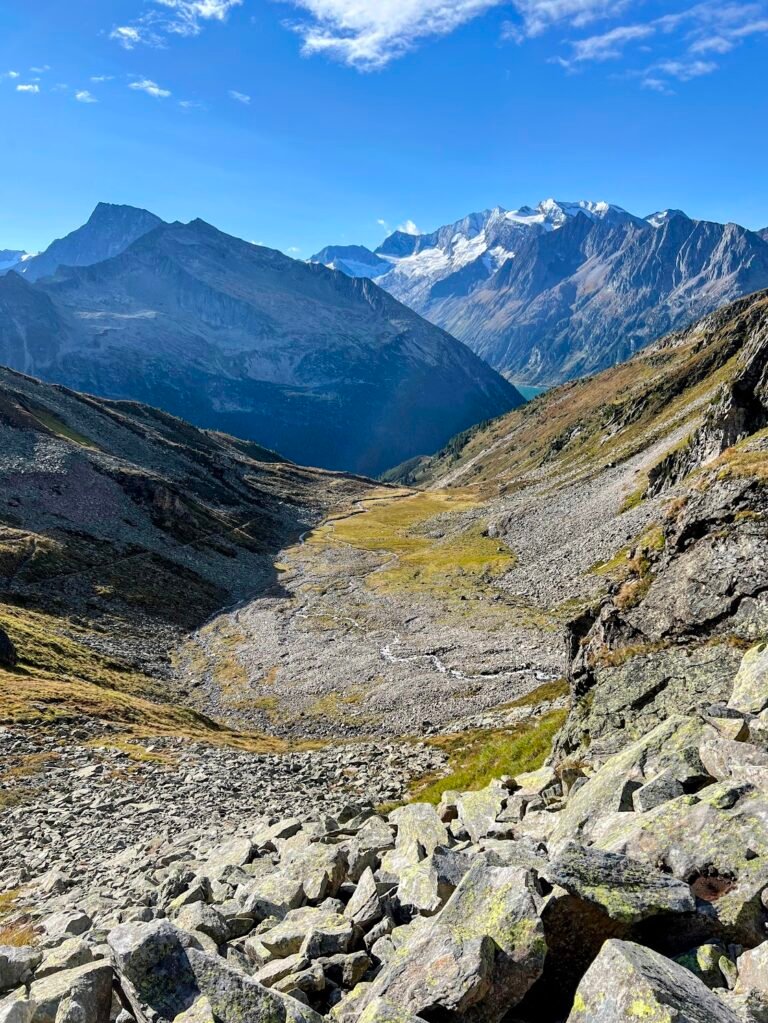
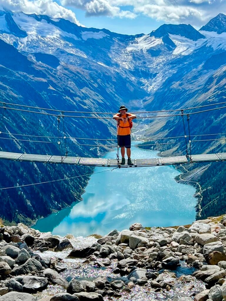
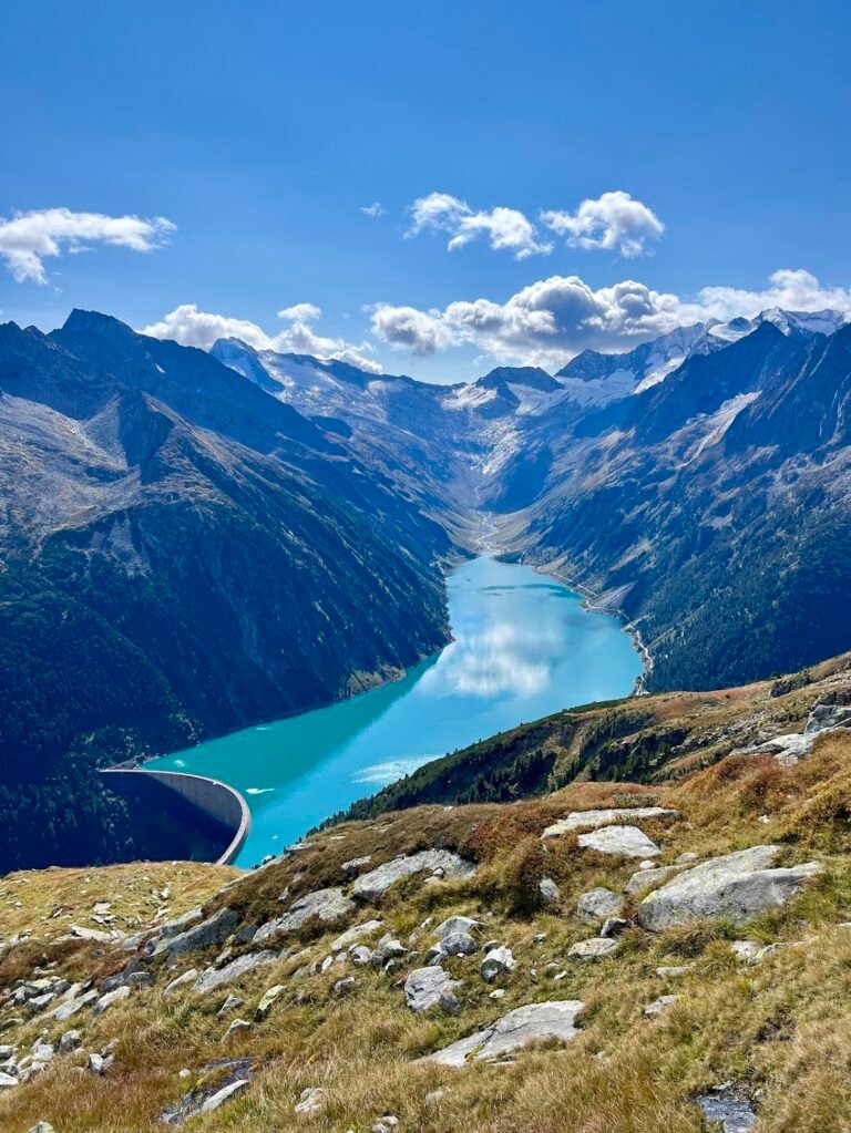
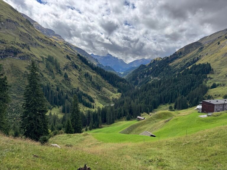
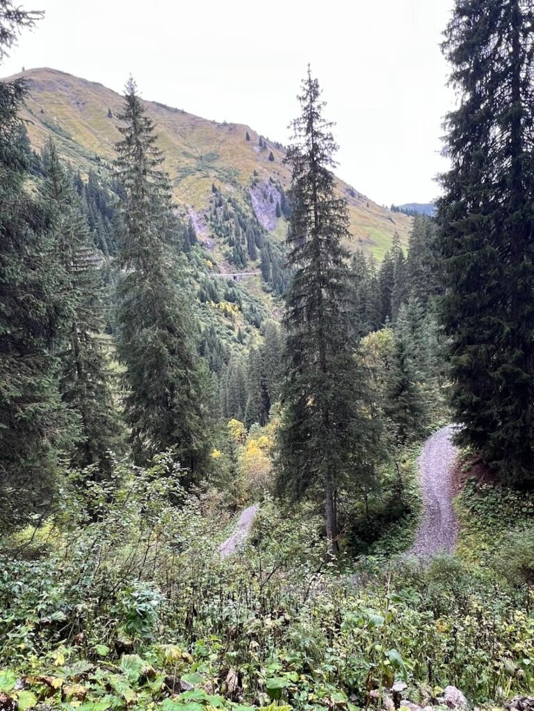
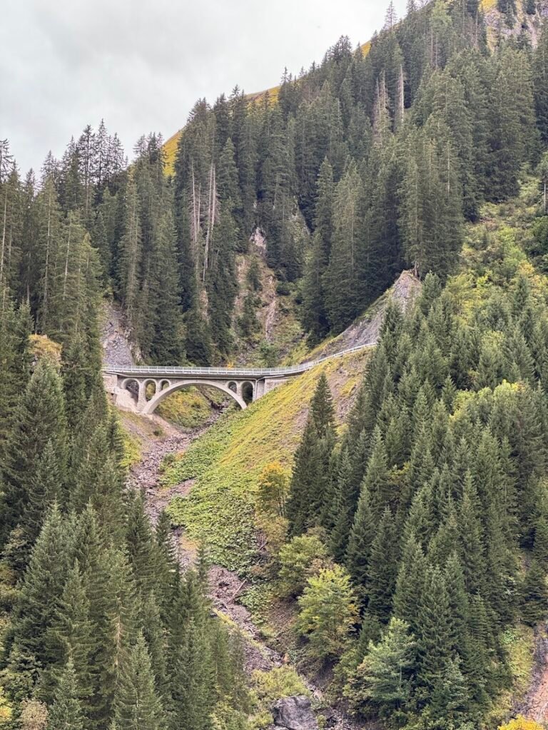
High above the turquoise-blue waters of the Schlegeisspeicher Reservoir in the Zillertal Alps lies one of our favorite hikes in all of Austria. While the suspension bridge near Olpererhütte gets all the Instagram fame, a longer hike takes you away from the crowds and gives even better views.
To complete this circuit hike, you will first head up in the direction of Friesenberghaus. The trail crosses small bridges over streams and switchbacks through a forest before reaching an open meadow where the views really open up providing glimpses of the reservoir below and peaks above.
After reaching Friesenberghaus the trail briefly descends to a lake below, then climbs very steeply up a pile of rocks. While difficult, the 600-foot climb is not as bad as it initially seems once you realize you are not going all the way to the top. At some point the trail veers off to the left and you’re left walking along a jaw-dropping balcony ledge with panoramic views.
Just before reaching Olpererhütte, you will reach the suspension bridge. After this point you can expect to see significantly more people on trail, as many hike directly to Olpererhütte from the reservoir. The view really is magnificent, so take lots of pictures and a rest, but once you can tear yourself away, head down the trail past Olpererhütte and directly down to the reservoir which should take about an hour. At this point we were so glad to be going down, as a parade of people were suffering up the steep switchbacks in the midday sun. As you will end at a different trailhead, you’ll need to walk along the shores of the reservoir to get back to your car.
Hike Details
8.6 miles | 2,950 feet elevation gain | 5 hours to complete
Drive to the location listed as "Parkplatz & Bushaltestelle" on your map. This parking area at the northern end of the reservoir will put you closest to the starting trailhead.
There are several large, parking lots, included for free as part of the toll road fee.
No fee for trail use.
Voralberg Region
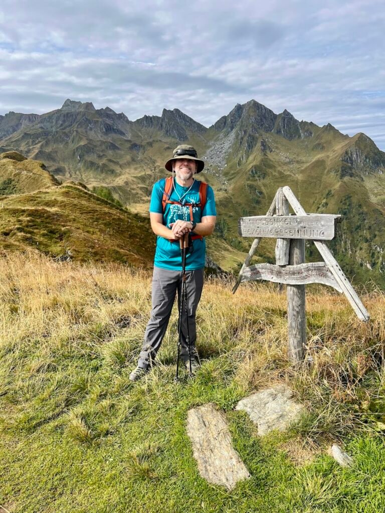
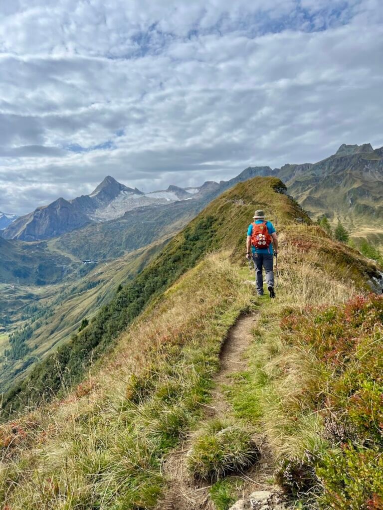
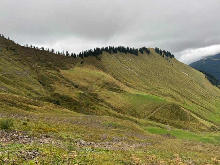
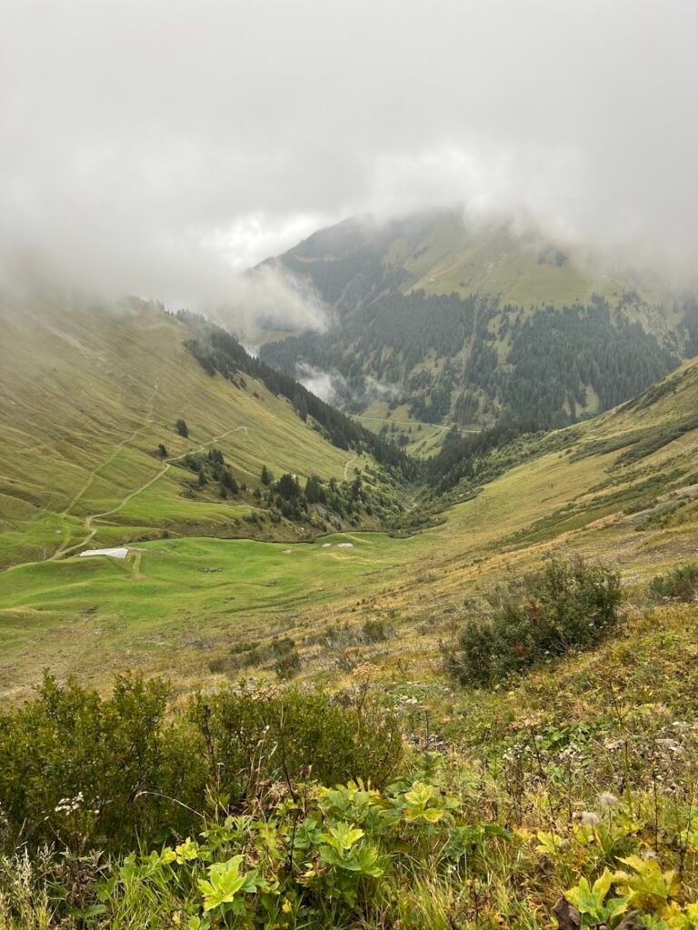
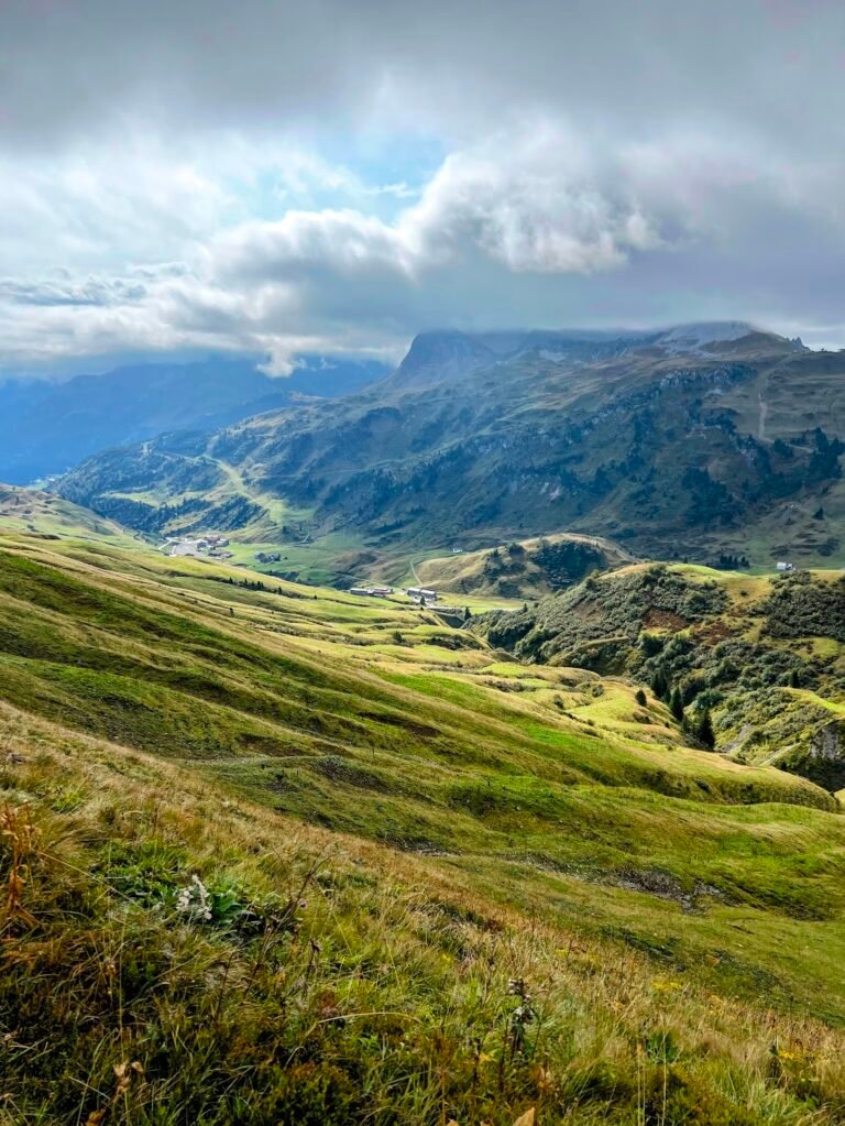
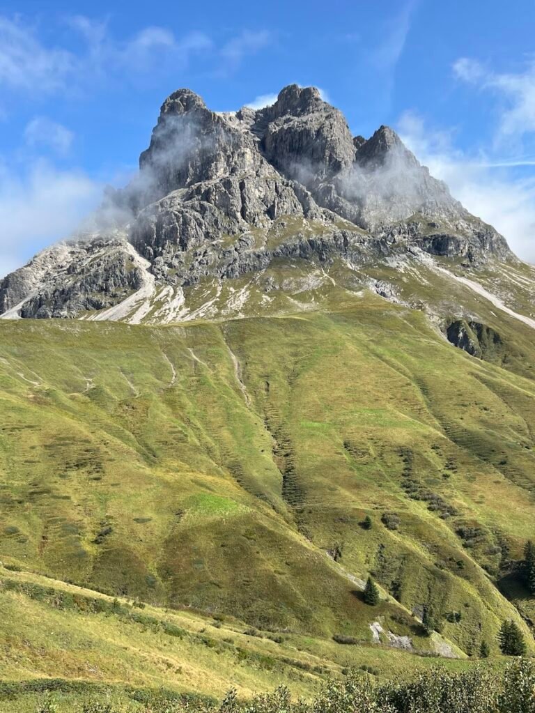
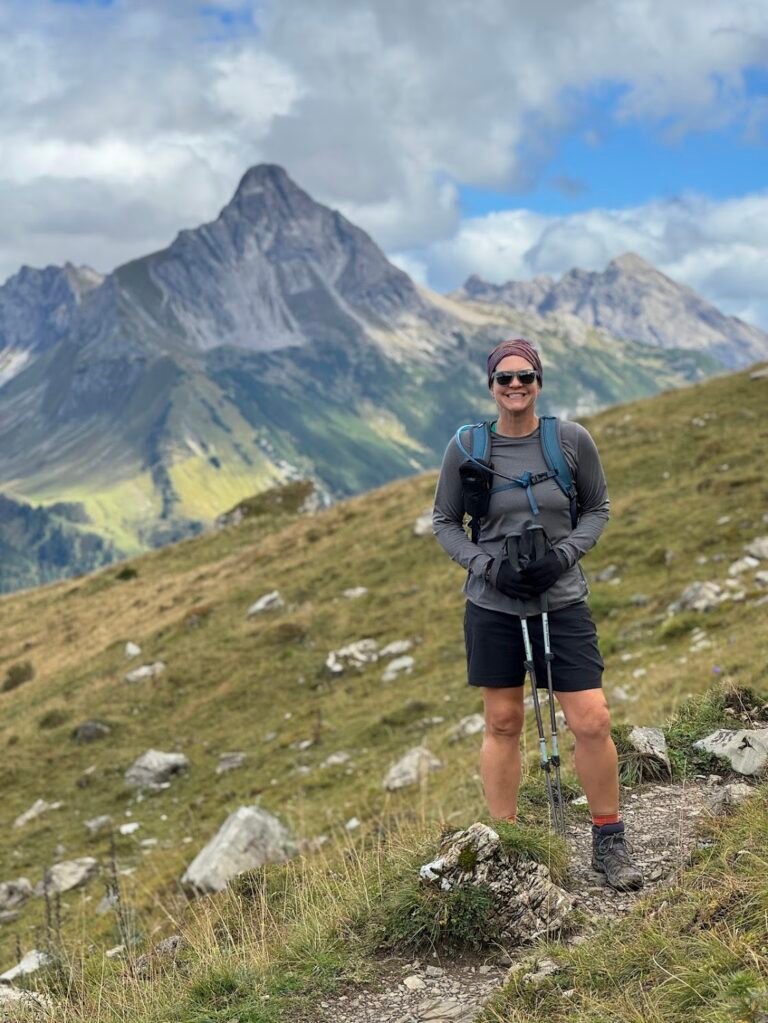
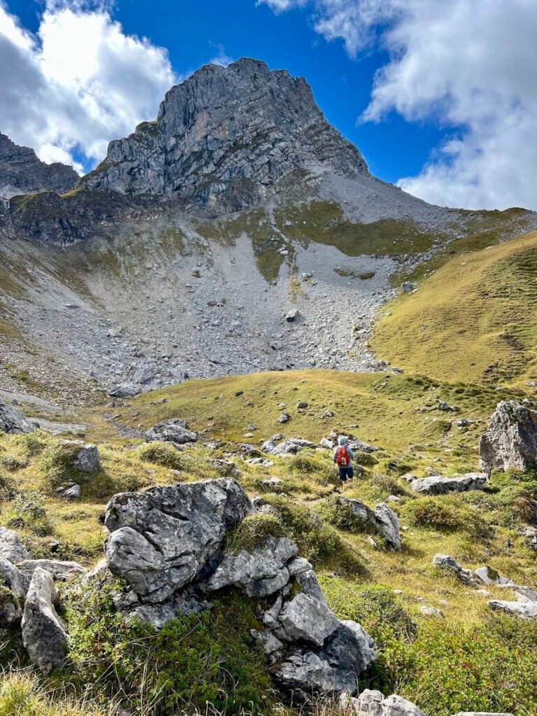
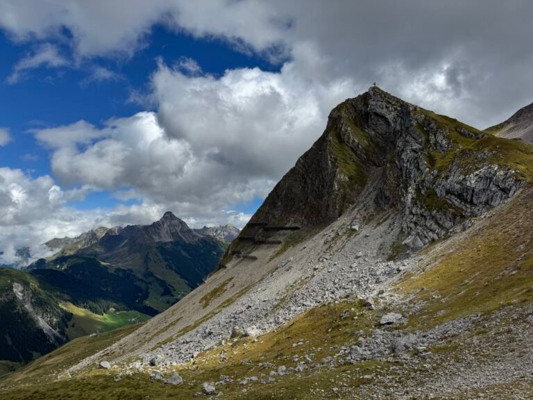
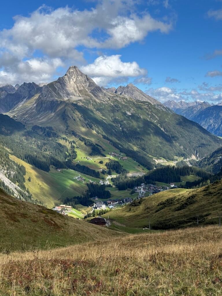
Zafernhorn Circuit
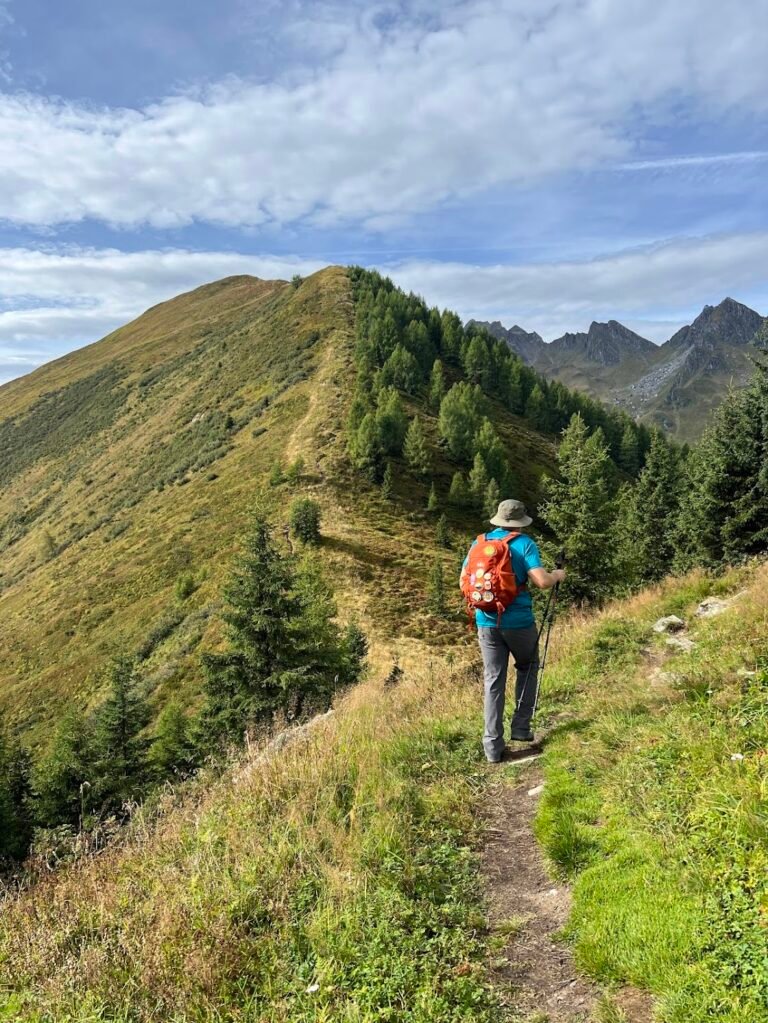
This trail begins in Faschina where a wide, gravel agricultural road winds its way to the Bartholomäus Alpe. After passing through a cattle turnstile, the trail and views open up so you can see pastures and the valley below. When we hiked, we even saw a magnificent lone stag in the distance.
Midway through the loop there is the option to climb to the summit of Zafernhorn itself. Unfortunately we had cloudy skies so although we reached the cross marking the summit, we could see nothing! The trail eventually re-joins the wide agricultural road that leads back towards the starting point. Before completing the trail, you will pass by a scenic waterfall in a valley and cross over a small stream. Even in less than ideal conditions, this was still a lovely hike in the Voralberg region of Austria. Pro tip: Don’t miss the dairy vending machine in the trailhead parking lot! The local cheese and meat products on offer were stellar.
Hike Details
6.4 miles | 2,400 feet elevation gain | 3 hours, 50 mins to complete
Drive to the location listed as "Lari Fari" on your map. This restaurant is a good approximation for the trailhead which lies just behind the building.
There is a medium-sized parking lot for which payment, by credit card, is taken in advance at the automated kiosk. We paid €6 to park for 24 hours when we visited.
No fee for trail use.
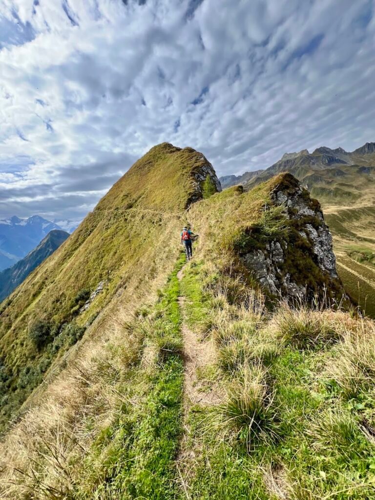
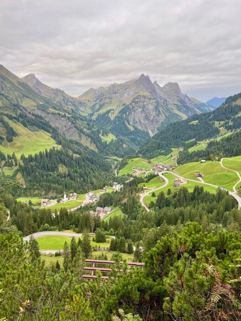
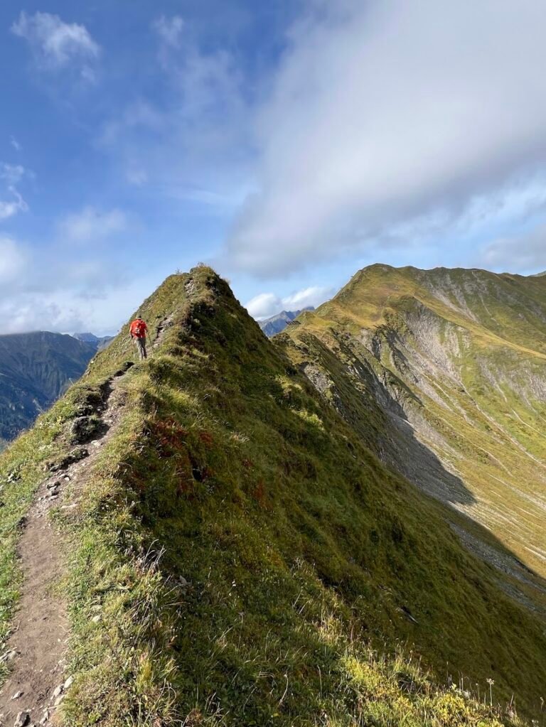
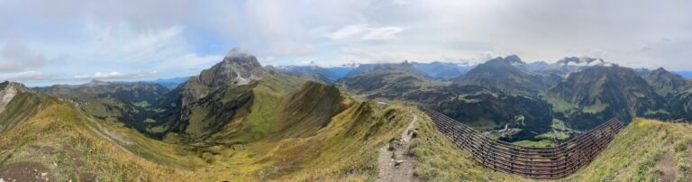
Nesslegg - Seekopf Loop
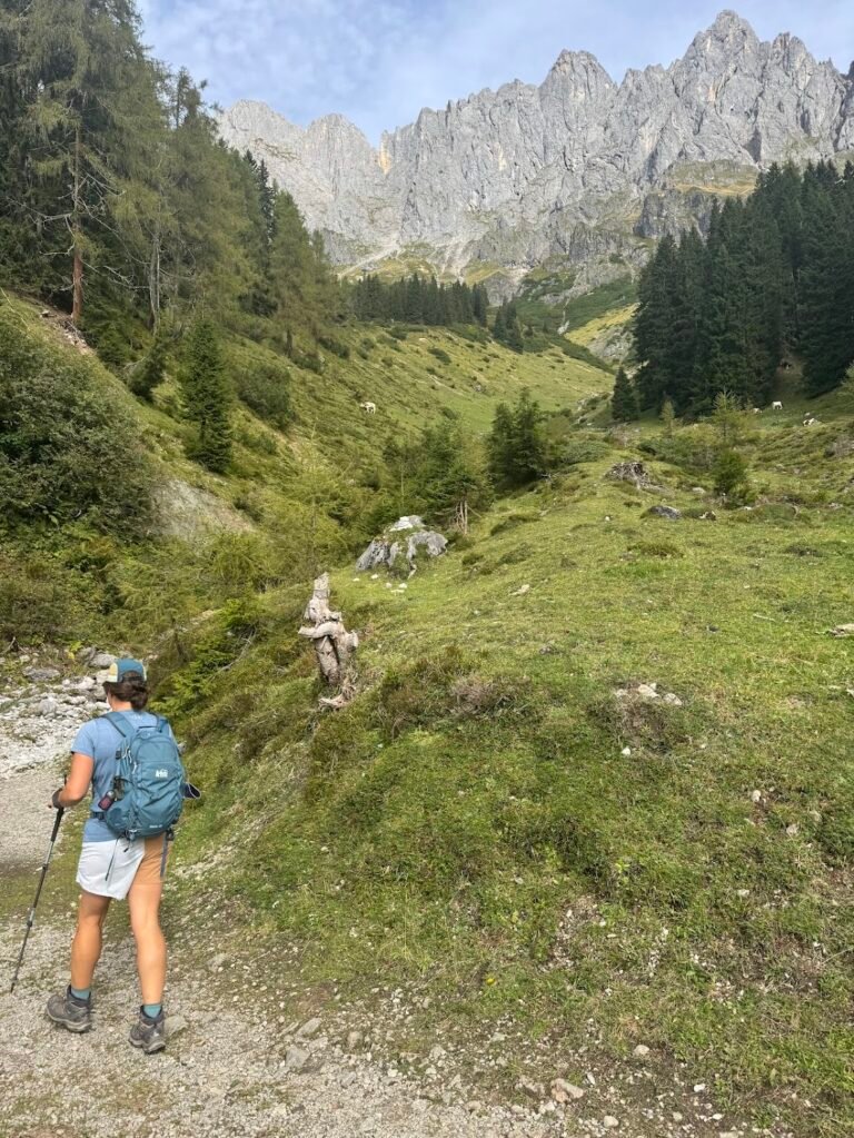
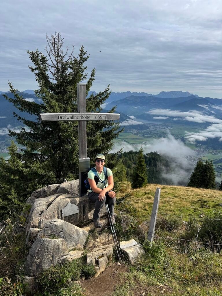
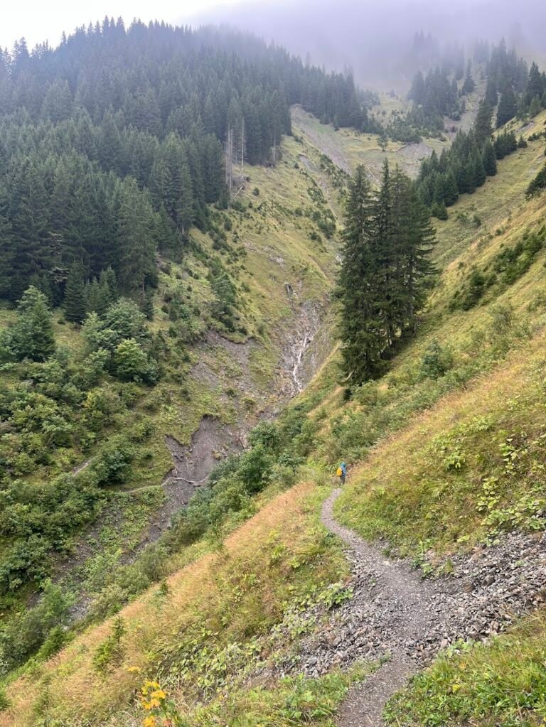
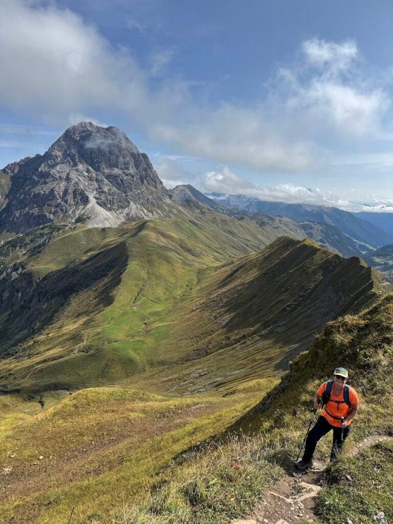
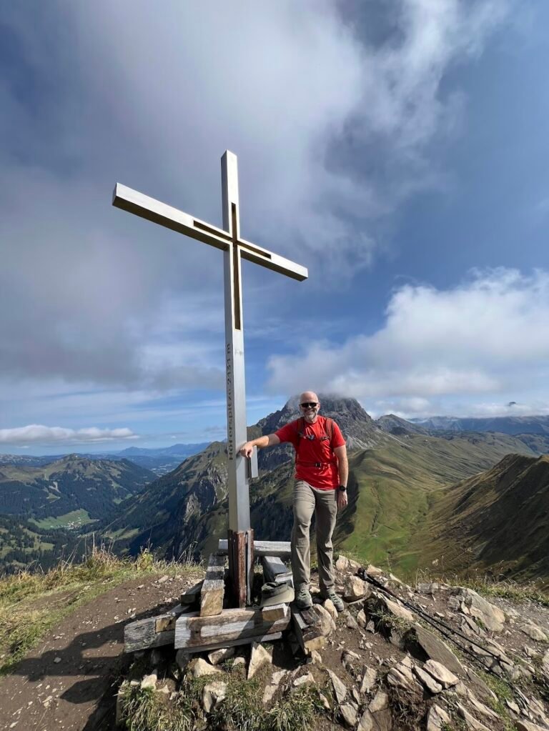
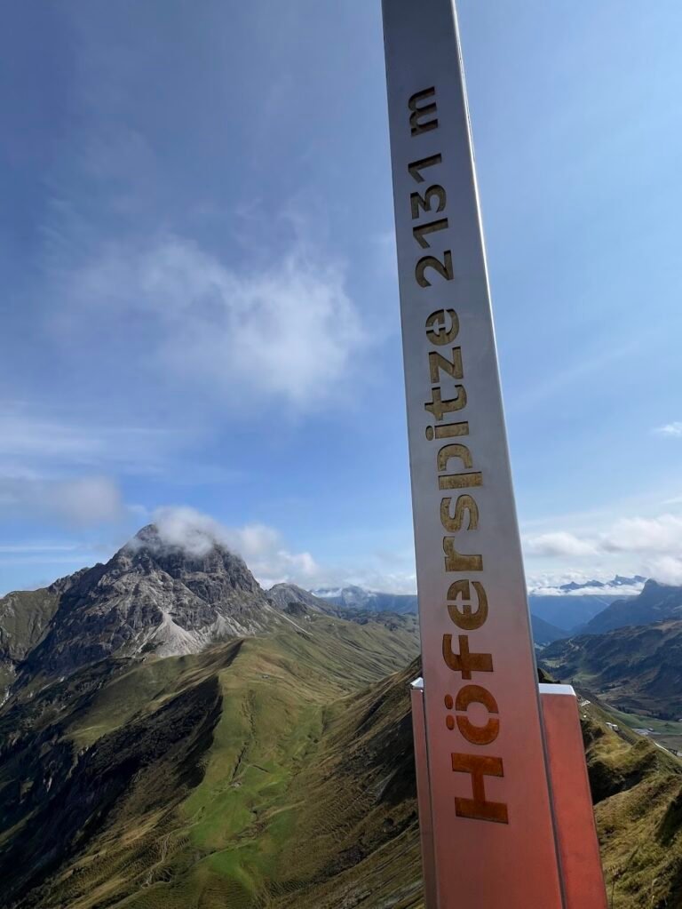
This hike is challenging but makes for a fantastic day out in the mountains of the Warth-Schröcken region. As a bonus, it includes bragging rights for summiting the 6,991-foot tall Höferspitze. From the small hamlet of Nesslegg, the trail immediately begins climbing a steep set of switchbacks through the forest. Near the top of the climb, there are excellent views of Schröcken below. From here, the trail flattens out as you pass by the Körbersee mountain lake and adjacent hotel.
The trail then descends and walks briefly along the road to get to Hochtannberg Pass. Here the trail will be on your left (turn at the Widdersteinhütte) and switchback steeply up the hillside towards Bärgunt Hochalpe, a charming mountain hut. Here again the trail levels out and skirts under the imposing mountain of Widderstein.
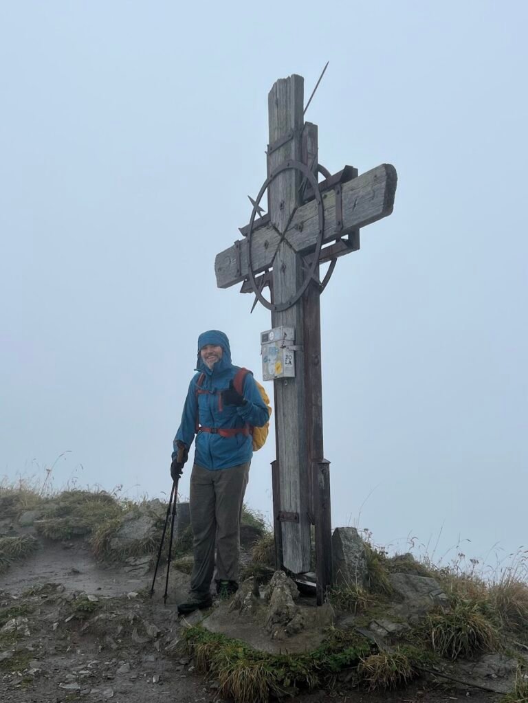
After descending one more time, the last climb is a true test of endurance and nerves. The trail is narrow and follows an undulating ridgeline before eventually reaching the summit of Höferspitze, marked by a beautiful silver and gold cross.
The views here are superb: the rocky Widderstein is still in view, as are the Kleinwalsertal Valley, Braunarlspitze peak, and Schröcken. We ate our lunch at the summit which we had to ourselves, similar to the rest of the hike.
The first mile of the trail heading down from the summit is especially treacherous. It descends very sharply through the maze of avalanche bridges high above Schröcken. For us, our progress was very slow until the trail eventually joined up with a gravel farm road, for which we were grateful. The rest of the way is quite easy, yet still scenic as you descend back to Nesslegg.
Hike Details
8.8 miles | 3,000 feet elevation gain | 5 hours, 40 mins to complete
Drive to the location listed as "Schröcken Neßlegg" on your map. This is technically a bus stop but is the closest approximation to where we parked to access the trailhead.
We could not find dedicated parking for this trail, but parked in an open spot near the Schröcken Neßlegg bus stop where there were no "No Parking" signs, and had no issue.
No fee for trail use.
Lechweg: Stage 2
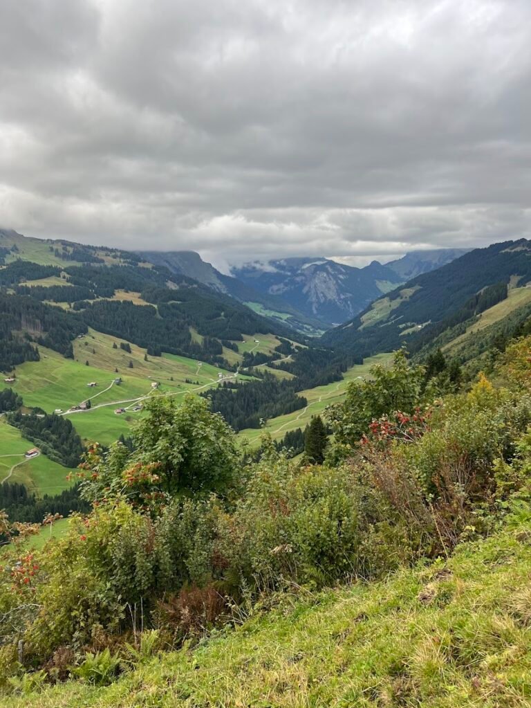
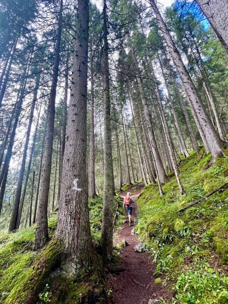
The Lechweg is a 78-mile long-distance hiking trail following the Lech River. Typically completed in multiple stages, individual stages make for a great day hike, even on an overcast day like we had. From Warth, the trail meanders through a forest of tall trees, then descends steeply to the rushing river before crossing a bridge and climbing through a valley on the other side.
The second climb of the trail goes through alpine pastures (watch out for grazing cows!) before climbing up a serpentine gravel road. Because we opted to hike an out-and-back portion, we turned around about 3 miles into the hike after enjoying our lunch on a bench with a view.
Hike Details
6.1 miles | 1,300 feet elevation gain | 3 hours to complete
Drive to the location listed as "Wälder Metzge" on your map. This is the best approximation for the Lechweg trailhead in Warth, located just across from the Seebach Lake.
There is a small, free, gravel parking turnout located along the road.
No fee for trail use.
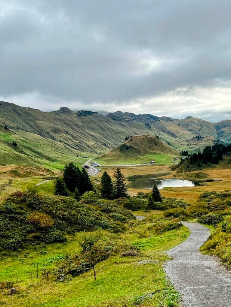
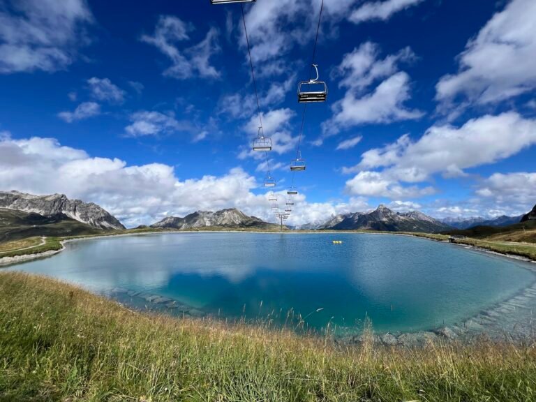
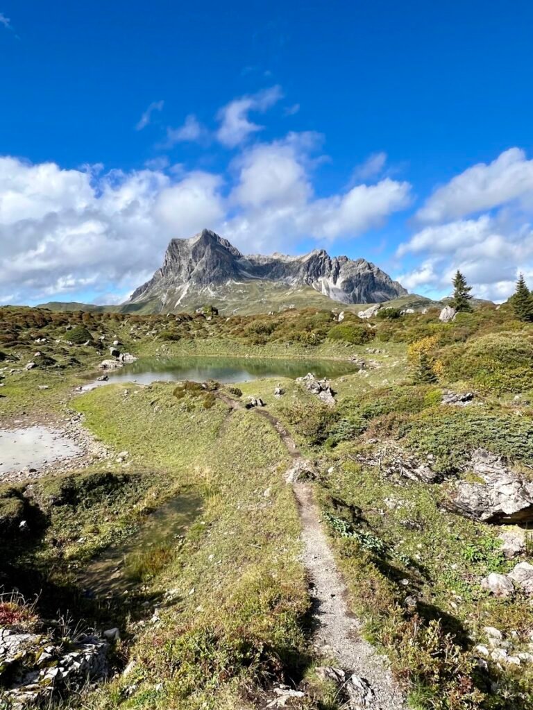
Hochalpsee Warth - Hochalphütte Loop
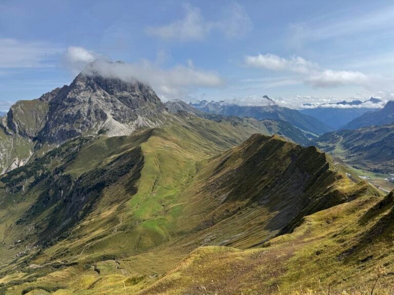
From Warth, the Steffisalp-Express cable car whisks hikers up to 6,181 feet in elevation to begin this panoramic hike. Most of this trail’s elevation gain takes place in the first half mile as you set out from the top station. If you’re anything like us, you’ll be so distracted by views of Biberkopf, a striking mountain in the German Alps that literally translates to “beaver’s head”, you won’t even mind! Despite the ski infrastructure in the area, it remains downright beautiful.
Don’t miss the small trail detour up to Panoramasee, a turquoise-blue reservoir from which there are 360-degree views including those of the Widderstein in the background. As the trail loops around it passes by the Hochalphütte where you can stop for a refreshment, or press on back to the cable car station, continuing down to the valley below.
Hike Details
3.8 miles | 800 feet elevation gain | 1 hour, 50 mins to complete
Drive to the location listed as "Steffisalp-Express Valley Station" on your map.
There are plenty of free parking spots located along the road just outside the valley station.
No fee for trail use. Riding the Steffisalp-Express cable car was free as part of the Guest-Card Bregenzerwald & Großes Walsertal provided by our accommodation in Schröcken. Be sure to check the website for current operating hours and pricing.
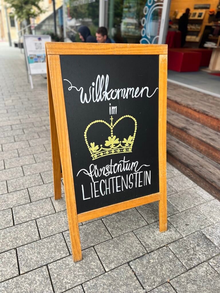
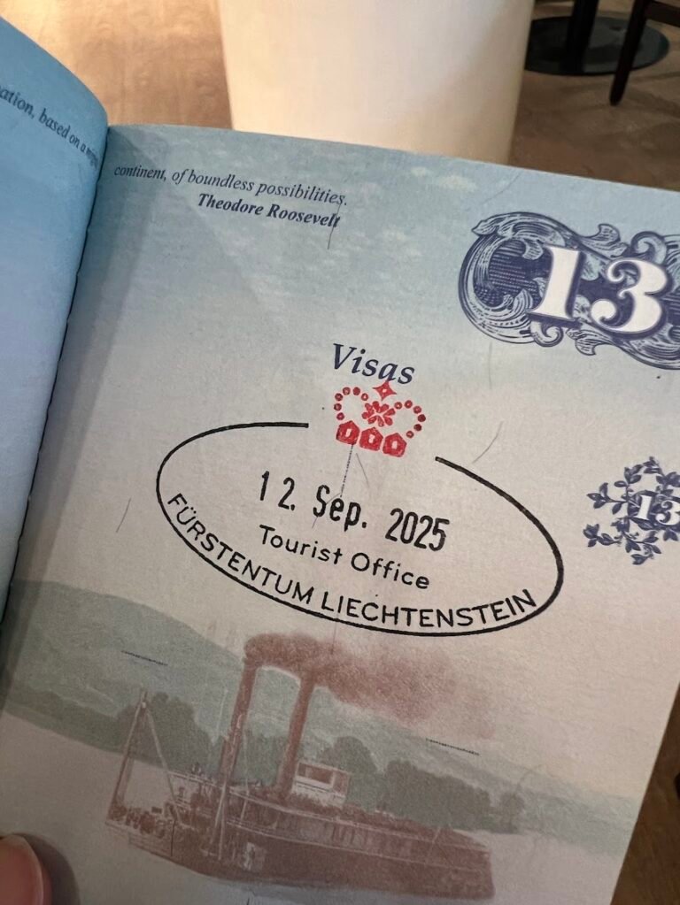
Bonus Adventure: Visit Liechtenstein
If you’re exploring the Tyrol region of Austria, Liechtenstein is a stone’s throw away across the western border. As Europe’s fourth-smallest country, you can easily visit in an afternoon, which is just what we did. We drove into Vaduz, the capital city, and visited the tourist office to get our passports stamped. We then took a quick walk through town, did some shopping, and enjoyed cappuccinos and croissants at a lovely cafe before heading back to Austria. 🇱🇮