This epic road trip itinerary covers Arizona from bottom to top, with a quick dip over the border into Utah. Along the way it covers 3 national parks, 2 national monuments, breathtaking sites in the Navajo Nation, and a visit to the best-preserved meteorite impact site in the world.
In late May we did this exact trip completing countless hikes and scenic drives. We documented it all here to help foster some inspiration for your own adventurous road trip!
Arizona Road Trip Map
Below is a map of our trip including points of interest, activities, and restaurants. It also provides an overview of the road trip route. Toggle the sidebar for details.
Trip Overview & Tips
This trip begins and ends in Phoenix with a lot of driving in between, but it’s so worth it!
Phoenix, AZ | Days 1-2
Tucson, AZ | Days 3-5
Holbrook, AZ | Days 6-7
Bluff, UT | Day 8
Page, AZ | Days 9-10
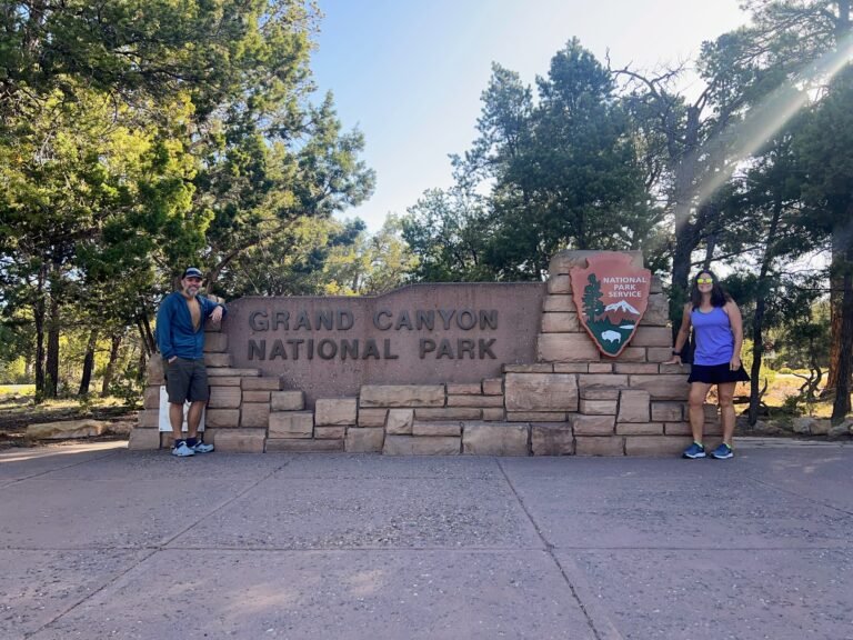
Grand Canyon, AZ | Days 11-13
Phoenix, AZ | Day 14
Time Zone in Arizona
Arizona does not observe Daylight Saving Time (DST), remaining on Mountain Standard Time year-round. For example, this means that during the summer months, on DST, the time in Arizona and California is the same.
To make matters even more complicated, if visiting any part of the Navajo Nation within Arizona, they do observe DST and will be one hour ahead than other parts of the state.
Stay Safe in the Heat
When we visited in May, temperatures were already soaring to 100 degrees Fahrenheit on many days. Things we found really help when recreating outdoors were:
A wide-brimmed hat.
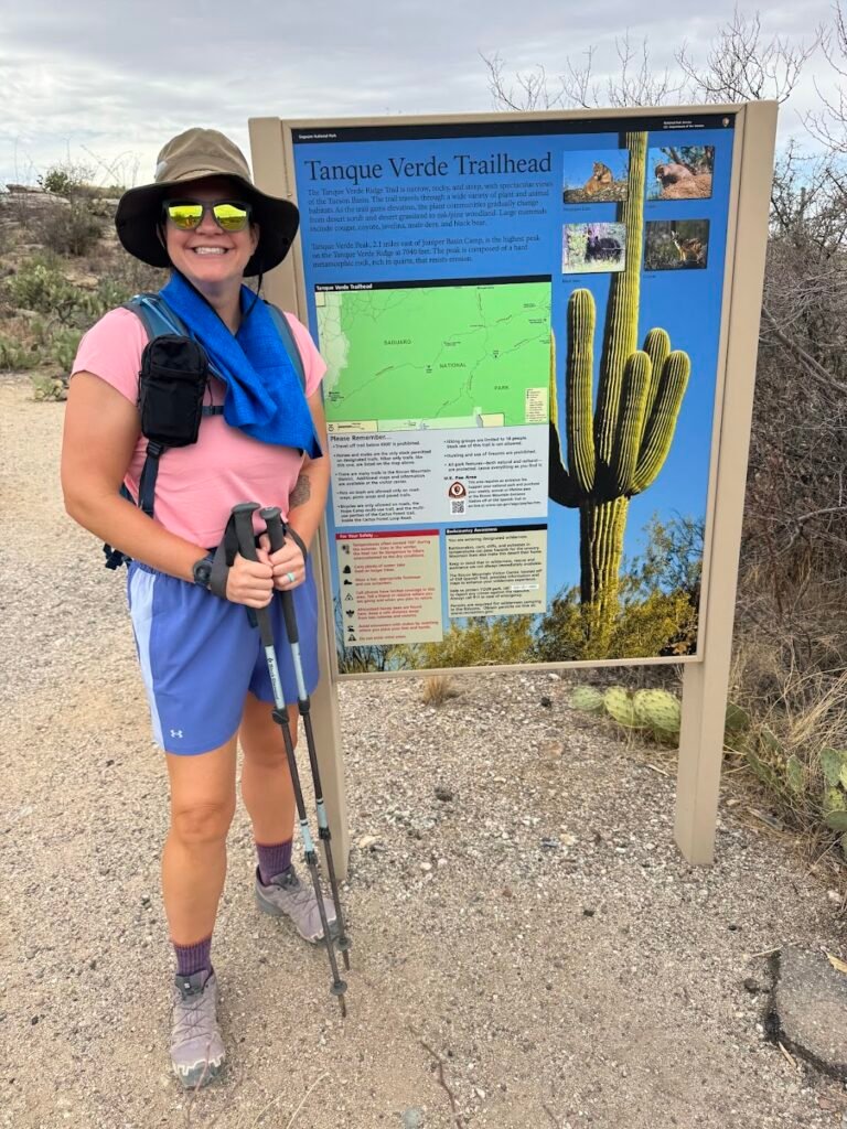
Cooling towels by Frogg Toggs were absolute lifesavers (see blue towel in the photo below). These towels, once wet with cold or warm water, provided hours of cooling relief.
Electrolyte drink mixes to stay on top of hydration. We really liked the sugar-free Liquid IV packets and drank one on nearly every hike when in Arizona, in addition to lots of water.
This itinerary assumes you’ll have arrived the night prior. We arrived in the afternoon to settle in, do some grocery shopping, and acclimate to the heat. Even though it was early May, temperatures hovered just below 100 degrees! We also had time to grab a few beers at Roses by the Stairs Brewing. We loved their local flavors such as a prickly pear fruited sour.
Where We Stayed
We stayed at an Airbnb in a quiet residential neighborhood. We enjoyed having plenty of space to spread out and cook our meals, but were also just a 15-minute drive away from the airport and every activity we did in Phoenix.
Day 1 | Phoenix: Desert Botanical Garden & Diamondbacks Baseball Game
Desert Botanical Garden
The Desert Botanical Garden is a 140-acre garden home to over 50,000 plants, many of which are native to the area and/or endangered. Born out of a desire to protect the fragile local environment, 85 years after its establishment, the garden is still thriving.
We arrived at 8:30am on a crowded Mother’s Day Sunday and spent the next two hours exploring the grounds. Even at that time of day it was extremely hot, so we made sure to drink plenty of water and sought out shade whenever possible.
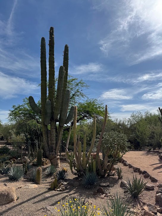
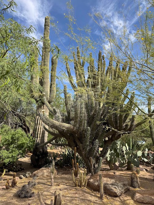
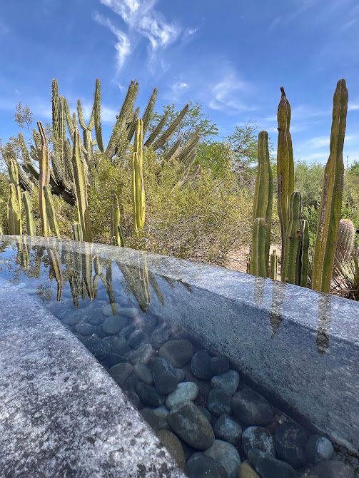
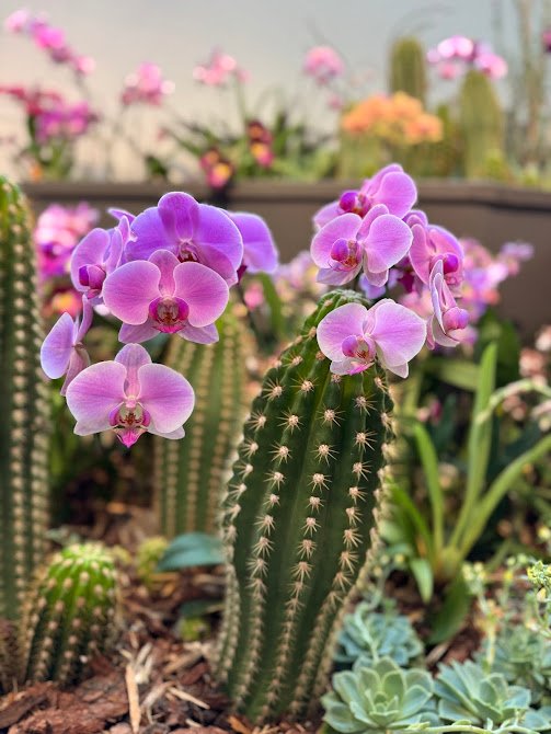
The gardens were divided into quarter-mile loop trails, each with a different focus. Here we got our first glimpses of giant saguaro cacti, native to the Sonoran Desert. We really liked how everything was laid out in the gardens in a seemingly natural environment. We particularly enjoyed the succulent garden and the indoor “orchid extravaganza” exhibit that was on display when we visited.
Need to Know
Tickets: Especially during peak visitation times, advance tickets are recommended and these can be purchased on the Desert Botanical Garden website.
Hours & Admission Fees: Hours vary throughout the year, but the gardens open at 8am most days. An adult ticket was $39.95 when we visited.
Directions: The gardens are located in Papago Park. There is a large, free parking lot.
Pro tip!: To stay cool, make sure to wear a hat and bring a reusable water bottle and fill up at one of the many bottle fill stations around the gardens.
Diamondbacks Baseball Game
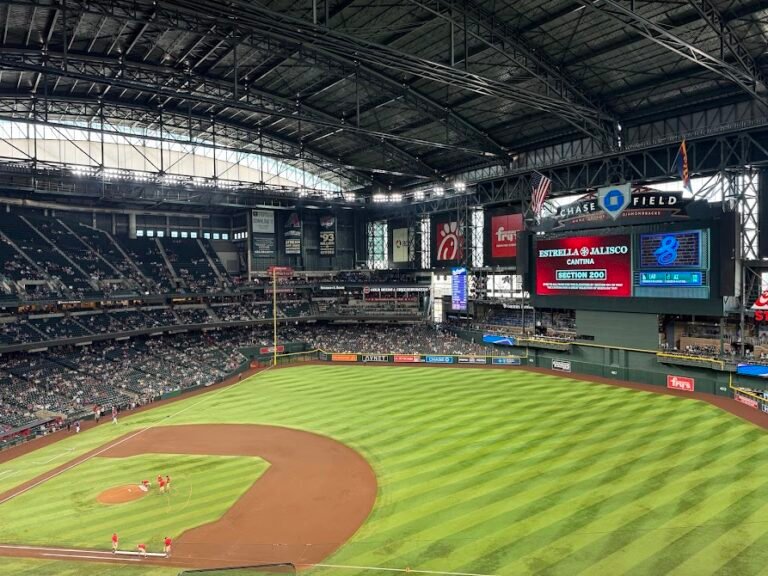
If you’re a baseball fan and the Diamondbacks are in town, we highly recommend catching a game downtown at Chase Field. By game time temperatures had climbed to 100 degrees, so we were thankful for the retractable roof at the ballpark.
We arrived early and had plenty of time to walk around and explore the concourse, then pick out our food. Chase Field has some crazy options like churro dogs (churros in a donut bun) and nachos in a football-sized helmet. We settled on Big Dawgs where we had their “Arizona Dog”. Footlongs with chorizo, jalapeño, salsa, cheese and more. I had to eat mine with a fork!
When we visited the Diamondbacks were wearing their City Connect jerseys, so they were the Serpientes (snake). Very cool! We sat in Section 307 which had great views of the whole field. Unfortunately the Serpientes lost to the Dodgers that day, but hey, at least we can now say they lost to the reigning 2x World Series champions.
Day 2 | Phoenix: ATV/UTV Tour + Travel to Tucson
Centipede Guided UTV Tour
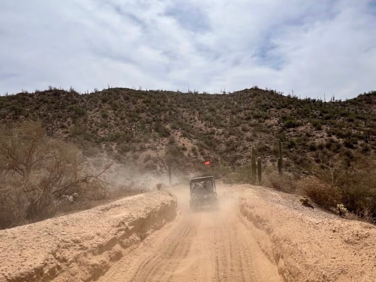
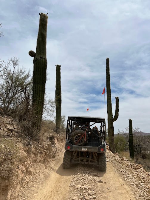
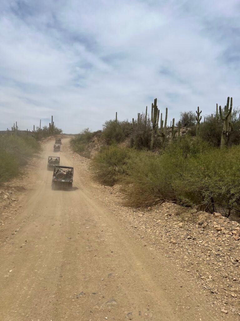
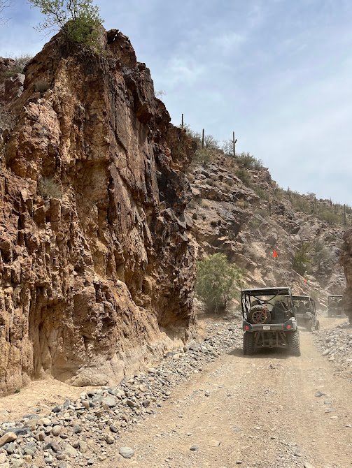
About an hour north of Phoenix lie the Bradshaw Mountains. We made the drive to the Arizona Outdoor Adventures base for a 2-hour guided UTV tour on the famous Centipede Trail. The trail is rugged and narrow, winding through a maze of cacti in the foothills of the Bradshaw Mountains.
After a safety briefing and instructions, we donned our face covering and goggles to help keep the dust at bay and we were off, with Mike expertly driving us through the desert.
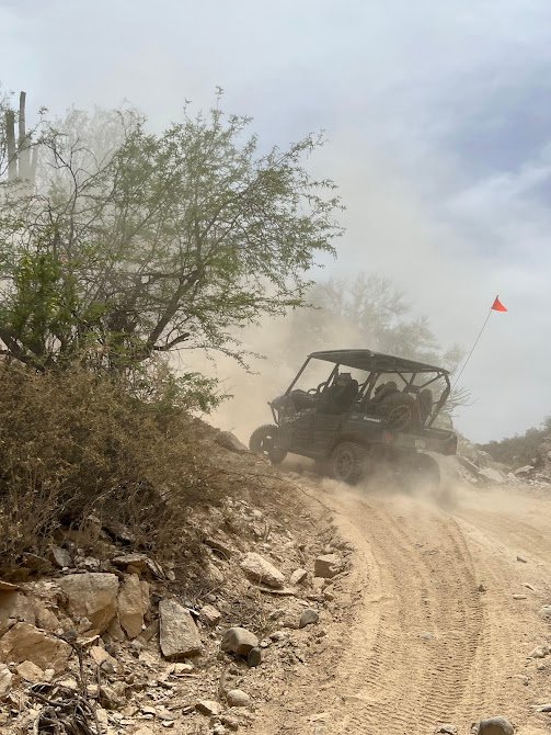
The drive was incredibly fun through tons of cacti, up and down very steep terrain, and through narrow canyons. Midway through the tour we stopped for photos at a scenic viewpoint and to down some water.
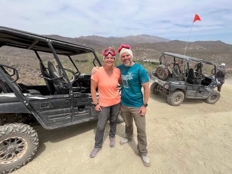
By the end of the tour we were absolutely covered in dirt, but were super duper happy. What an amazing adventure in the desert!
Need to Know
Tours: Tours run daily at various times throughout the day. Advance bookings should be made on the Arizona Outdoor Adventures website. The tours are 2 hours in duration. When we went the price for a 2-seater UTV was $150.
Directions: The meeting point is located a one-hour drive north of Phoenix. There is plenty of free parking onsite.
Pro tip!: Plan to get very dirty! The baklava and goggles provided as part of the tour really helped keep the dust out of our face, but the rest of us was covered in dirt. You may want to consider bringing a change of clothes.
Travel to Tucson
Having worked up an appetite on tour, we stopped at the nearby Rock Springs Cafe for lunch. While they are known for their pies, we had the most gargantuan (and delicious) pulled pork ruebens with fries. We definitely recommend a stop here!
It was about a 2.5-hour drive to Tucson, but very easy as it was all along highways.
Where We Stayed
We stayed at another lovely Airbnb in Tucson near the University of Arizona. This was a location equidistant from the sites we visited in East and West Saguaro National Park.
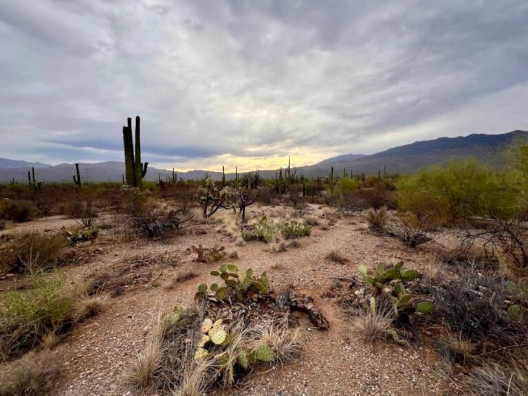
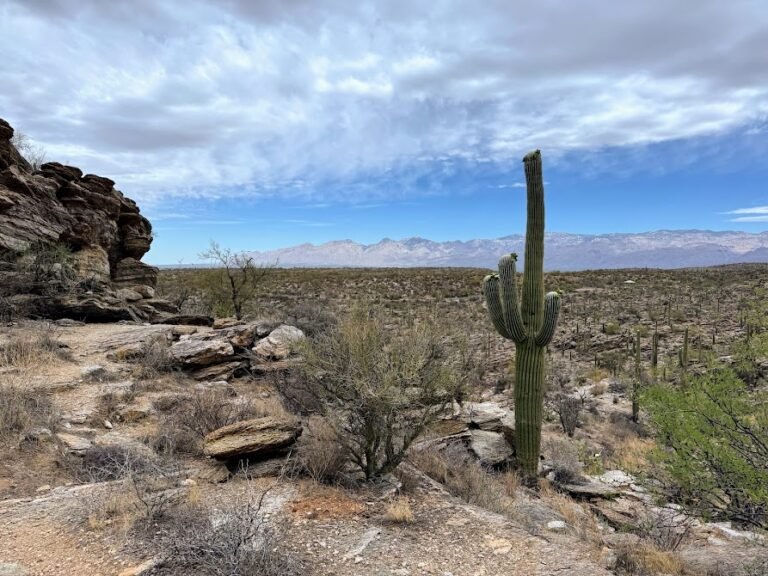
Day 3 | Tucson: East Saguaro National Park
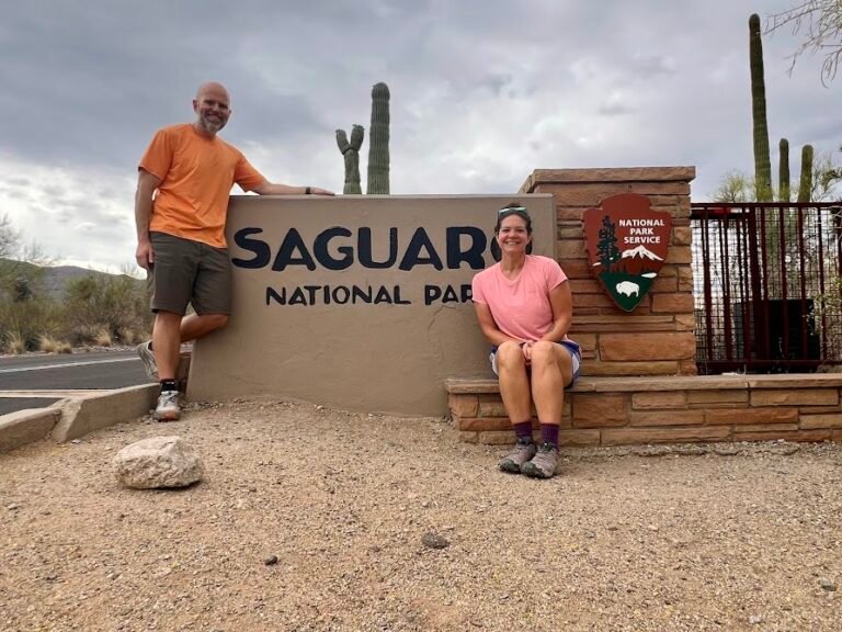
First declared a National Monument in 1933, Saguaro gained National Park status in 1994. There are dozens of trails in the park offering gorgeous desert views. But no doubt the star of the show are the saguaro themselves, a symbol of the American west.
The sites within Saguaro are clustered in two distinct sections to either side of urban Tucson. Some sites are to the west, near the Red Hills Visitor Center in the Tucson Mountain District, and others to the east, near the Rincon Mountain Visitor Center in the Rincon Mountain District.
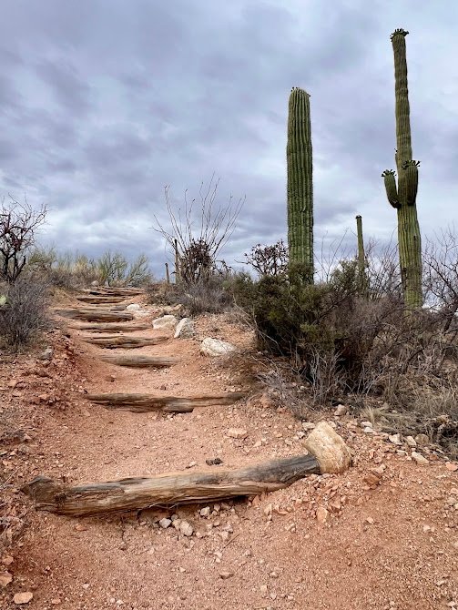
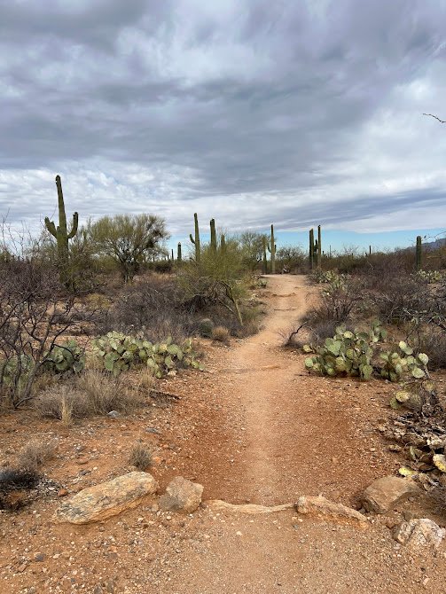
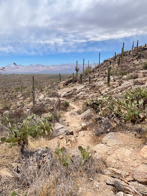
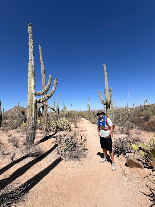
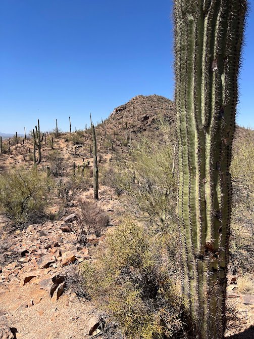
We spent our first day in the eastern park sector, and in the morning we went on a hike combining two separate trails into one, long figure-eight loop. Our route covered 6.8 miles but was very flat with only 240 feet of elevation gain. It took us about 2.5 hours to complete, mostly because we stopped to take so many pictures!
We hiked through low desert vegetation, dry washes, and up bluffs with great overlooks of the cactus forest below.
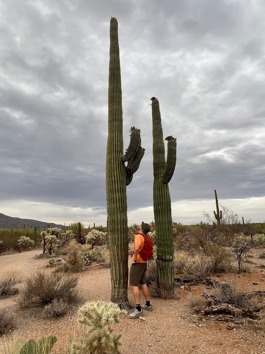
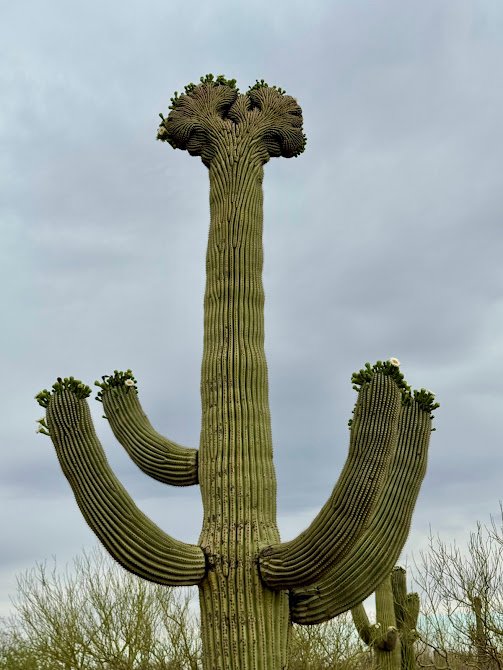
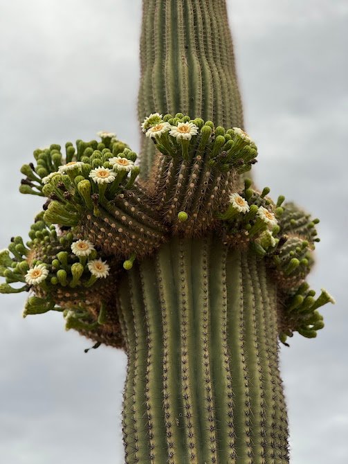
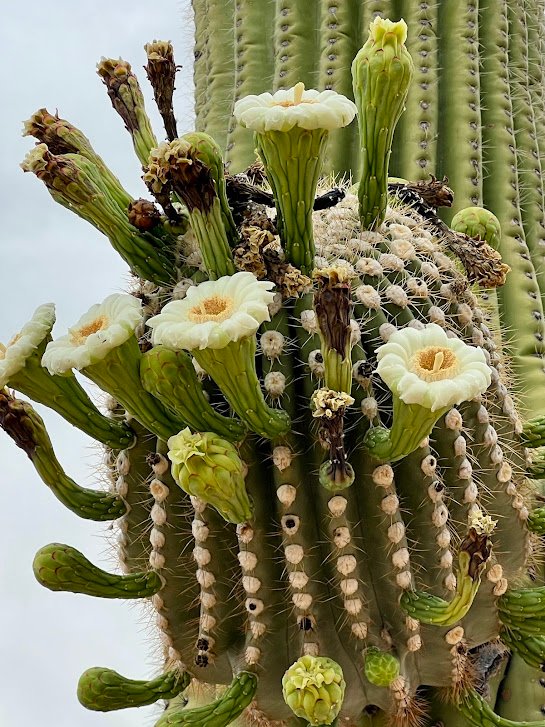
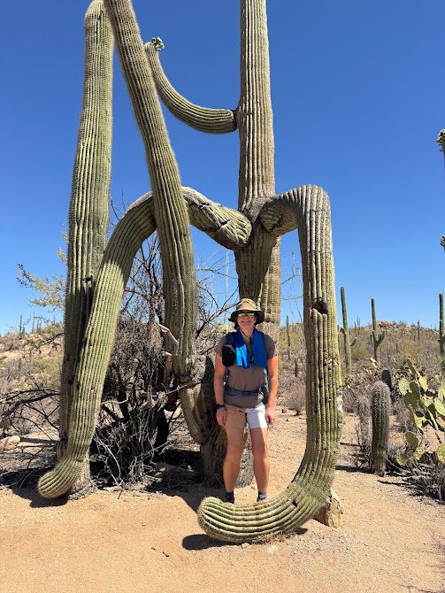
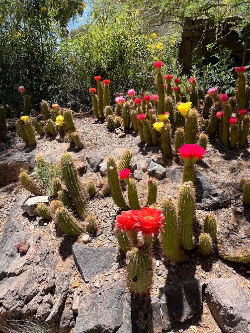
Walking to close to the saguaro gave us a newfound appreciation for just how enormous they can grow to be! These cacti can live up to 200 years and grow as tall as 50 feet with up to 24 arms branching off. Some, called cristates, have fan-like growths at the top. Scientists are not sure why…lightning? freeze? abnormality? Regardless, they are very cool to spot.
Saguaro only bloom once a year during May and June, and we completely lucked into seeing the blooms during our visit. The creamy white blossoms open at night and only remain open for the next day before permanently closing. That leaves them just 24 hours to attract a pollinator.
Need to Know
Hours: This area of the park is open 24/7. We began our hike at 6am to get ahead of the heat of the day and saw almost no one else.
Parking: Parking for this trail is at the Broadway Trailhead. There is a fair amount of nearby parking just outside the trail start. Note this is in an urban area and while we had no problems during our visit, we recommend storing valuables out of sight in your car while parked.
Fees: Saguaro National Park charges a fee to enter. It is $25 per vehicle and is valid for 7 days in both the east and west districts. If you will be visiting several national parks or national historic sites in a year, we highly recommend purchasing the $80 America the Beautiful Pass which is accepted at Saguaro National Park.
Rincon Mountain Visitor Center & Cactus Forest Drive
We next stopped by the Rincon Mountain Visitor Center. This is a great place to stop for any information, if needed, and to refill water bottles. It is also the starting point for the Cactus Forest Drive.
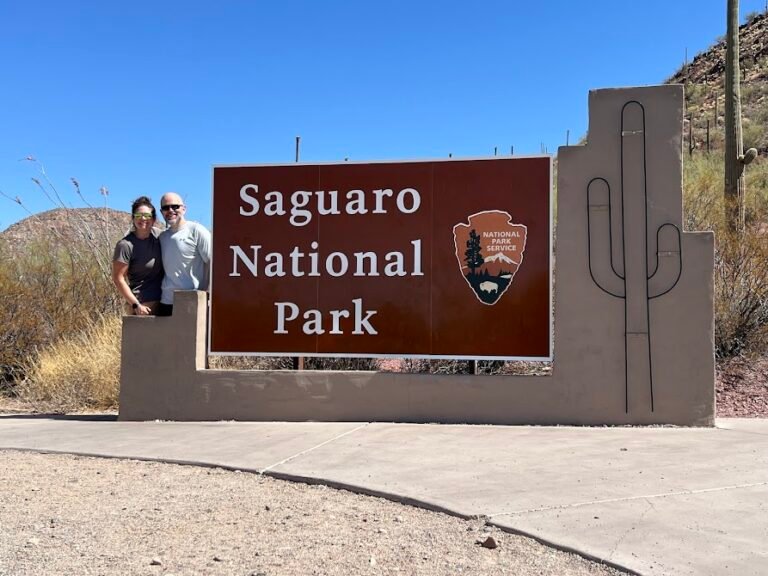
Before leaving the area, we snapped a picture at the entrance sign.
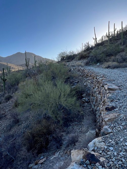
Cactus Forest Drive
The Cactus Forest Drive is a one-way, paved 8-mile scenic loop drive. The road winds through the desert and passes a ton of really fun cactus formations. Even having seen so much on foot already, this drive was still fun for us. The entire loop took about 35 minutes to drive as the speed limit hovers around 15-20mph.
Tanque Verde Ridge Trail to Tanque Verde Dome Hike
A few miles into the drive is the turnout for the Javelina Picnic Area, the trailhead for our second hike of the day. We hiked the Tanque Verde Ridge Trail up to the summit of the dome. Even though it was mid-morning, the sun was really intense by this point and the trail was very exposed. The upside was the far-reaching views of mountains in the distance as we hiked.
The trail steeply climbed up rocks and through varied cactus forests before reaching the ridgeline. We had the summit all to ourselves and enjoyed a snack before heading down, then eating a proper lunch in the shaded picnic area. We hiked 5.4 miles on this trail, gaining 1,545 feet in elevation. All told we were out there for 2.5 hours and glad to be done hiking by noon with the heat.
Need to Know
Hours: While you can walk or bike into this area of the park 24/7, the Cactus Forest Loop Drive is only open to cars between 5am-8:30pm.
Parking: Parking for this trail is at the Javelina Picnic area where there is a large parking lot.
Fees: Saguaro National Park charges a fee to enter. It is $25 per vehicle and is valid for 7 days in both the east and west districts. If you will be visiting several national parks or national historic sites in a year, we highly recommend purchasing the $80 America the Beautiful Pass which is accepted at Saguaro National Park.
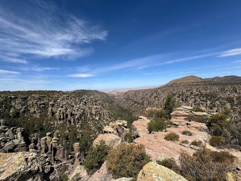
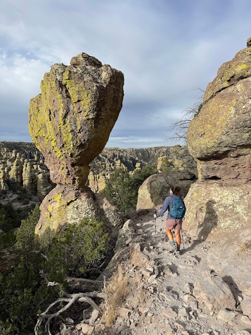
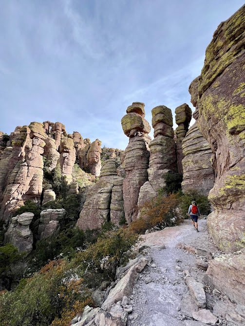
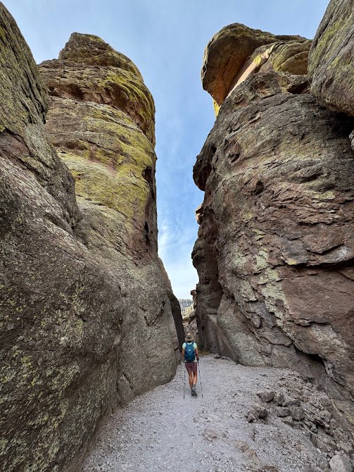
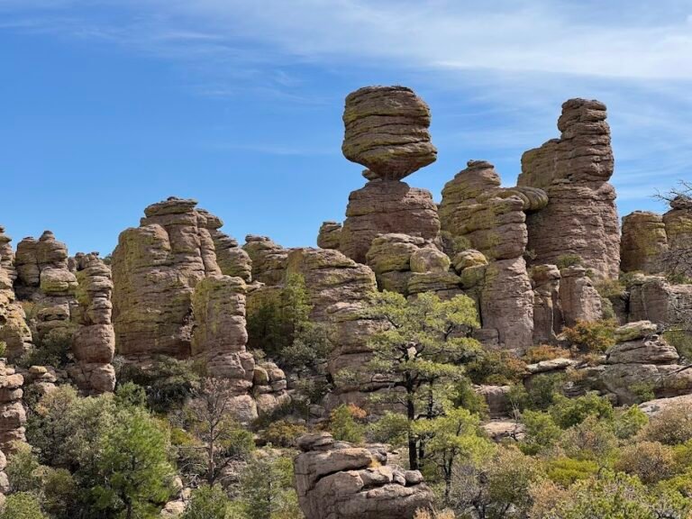
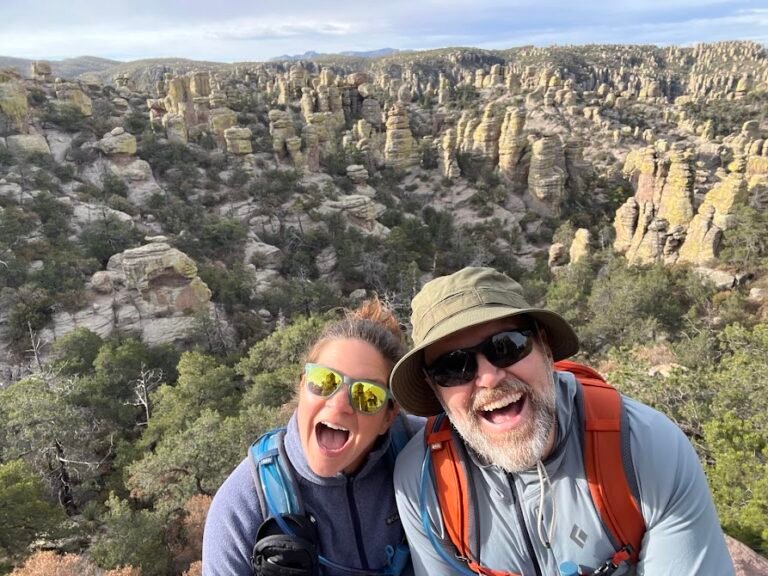
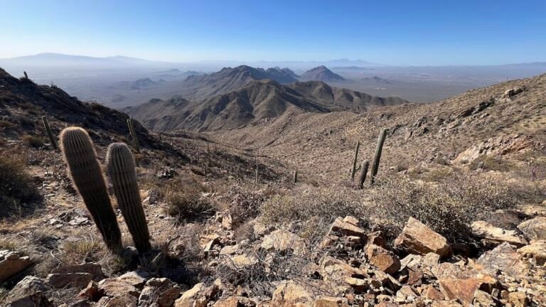
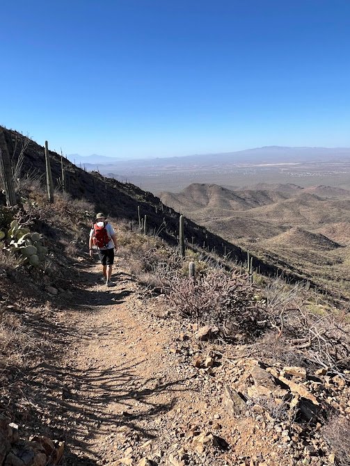
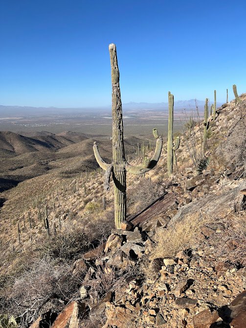
Day 4 | Tucson: Chiricahua National Monument
Just a 2-hour drive from Tucson is the Chiricahua National Monument, famed for its towering pinnacles and balanced rocks. We arrived early in the morning and found no other humans, just deer and two Gould’s turkeys, the largest subspecies of wild turkey. The park road was incredibly scenic and we drove up to an elevation of 6,000 feet before parking our car to start our hike.
The Big Loop Hike
The Big Loop Hike is just that. An epic 9.5-mile loop hike through the best Chiricahua has to offer.
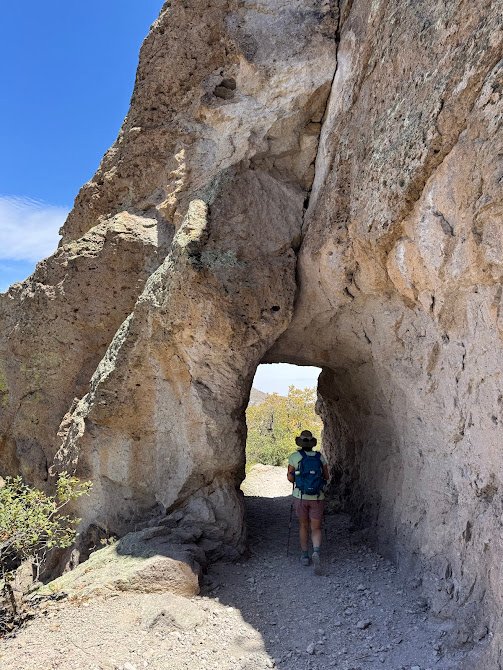
Almost immediately after setting off we were immersed in fields of rhyolite pinnacles. There were even hidden grottos to explore and we marveled at every turn of the trail.
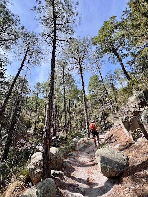
We were impressed by how well-maintained and graded the trail was the entire way. And we also saw zero other people. We couldn’t believe so many others were missing out on this seemingly hidden gem! This trail was pure, blissful Type 1 fun. The loop took us down into the canyons to the shade of the forest, which we were grateful for as the temperatures heated up.
We then climbed out of the canyon and looped through balanced rock formations, many of which were named (think: mushroom rock, duck rock, etc.). Feeling strong, we added on a 1-mile out-and-back detour to Inspiration Point. At the point there was an amazing overlook of the whole valley.
We arrived back at our car tired, but exhilarated. It truly was one of our favorite hikes ever. And we saw only one other person the entire time we were out there. Our hiking stats came in at 9.77 miles, 1,919 feet of elevation gain, and 5 hours on foot.
Need to Know
Hours: Chiricahua National Monument is open 24/7.
Parking: Parking for this trail is at the Echo Canyon trailhead where there is a large parking lot and toilet.
Fees: Chiricahua National Monument does not charge entrance or parking fees.
Pro tip!: After completing your hike, make sure to stop at the Visitor Center and speak with a ranger to snag your “Rock the Rhyolite” pin. Those hiking 5+ miles can earn this pin as part of a Hike for Health program. We had no idea this was available until we were casually chatting with a ranger and he awarded us our pins. How awesome is that?
Sugarloaf Mountain Hike
Not quite done for the day, we drove 5 minutes to the parking area for the Sugarloaf Mountain Trail. The trail was fairly moderate, but gained elevation the entire time.
In less than a mile, we arrived at the summit where there is a fire lookout. While the lookout was undergoing renovation when we visited, the 360-degree views were no less than amazing. As it was very windy by this point, we headed back down the trail and to our car. This short hike was 1.9 miles roundtrip and had 500 feet of elevation gain, taking us 50 minutes to complete.
Need to Know
Hours: Chiricahua National Monument is open 24/7.
Parking: Parking for this trail is at the Sugarloaf Mountain trailhead where there is a large parking lot and toilet.
Fees: Chiricahua National Monument does not charge entrance or parking fees.
Enjoy a Well-Deserved Beer (or Two) or an Ice Cream Cone
Downtown Tucson has a burgeoning beer scene and after a long day of hiking we stopped at Pueblo Vida Brewing for a few delicious IPAs. We really liked the artsy, laidback vibe of their pub.
Earlier in the week we visited Borderlands Brewing and had a good experience at their taproom.
On the sweet side, we stopped at The Screamery for ice cream to help cool off on a hot day. The flavors were amazing! We had horchata, Sonoran chocolate, and Cowboy Cookie. Yum!
Day 5 | Tucson: West Saguaro National Park
Wasson Peak Hike
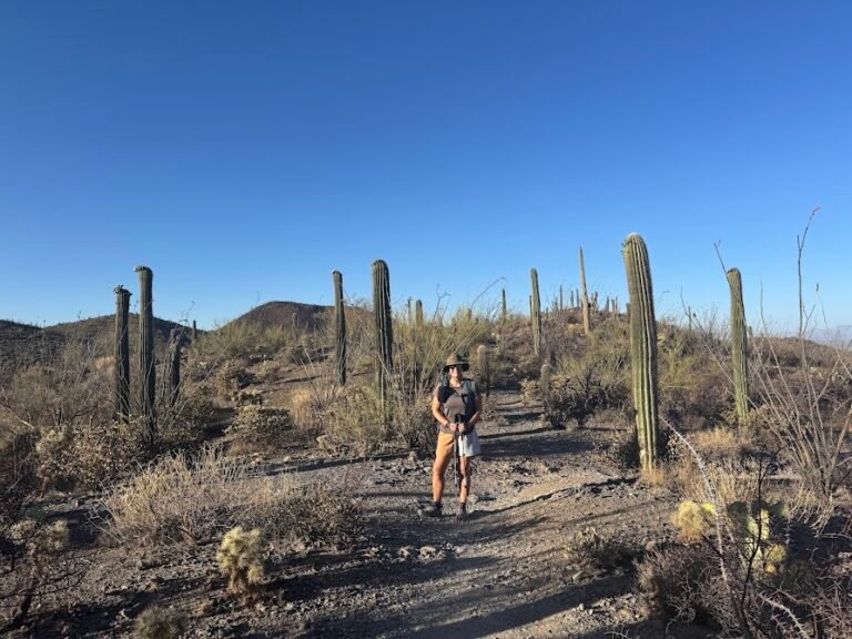
We spent our second day in Saguaro in the western park sector, and in the morning went on a hike to the summit of Wasson Peak. The trail started off a tiny bit boring in a rocky wash, but eventually reached a dense area of cacti with some of the tallest saguaro we’d seen to date (30 feet tall!).
The climb was steady but very doable, even in the full sun and heat. We saw no other hikers but a handful of trail runners out for an early morning run.
Once at the summit of Wasson Peak we were treated to incredible views across the whole desert. It’s no surprise given that at 4,687 feet, this is the highest point in the west side of the park.
As this trail was a loop, we made our way down a sandy ridgeline through mini-cactus gardens. We even saw a few old mine shafts along the way, evidence of the old mining industry in the area. It took us 3.5 hours to cover 7.78 miles with 1,854 feet elevation gain on this hike.
Need to Know
Hours: This area of the park is open 24/7. We began our hike at 6am to get ahead of the heat of the day and saw almost no one else.
Parking: Parking for this trail is at the King Canyon Trailhead where there is a large parking lot.
Fees: Saguaro National Park charges a fee to enter. It is $25 per vehicle and is valid for 7 days in both the east and west districts. If you will be visiting several national parks or national historic sites in a year, we highly recommend purchasing the $80 America the Beautiful Pass which is accepted at Saguaro National Park.
Red Hills Visitor Center & Bajada Loop Drive
We briefly stopped by the Red Hills Visitor Center, then set off to drive along the scenic, 6-mile Bajada Loop Drive. While the road is unpaved it is made of graded dirt (see photo below) and easily passable in any type of vehicle. Along the way there are scenic pullouts and trailheads.
We stopped along the way to hike two very short trails.
The Valley View Overlook Trail was a 0.8-mile out and back, with virtually no elevation gain that went through dense cacti.
The Signal Hill Trail was even shorter (0.3 miles), also with hardly any elevation gain, but is the best place to observe petroglyphs within the park.
Before we left the park, we stopped to get a picture at another sign. Note, the design of the signs on either side of the park are different, so pick your favorite!
Arizona-Sonora Desert Museum
The Arizona-Sonora Desert Museum is designed to foster an understanding of the Sonoran Desert through the natural world. They have exhibits on everything from fossils and gems to how cave systems are formed. They also have an aviary, aquarium, and a reptile and insect house. One of the highlights for us was their live animal program. We got to meet and learn about a macaw, porcupine, and skunk. We spent about 2.5 hours exploring the museum grounds. This would be a great place to take kids!
Need to Know
Tickets: We walked right up to the museum and easily purchased tickets onsite. They can, however, be purchased on the museum website.
Hours & Admission Fees: Hours vary throughout the year, but the museum generally opens by 8:30am most days. An adult ticket was $29.95 when we visited.
Directions: The museum is located on the west side of Tucson, adjacent to Old Tucson and Saguaro National Park West. There is a large, free parking lot.
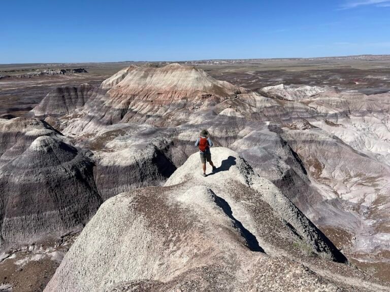
Day 6 | Holbrook: Petrified Forest National Park
Travel to Holbrook
We spent our morning driving from Tucson to the Petrified Forest, which took about 4.5 hours. The drive was beautiful at times, following a river or cutting through a canyon, but most of it was quite desolate.
Where We Stayed
We stayed the Days Inn by Wyndham Holbrook. The room was actually very nice and reasonably priced, considering that we were in the middle of nowhere.
Where We Ate
We walked across the street from our hotel to eat dinner at Bienvenidos Restaurant. I’ll admit I was a bit dubious based on the looks from the outside. But inside we were welcomed into a friendly environment and had delicious burgers and fries.
Petrified Forest National Park
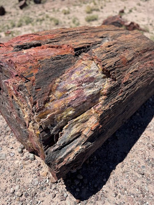
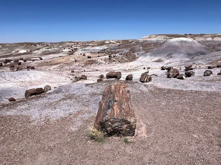
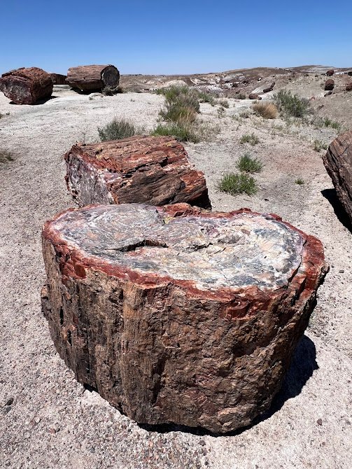
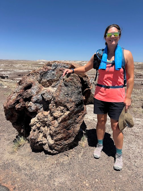
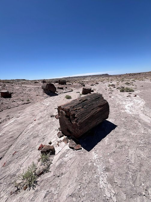
The headline attraction of Petrified Forest National Park is the colorful, petrified wood strewn across the landscape. The wood was formed over 200 million years ago when logs washed into an ancient river system, then were quickly buried and began absorbing minerals. Today, the wood is comprised of almost solid quartz, making them glitter and sparkle in the sun. No doubt seeing so much of this petrified wood was amazing, but within the park we also found fascinating paleontology exhibits, badlands, petroglyphs, and stunning vistas. A truly varied park!
Giant Logs, Long Logs & Agate House Hike
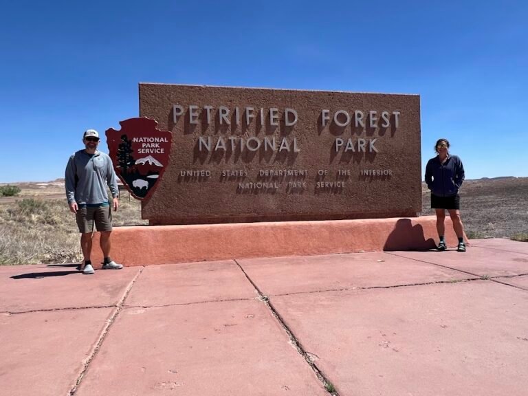
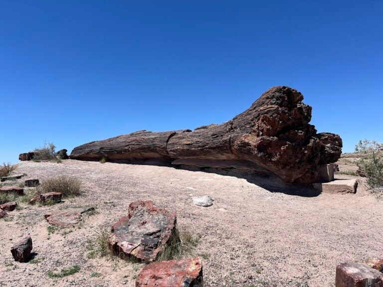
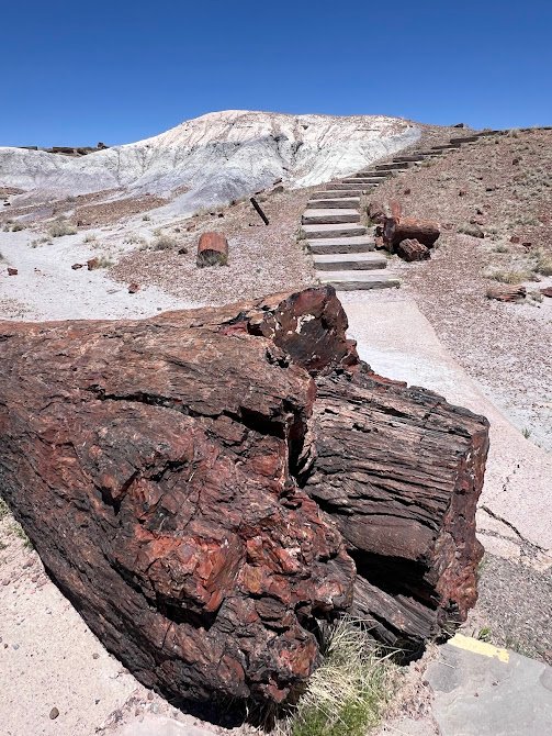
We entered the park through the South Entrance, stopping at the sign for a quick picture, then continuing on to the Rainbow Forest Museum. After viewing the exhibits on display, we headed out to the Giant Logs Loop Trail just behind the museum. As the name implies, some of the largest and most colorful logs in the park are located right here. The largest one was almost 10 feet wide at its base! This trail was very easy, and paved, with a few stairs.
Next, we walked along the park road to get to the trailhead for the Long Logs & Agate House Loop Trail. Although these hiking paths are relatively flat, we were exerting a fair amount of energy due to the intense sun and the fact that the average elevation within the park is almost 6,000 feet!
The first part of this trail was a bit of a slog along a paved path with not much to see, but once we got to the real trail it was great. The long logs area is the result of an ancient log jam, so there was a high concentration to see in this area.
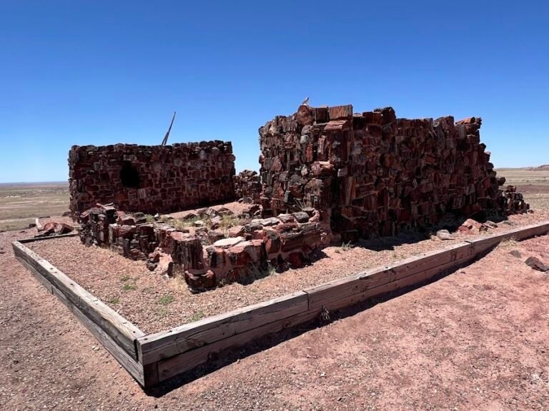
We continued on to get to the Agate House. Believed to be occupied 700 years ago, this small pueblo is made almost entirely of petrified wood. We stopped in a shaded picnic pavilion to eat our lunch, then made our way back to our car. This combination of trails was about 3.5 miles in length and took us 1.5 hours (there was only 150 feet of elevation gain).
Need to Know
Hours: Petrified Forest National Park is only open 8am-5pm daily. There are gates at the South and North entrances.
Parking: Parking for these trails is at the Rainbow Forest Museum where there is a very large parking lot.
Fees: Petrified Forest National Park charges a fee to enter. It is $25 per vehicle and is valid for 7 days. If you will be visiting several national parks or national historic sites in a year, we highly recommend purchasing the $80 America the Beautiful Pass which is accepted at Petrified Forest National Park.
Crystal Forest Hike
Located just off the park road, the Crystal Forest Trail is a great place to see the crystals in the wood up close. In the bright sunlight they were practically sparkling! We stopped at the viewpoint in the beginning, then made our way around the 0.8-mile loop in about 25 minutes. Here again, there was almost no elevation gain making this an easy path to tackle.
Need to Know
Hours: Petrified Forest National Park is only open 8am-5pm daily. There are gates at the South and North entrances.
Parking: Parking for this trail is just off the park road in a large parking area.
Fees: Petrified Forest National Park charges a fee to enter. It is $25 per vehicle and is valid for 7 days. If you will be visiting several national parks or national historic sites in a year, we highly recommend purchasing the $80 America the Beautiful Pass which is accepted at Petrified Forest National Park.
Old Jasper Forest Road Hike
Just a bit farther up the road is the Jasper Forest Overlook, a great space to stop for the views. We headed down along the trail which loosely follows an old park road built in the 1930s. Later closed to prevent the theft of petrified wood, it has been left to erode away and is now the site of one of the park’s “Off the Beaten Path” hikes.
We thought some of the logs along the beginning of the trail were neat, but quickly lost interest as we hiked along a hot, sandy wash, with not much scenery. We ended up turning around about a mile in, taking 45 minutes to complete the 2-mile roundtrip.
Need to Know
Hours: Petrified Forest National Park is only open 8am-5pm daily. There are gates at the South and North entrances.
Parking: Parking for this trail is at the Jasper Forest Overlook where there is a large parking area.
Fees: Petrified Forest National Park charges a fee to enter. It is $25 per vehicle and is valid for 7 days. If you will be visiting several national parks or national historic sites in a year, we highly recommend purchasing the $80 America the Beautiful Pass which is accepted at Petrified Forest National Park.
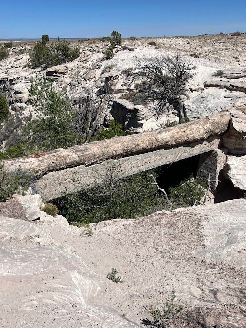
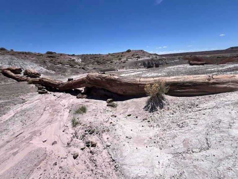
Agate Bridge & Newspaper Rock
Our final stops of the day were at Agate Bridge and Newspaper Rock, quick stops in the car to walk to the overlooks.
The Agate Bridge is a partially exposed petrified log spanning a gully. Fears of collapse led to a support beam to be constructed underneath in the early 1900s, which made the site less impressive to us. See the photo below for an idea of what the bridge looks like.
Newspaper Rock is an archeological site home to over 650 petroglyphs created by ancestral Puebloan people. Honestly, even with the help of the free telescopes, we had trouble seeing the petroglyphs.
Day 7 | Petrified Forest National Park + Travel to Bluff, UT
Blue Mesa & Blue Forest Hike
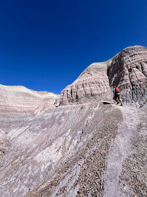
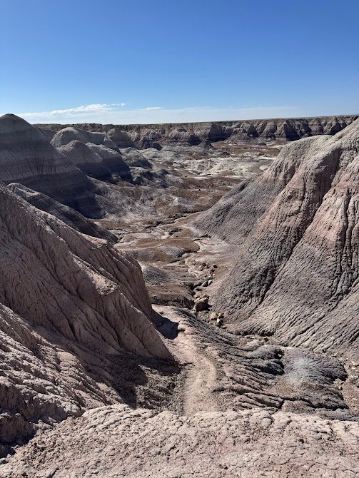
We began our second day in the park with what would become our favorite trail by far! Instead of seeing petrified wood on this hike, after a sharp descent from the mesa along a paved trail, we were immersed among the badlands hills. While you can just complete the 1-mile, mostly paved loop around Blue Mesa, the real magic is the Blue Forest Trail. We literally stepped into and on top of the badland formations, climbing our way to amazing views.
The trail got better and better as we went along with eye-popping colorful blue and white badland hills. The trail was incredibly fun as it wound its way through and up and down the formations. After retracing our steps back to the Mesa Trail junction, we ended our hike by completing the paved loop. We saw exactly zero people on this trail which was about 3 miles roundtrip with 360 feet of elevation gain. It took us 1.5 hours to complete, mostly because we stopped so much to admire the views.
Need to Know
Hours: Petrified Forest National Park is only open 8am-5pm daily. There are gates at the South and North entrances.
Parking: Parking for this trail is at the Blue Mesa Viewpoint where there is a large parking area. This is located along the 3-mile Blue Mesa Scenic Road, a short loop off the main park road.
Fees: Petrified Forest National Park charges a fee to enter. It is $25 per vehicle and is valid for 7 days. If you will be visiting several national parks or national historic sites in a year, we highly recommend purchasing the $80 America the Beautiful Pass which is accepted at Petrified Forest National Park.
Onyx Bridge Hike
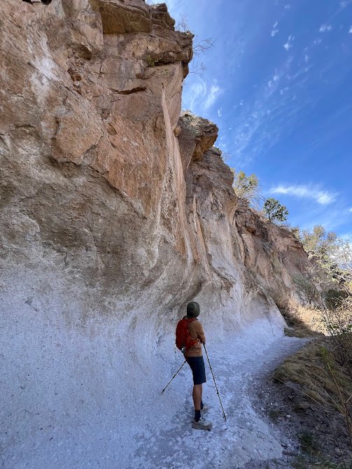
In the late morning, we drove to the north end of the park to complete the hike out to Onyx Bridge. The bridge is a long, petrified log dating back 210 million years ago (!), that stretches across a wash. This is another “Off the Beaten Path” hike within the park. The initial part of the trail had a very steep descent, but then leveled out. Completely different than any other area of the park, here we were in the middle of a crazy red desert.
Though we passed by some more badland formations, the hike was pretty desolate and even with our map, route-finding was difficult at times. At the end of the trail we had to do a small bit of scrambling to finally make it to the Onyx Bridge. It was definitely neat to see, but kind of anti-climactic! We retraced our steps and made the steep climb up to the trailhead located at the historic Painted Desert Inn. This hike was 4.4 miles with 430 feet of elevation gain and took us 1 hour and 40 minutes to complete.
Need to Know
Hours: Petrified Forest National Park is only open 8am-5pm daily. There are gates at the South and North entrances.
Parking: Parking for this trail is at the Painted Desert Inn where there is a large parking lot.
Fees: Petrified Forest National Park charges a fee to enter. It is $25 per vehicle and is valid for 7 days. If you will be visiting several national parks or national historic sites in a year, we highly recommend purchasing the $80 America the Beautiful Pass which is accepted at Petrified Forest National Park.
Caution!: We highly recommend downloading an offline map from AllTrails for this hike. The path was very unclear and not marked at all. Even with our map we had difficulty finding the route at times and couldn’t imagine doing it with just a paper map.
Travel to Bluff, UT
After a picnic lunch at Petrified Forest National Park, we made the 3-hour drive just over the Arizona border to Bluff, UT.
Where We Stayed
We stayed at a lovely Airbnb cabin in Bluff. We loved having the ability to spread out and cook our own meals. A bonus was the comfortable and scenic front porch where we had happy hour each day.
Day 8 | Bluff: Monument Valley, Goosenecks State Park & Valley of the Gods
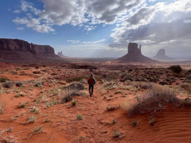
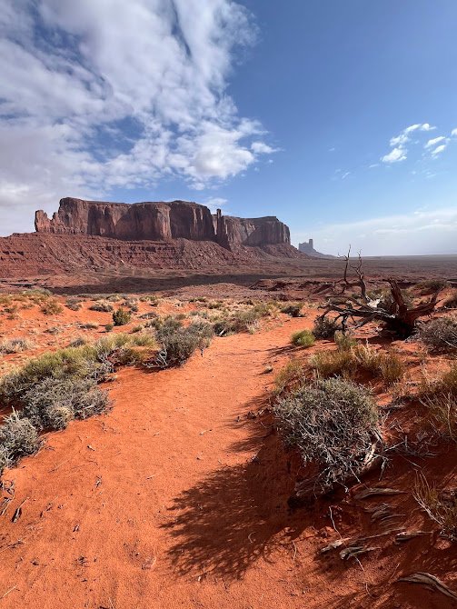
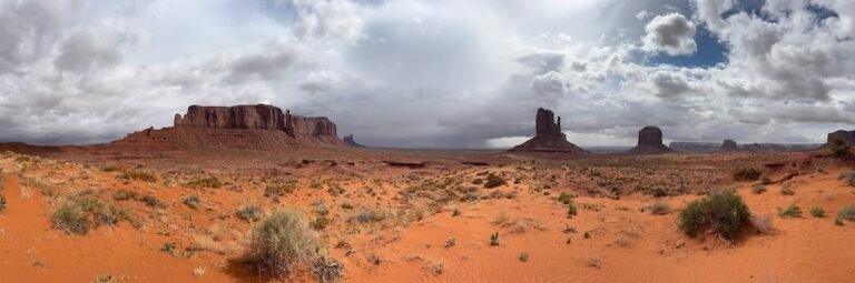
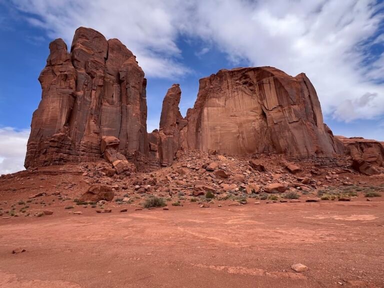
Located within the Navajo Nation, Monument Valley is known for its iconic sandstone buttes. These formations tower above the red-sand desert below and are incredibly impressive from both far away and up close. As we drove down Route 163 towards the entrance, we got our first glimpse of the buttes and all we could keep saying was “wow”!
If you make this same drive, you may get a sense of déjà vu, as this road is featured in the movie Forrest Gump (it’s where he ends his epic run).
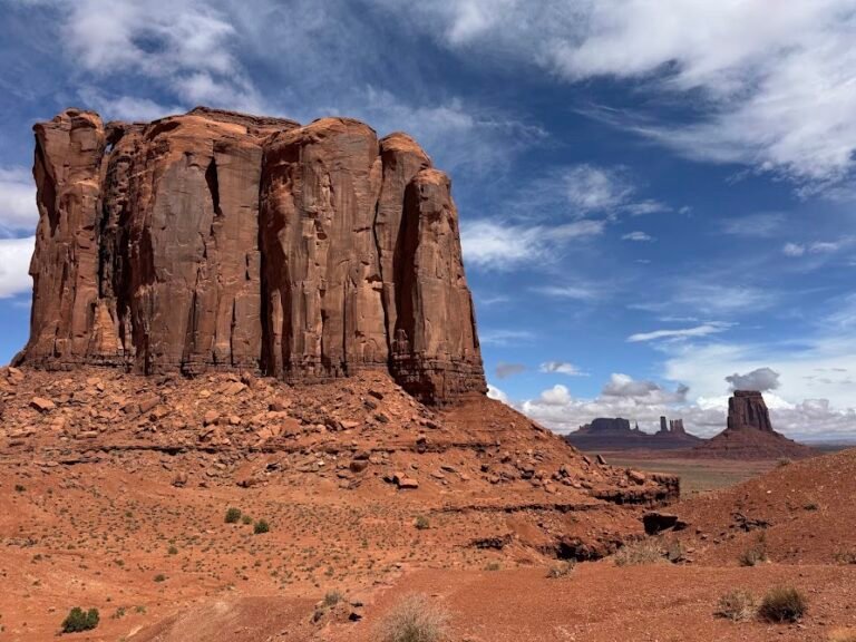
Wildcat Trail Hike
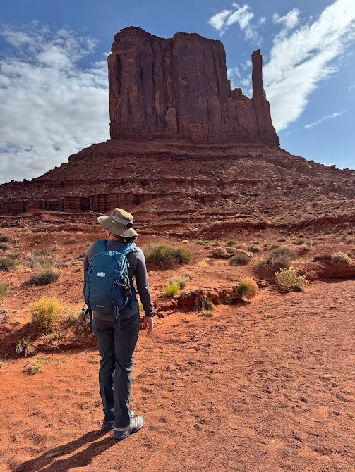
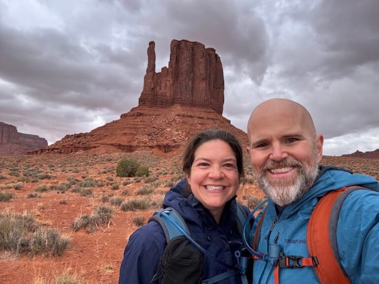
While many people visit Monument Valley by car, in our experience hardly anyone explores on foot. In fact, there is only one designated hiking trail in the entire area on which visitors are allowed to hike independently. The Wildcat Trail is a loop around some of the most famous formations: East and West Mitten.
With potential rain in the forecast a bit later in the day, we set out on trail early, descending from the Visitor Center into the valley. The path was on soft, red sand through small shrubs. Eventually we got really close to the rock formations which was a true highlight. Can you make out the mitten shape?
We walked through several sandy washes and at one point we were standing smack in the middle of the two Mitten Buttes and Merrick Butte. A short section of the trail joined up with a off-road route which had some small shelters along the way. These were conveniently situated as we ducked under one to avoid a light rain shower.
As we completed our loop we came across two wild horses that were grazing, and then decided to join our trail for a few minutes. Those were the only creatures we saw our entire time on the trail! The climb out of the valley was a little tough due to the soft sand and steep path, but we quickly reached the top. It took us 1 hour 45 minutes to hike the 4.35-mile, 400 feet elevation gain of the Wildcat Trail.
Need to Know
Hours: Monument Valley has hours that vary by season. Be sure to check the Navajo Tribal Park website for current hours and conditions.
Parking: Parking for this trail is in the large parking lot at the Visitor Center. It is a short walk to the trailhead located near the campground.
Fees: There is an entry fee of $8 per person, per day. This fee is collected at the booth to the entrance of Monument Valley, prior to reaching the Visitor Center and scenic drive.
Remember your time zones!: Remember that Navajo Nation observes DST and will be one hour head of others areas in Arizona during the summer months. If you’re following this itinerary and driving from Bluff, UT, the time zones for Monument Valley and Bluff will be the same during DST.
Monument Valley Loop Drive
Within Monument Valley there is a 17-mile scenic loop. You can drive this in your personal vehicle but a 4×4 with high clearance is absolutely necessary. We did this in our rental car which was a Mitsubishi Outlander Sport. The alternative is to go with a tour operator, generally in an open-air set up on the back of a pickup truck. There is a tour booth just outside the Visitor Center that it looked like you could just walk up to and pay for on the spot.
The website warns in advance of rough terrain and deep sand dunes, but I wasn’t prepared for just how terrible a shape the road was in. We began what I would call a hellish descent down into the valley and the skies absolutely opened up. It started hailing!
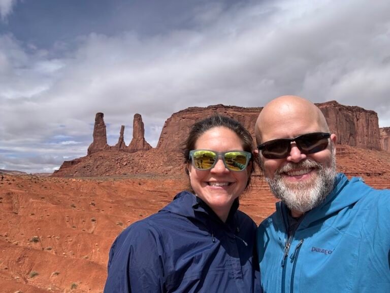
Luckily the weather stopped after a bit but it continued to be stressful driving the road. On the bright side, getting so up close to the formations was really neat. There were plenty of places to stop off and stretch our legs. Here we are in front of the Three Sisters formations. Three tall and narrow fingers close together off the edge of a large plateau.
At the entrance booth to Monument Valley we were given a faded map, denoting the most remarkable formations. We made sure to stop at marked viewpoints such as John Ford’s Point, named for the Hollywood director who filmed from that location for many movies. Plus plenty of other sites like Camel Butte, Elephant Butte, and Artist’s Point.
It took us about 1.5 hours to drive the scenic loop, including stops. We can’t emphasize enough how important it is to drive slowly and carefully. We saw a guy rip out part of his undercarriage on a rock, even with a high-clearance 4×4!
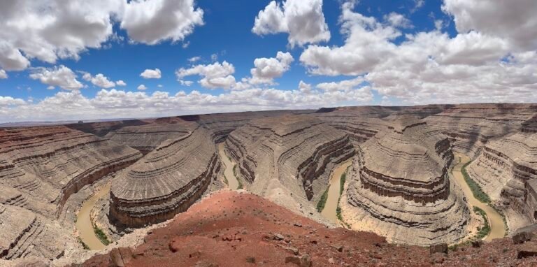
Goosenecks State Park
On the way back to to Utah, we made a stop at Goosenecks State Park which has an entry fee of $5 per car and is open 24/7.
Although the photo may look like an optical illusion, it’s not! At the park’s overlook, you can peer into the abyss to see the San Juan River winding through the 1,000 foot canyon below. An excellent example of a river meander known as a gooseneck. As a result of this serpentine form, the river flows a distance of 6 miles while only advancing 1.5 miles west on its way to Lake Powell!
If you’re not camping, there isn’t much to do here other than marvel at the gooseneck at the various overlooks. It does make for a great picnic lunch spot though, with plenty of benches!
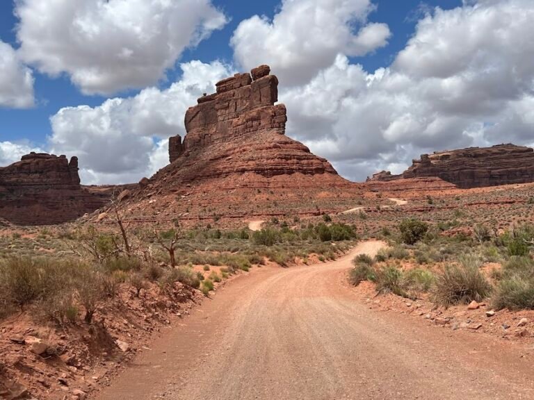
Valley of the Gods
Valley of the Gods is another scenic, 17-mile drive on a graded gravel and clay surface road. The road may be suitable for passenger cars when the conditions are dry, but we’d still recommend a 4×4. The road runs between Highways 163 and 261, and we entered from the west, just a short drive from Goosenecks State Park.
Many people call this a mini-Monument Valley, because you have the chance to see similar isolated and towering pinnacles. Managed by the Bureau of Land Management (BLM), entrance is free and the road was in MUCH better shape than the one within Monument Valley. We also only saw a handful of other cars during the entire drive.
While we found Monument Valley to be more spectacular, we are glad we drove through Valley of the Gods too. We popped out of the east entrance and ended our day back at our cabin.
Day 9 | Natural Bridges National Monument + Travel to Page & Horseshoe Bend
Butler Wash Anasazi Ruins
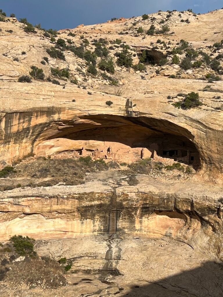
On the drive from Bluff, UT, to Natural Bridges National Monument there is a turnout for the Butler Wash Interpretative Site. Here, a short (<0.5-mile) hike takes you to the viewpoint for a cliff dwelling that was built and occupied by Ancestral Puebloans in the 13th century.
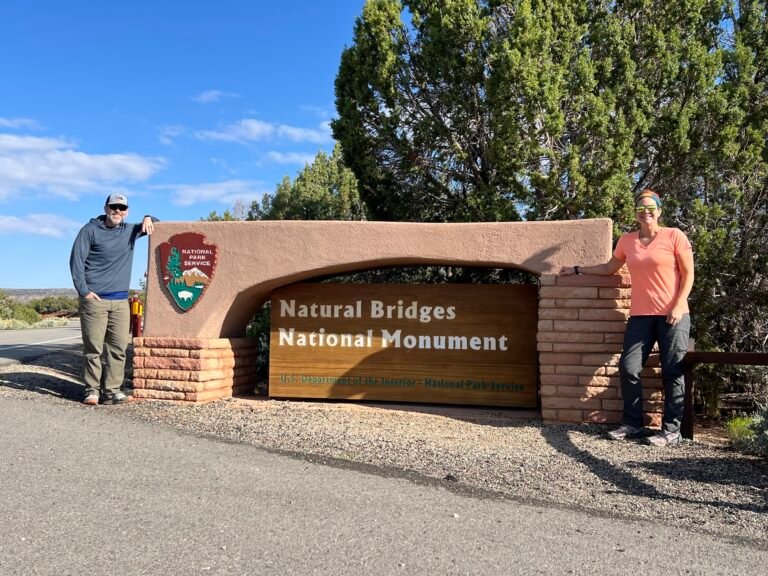
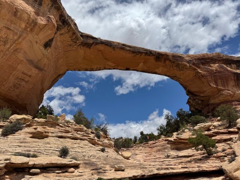
Natural Bridges National Monument
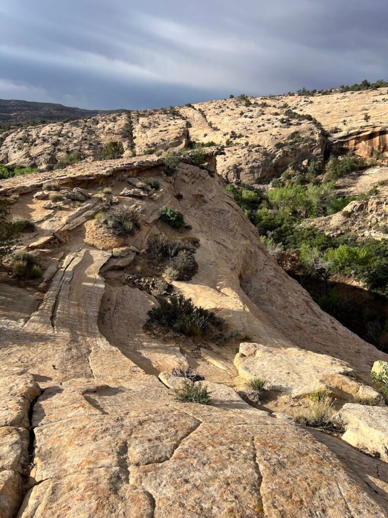
It took us about 1-hour to drive to Natural Bridges National Monument located in Southeast Utah. The park is home to three massive natural bridges and all sites are accessed via a paved, 9-mile loop. We drove and then parked about halfway around the loop to do a hike.
Sipapu Bridge to Kachina Bridge Loop Hike
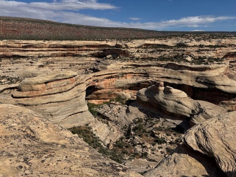
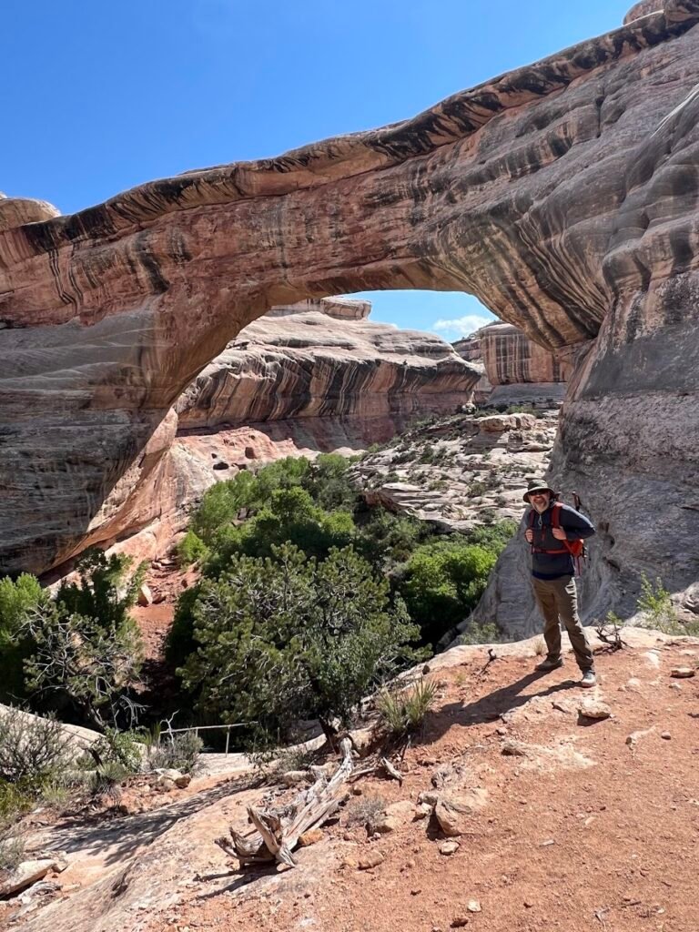
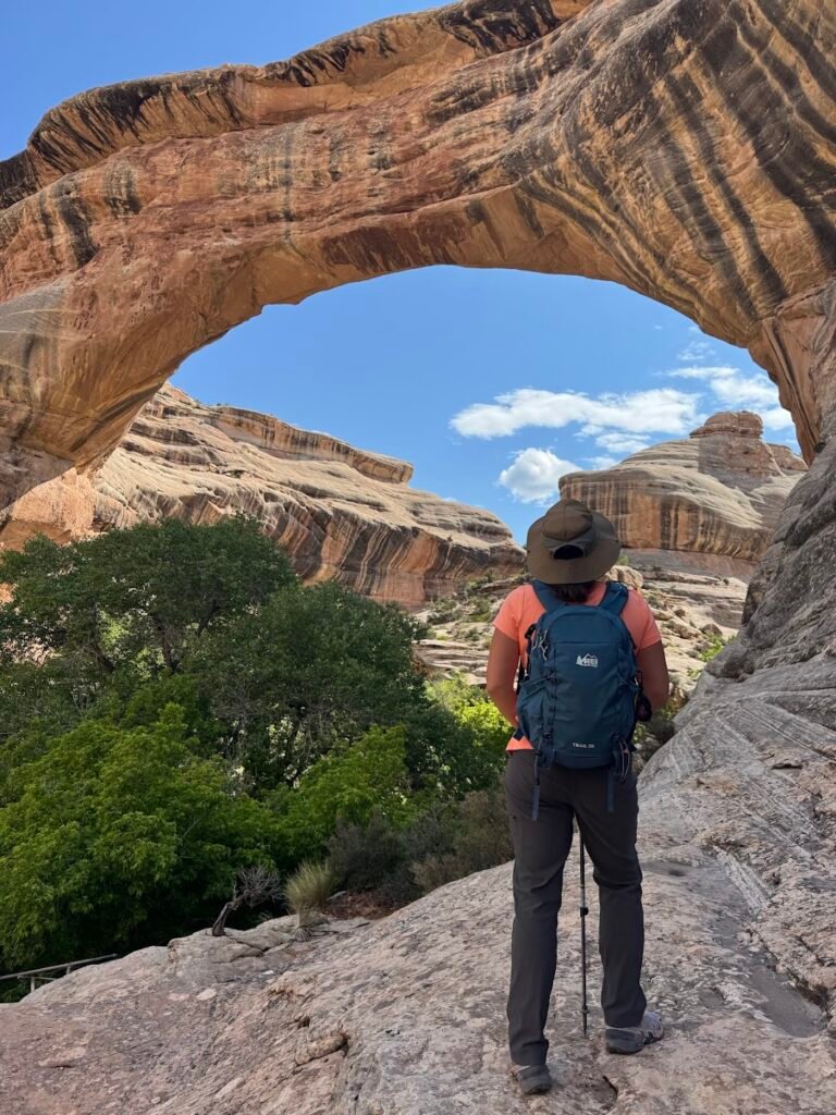
Our planned loop hike would traverse much of the park and go past two of the three main arches in the park. We set off along the Mesa Trail for about 2 miles which was so peaceful with lots of tree and birds, and mostly flat terrain. We then reached the viewpoint for Sipapu Bridge, one of the largest in the US. Here we saw sweeping panoramic views of the formations below.
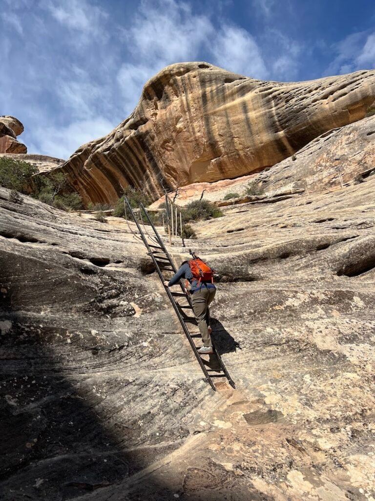
The descent to Sipapu Bridge was so fun, making use of stairs and ladders to downclimb. The arch was so thick and impressive once up close. It’s the largest we’d ever seen.
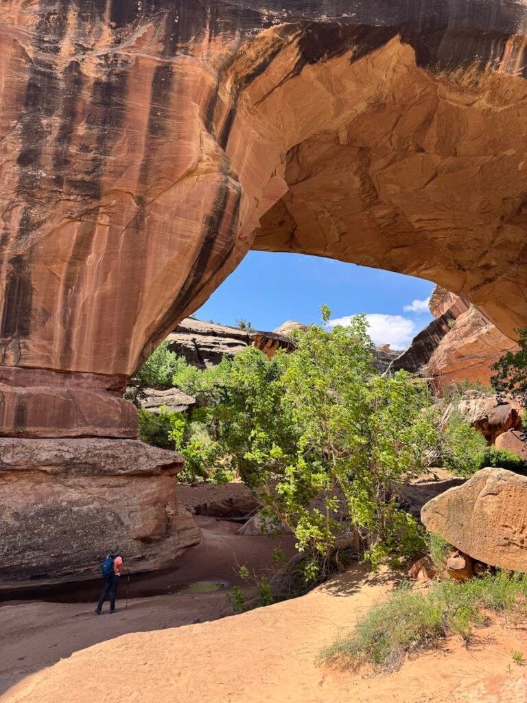
From this point, the trail followed a mostly dry wash through the floor of the canyon. We then reached Kachina Bridge which was even more substantial. See if you can spot me as a teeny tiny dot in comparison to the arch above. The hike came in at just under 6 miles for us, with almost 900 feet of elevation gain. It took us nearly 3 hours with lots of breaks and photo stops. People are totally sleeping on this park because we saw only one other person on trail the whole day!
Need to Know
Hours: Natural Bridges National Monument is open 24/7.
Parking: There is ample parking at either of the overlooks for Sipapu Bridge and Kachina Bridge. You can start this loop hike at either location. We were happy to have parked at Kachina Bridge to get the “boring” part of the hike without much scenery, over first.
Fees: Natural Bridges National Monument charges a fee to enter. It is $20 per vehicle and is valid for 7 days. If you will be visiting several national parks or national historic sites in a year, we highly recommend purchasing the $80 America the Beautiful Pass which is accepted at Natural Bridges National Monument.
Owachomo Bridge Hike
Just a short drive from the Kachina Bridge trailhead is the parking area for the short (0.6-mile roundtrip) hike out to Owachomo Bridge, the third of the park’s main arches. This arch was more thin and delicate than the rest, and had a beautiful shady area where we ate our lunch. This is a quick stop and only took us about 20 minutes.
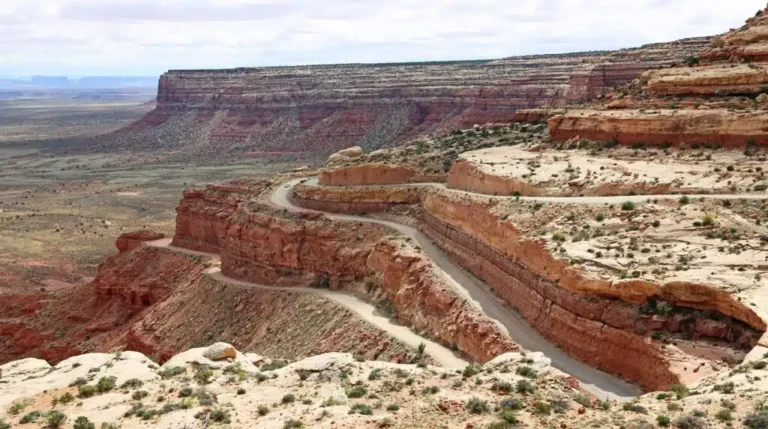
Travel to Page, AZ | Moki Dugway
After wrapping up our hiking adventures, we made the roughly 3-hour drive to Page, AZ. Along the way we drove a 3-mile, unpaved section of the road known as Moki Dugway. This section of very tight switchbacks along Highway 261 allowed us to descend the cliff face from the top of Cedar Mesa. It was one of the craziest roads I’ve ever driven!
In Page, AZ, we stayed at the La Quinta by Wyndham Page at Lake Powell. The hotel was nice and felt new, but was definitely overcrowded and understaffed. We felt this acutely when our room was not yet ready (even though it was an hour after the stated check-in time) and at breakfast the next morning when items went unfilled and it was almost impossible to find a seat.
Where We Ate
We had a dinner of sandwiches, fries, and beer at State 48 Tavern, very serviceable bar food in an upbeat, busy environment.
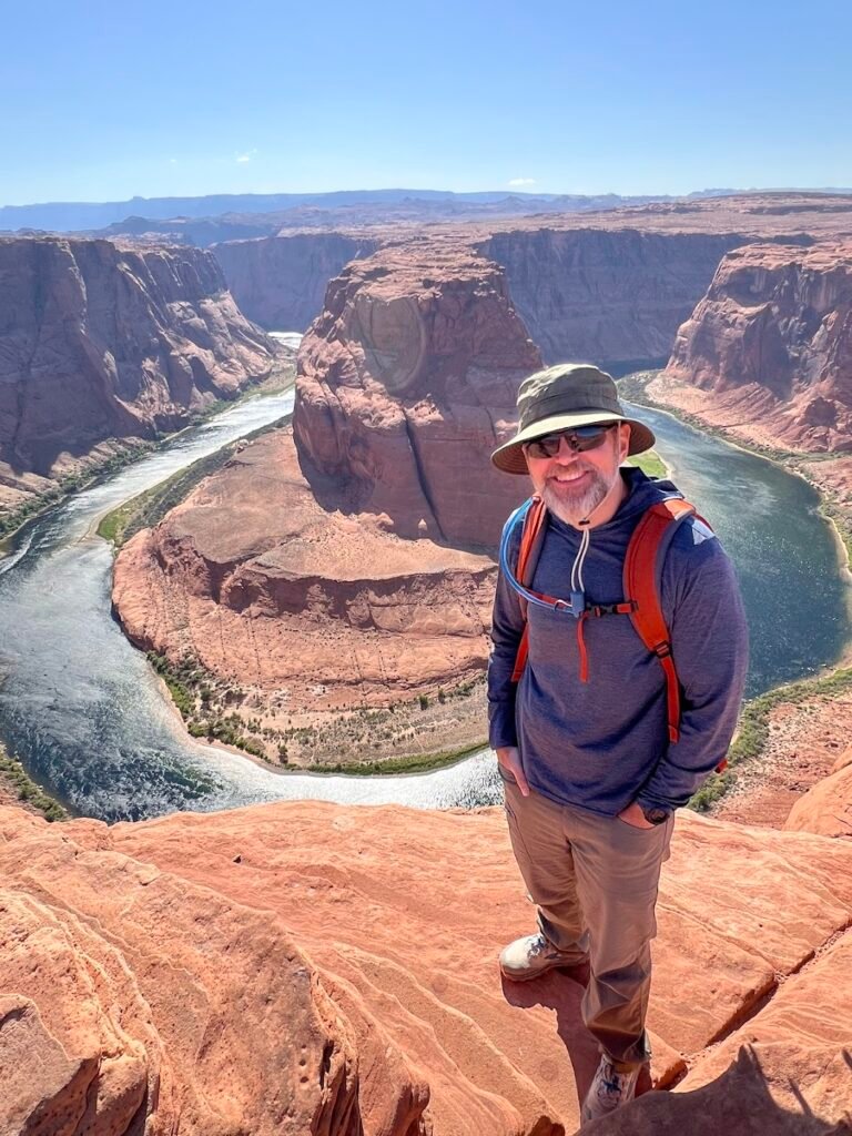
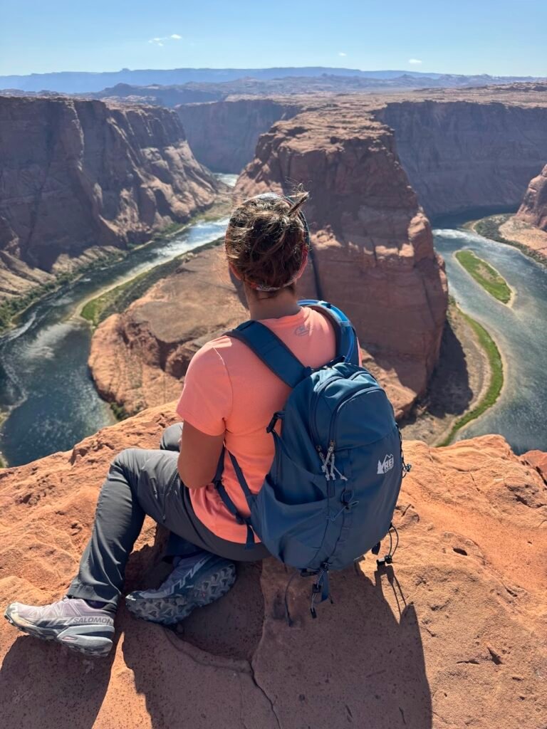
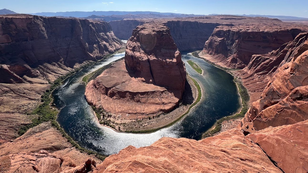
Horseshoe Bend
With plenty of daylight and time left, we headed out to Horseshoe Bend. Parking at, and access to, Horseshoe Bend is managed by the city of Page. Upon entering the large parking area the $10 fee per vehicle is collected (no national park passes are valid here). The area is open daily from sunrise to sunset.
Getting to the overlook requires a 1.5-mile roundtrip out-and-back hike over a packed dirt trail. There is a main, fenced overlook. We, however, recommend carefully walking out further. Here you’ll find solitude and some of the most gorgeous views. Seeing Horseshoe Bend in person was beyond our wildest expectations. It looks exactly like the photos we’d seen, but is so vivid in person. Absolutely worth a visit when in the area.
Day 10 | Cardiac Canyon Tour + Travel to Grand Canyon
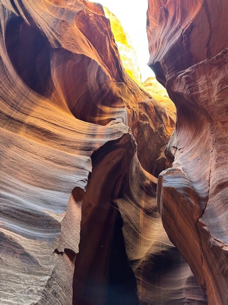
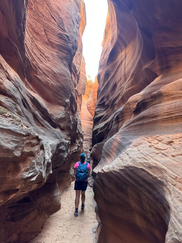
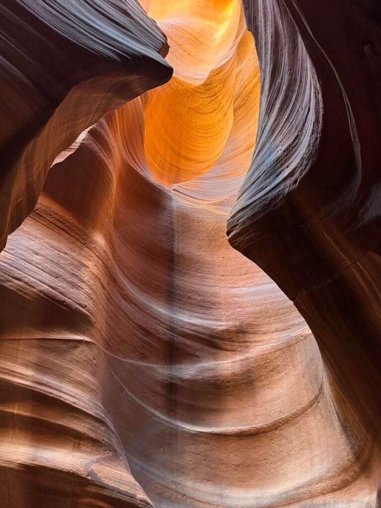
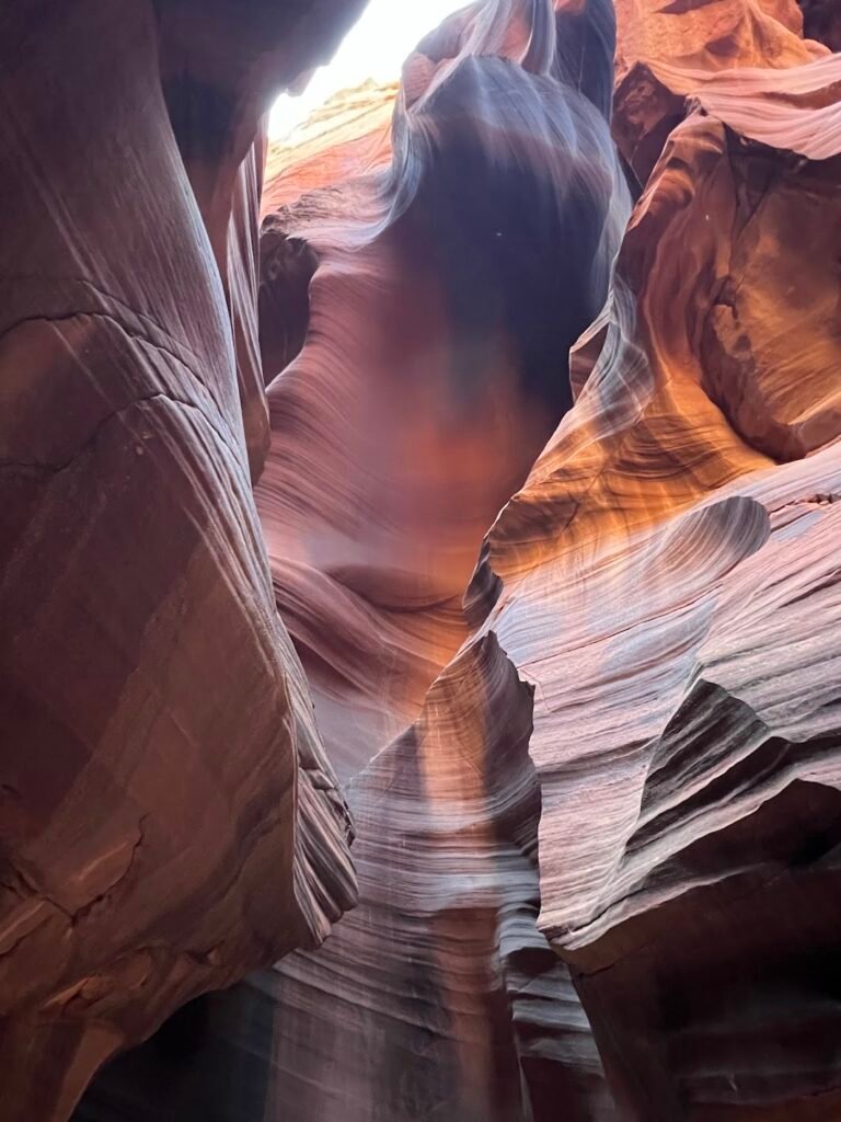
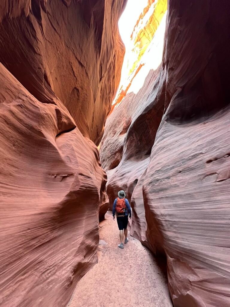
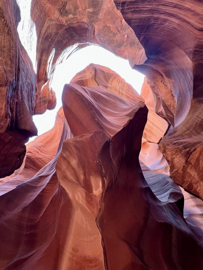
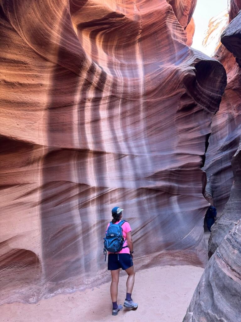
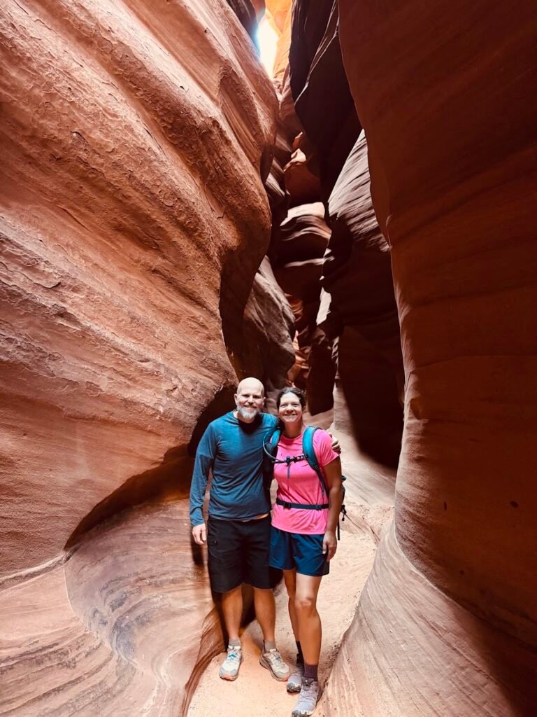
Cardiac Canyon Hiking Tour
If you’ve heard of a slot canyon near Page, AZ, it’s probably Antelope Canyon whose light-filled, narrow passageways are the subject of many a beautiful photograph. Even though the canyon may only be visited by tour with a Navajo-owned company, we heard it’s ridiculously crowded.
We instead decided to book a 4-hour hiking tour with Taadidiin Tours. Located within the Antelope Canyon wash system, this tour was billed as a slot canyon tour without the crowds. Perfect!
Upon arrival for our 9am tour, we met up with our guide and two other guys from Germany that would be joining us for the morning. We were then transported via a sturdy 4×4 van for a 7-mile, 30-minute drive to the remote trailhead where we would drop in to Cardiac Canyon. Almost immediately our jaws dropped at the beauty within the canyon.
The light seemed to almost dance off the red canyon, as the occasional wind blew through to create a temporary sand waterfall down the walls. While we hiked mostly on the canyon floor, there were plenty of stairs, ladders, and even ropes that were used to traverse the terrain.
At one point we dropped our packs and squeezed in to a super narrow section of the canyon that required some minor gymnastics. We were in awe the whole trip and it was made even more magical by the fact that we only briefly encountered one other group of four people on a photography tour. We are SO glad we chose this option.
Need to Know
Tours: Tours run daily at 9am with a minimum of two participants required. Advance bookings should be made on the Taadidiin Tours website. The tours are 4 hours in duration and require 2.5 miles of hiking with lots of different elevation changes.
Directions: The meeting point is located a 15-minute drive from Page. There is plenty of free parking onsite.
Time zone: Even though tours take place on the Navajo Nation, for the purposes of the tour they do not operate on Daylight Savings Time. This means the time zone will always be the same of that in Page.
Packing tips: We recommend bringing a small backpack with water and snacks. A hat is also helpful for the sunny areas and be prepared that you might get a little dirty as you shimmy along the canyon walls at points.
Travel to the Grand Canyon
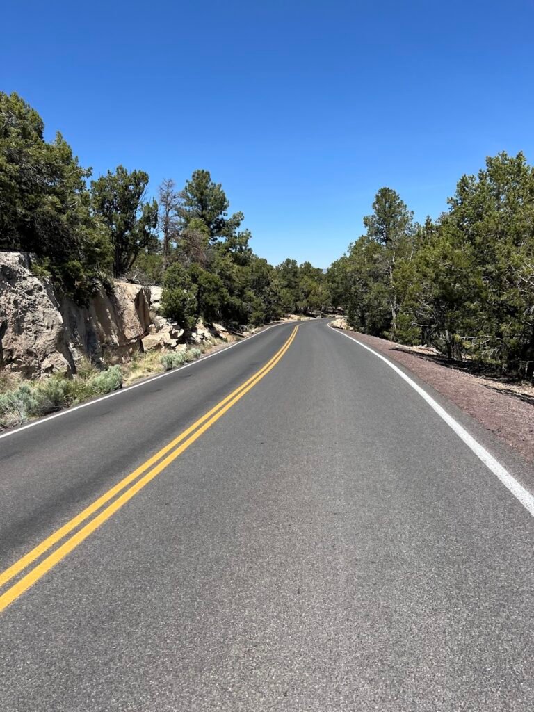
From Page, it was about a 2.5-hour drive to the Grand Canyon. Especially as you approach the canyon rim, the drive is incredibly scenic.
Where We Stayed | South Rim
Because we were completing Rim to Rim, we had two separate stays on the South Rim of the Grand Canyon.
We stayed one night at the Bright Angel Lodge. Located right on the rim, our room here was a real treat. There is something special about being just steps away from the magnificent canyon. This made up for the fact that the room was a bit rustic and had no A/C or in-room shower (there are private/communal showers).
For our final three nights, we stayed at Maswik Lodge. Our room here was modern and comfortable with A/C, a king-sized bed, and plenty of room to spread out. Although set back from the rim, it was still just an easy 15-minute walk. Plus, since it’s tucked away from the main park attractions, finding parking right outside our room each day was very easy. We loved the quiet tranquility of the place, tucked among the Ponderosa pines.
Where We Ate | South Rim
Harvey House Café, located in Bright Angel Lodge, was where was had breakfast twice and dinner once. If you can’t tell, we loved the food, friendly service, and tables next to the rim views.
Fred Harvey Tavern, also located within Bright Angel Lodge, was the site of our post-Rim to Rim celebratory drinks and dinner. The cold beers, hot beef sandwiches, and salty fries were the perfect antidote to almost 14 hours on trail.
Maswik Pizza Pub, located in the Maswik Lodge was our least favorite dining experience. Insanely crowded every night of the week, you can expect a long wait for your food. Even longer if your waitress inadvertently forgets to put in your order, as was our experience. Doh!
Bright Angel Fountain: Just steps away from Bright Angel Trailhead and Lodge, this shop serves generically-flavored, but still delicious ice cream cones.
Canyon Adventures located near the South Rim Visitor Center offers up delicious coffee, and bike rentals.
Canyon Village Market & Deli, in the Grand Canyon Village, is a one-stop shop for groceries, souvenirs, and grab-and-go food. We had pretty amazing bagel breakfast sandwiches and coffees on our way out of the park.
Beer Garden: Quite possibly our favorite hangout, the beer garden just outside the El Tovar Hotel was amazing. We loved ending our day with a pint of delicious beer, cooled by the light wind climbing up and over the canyon walls just steps away.
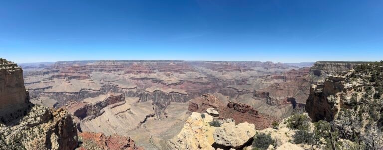
Days 11-13 | Grand Canyon National Park
Grand Canyon National Park never ceases to amaze. This was our second visit and we had just as much fun the second time as our first, over 10 years prior. With an average depth of 1 mile and 277 miles of the Colorado River snaking its way through the park, the canyon is nothing short of magnificent. There are a multitude of ways to spend your time in the park, and here we outline our experiences over several days in late May.
Need to Know
Hours: The South Rim of Grand Canyon National Park is open 24/7. Following the Dragon Bravo Fire, the North Rim is partially re-opened during the summer season. Check the park website for current alerts and opening information.
Fees: Grand Canyon National Park charges a fee to enter. It is $35 per vehicle and is valid for 7 days. If you will be visiting several national parks or national historic sites in a year, we highly recommend purchasing the $80 America the Beautiful Pass which is accepted at Grand Canyon National Park.
Pro tip!: No reservations or timed entry is required, but the lines to enter can be very long. It’s best to arrive earlier in the morning, or later in the afternoon. If you’re planning an overnight stay within the park, reservations are absolutely essential and generally open on a rolling 365-day basis prior to your stay.
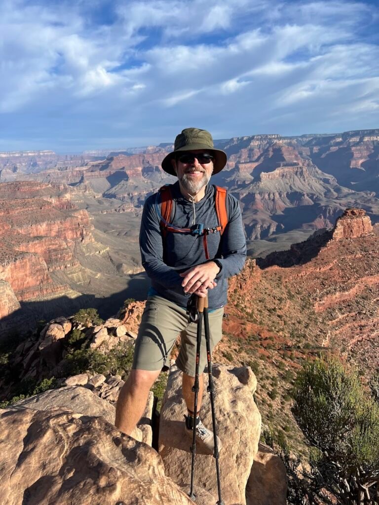
Hike Rim to Rim
We can think of no finer way to experience the Grand Canyon than by hiking from one rim to another. We were fortunate enough to be able to hike from the the North to South rim in what would be one of the most grueling, but rewarding hikes we’ve ever completed. When we visited, trans-canyon waterline work resulted in trail diversions, making a very long day even longer. Our hike was 28.5 miles and 5,990 feet of elevation gain over a staggering 13 hours and 45 minutes.
Unfortunately, the devastating Dragon Bravo Fire in July 2025 destroyed the historic Grand Canyon Lodge on the North Rim. This means the hike as we completed it is currently not possible. You can still read about our experience hiking Rim to Rim in one day here. Our hope is that one day in the not too distant future, the North Rim will fully re-open for business for all to enjoy.
Hike the Trail of Time
The Trail of Time is an easy, paved walk along the rim of the Grand Canyon from the Yavapai Geology Museum to the village, although it can be accessed from most places along the rim. The walk is designed to take visitors along a geologic timeline, with each meter walked signifying one million years of Grand Canyon’s geologic history. There are informational placards along the way to help you understand the journey, and the views are stunning! When we walked we even saw mule deer and elk, grazing close to the path.
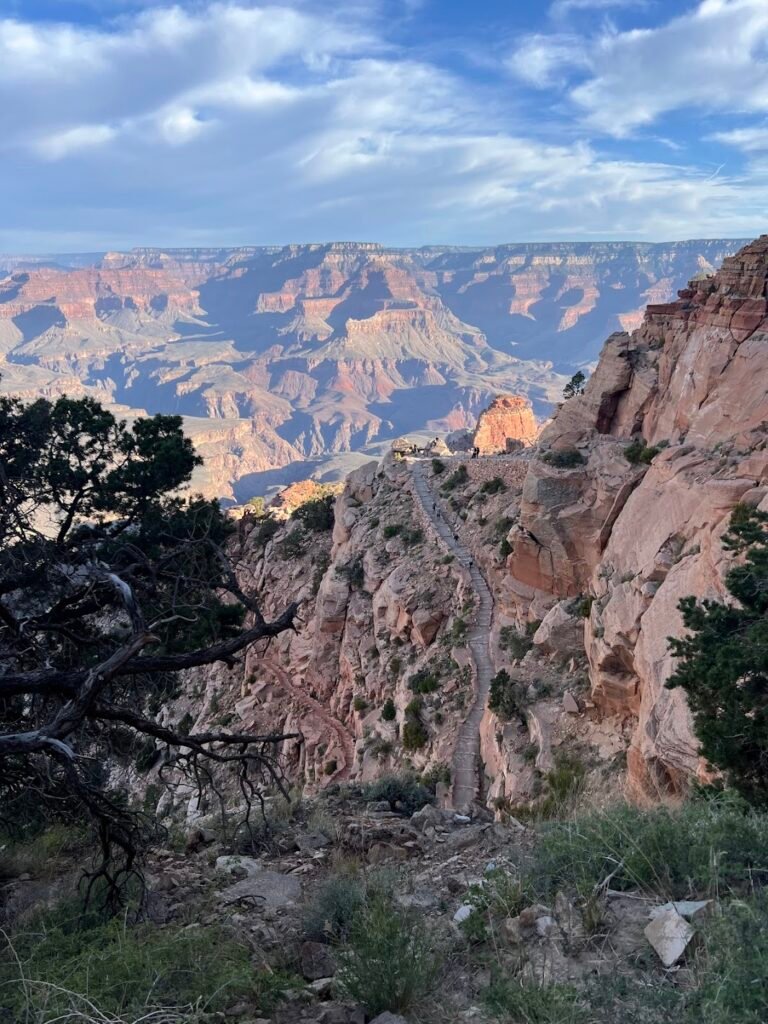
Hike South Kaibab Trail to Ooh Aah Point
South Kaibab Trail at sunrise is sublime. After hiking so many miles the previous days, this <1-mile trail was a joy. Although we descended and then ascended almost 700 feet, the payoff vs. hiking effort was strong. The trail was in great shape with numerous switchbacks to help lessen the burden of the climb. We can’t think of a more perfect name than Ooh Aah.
If you want to combine this hike with more miles, we recommended hitting Ooh Aah first, then doing a portion of the Rim Trail afterwards. We did this and ended up hiking the Rim Trail to the village to get iced coffees at Canyon Adventures (10/10), then meandered back to our car at the trailhead. We hiked 7 miles over the course of about 3 hours.
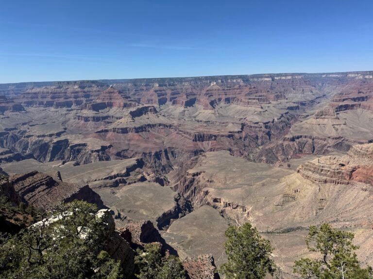
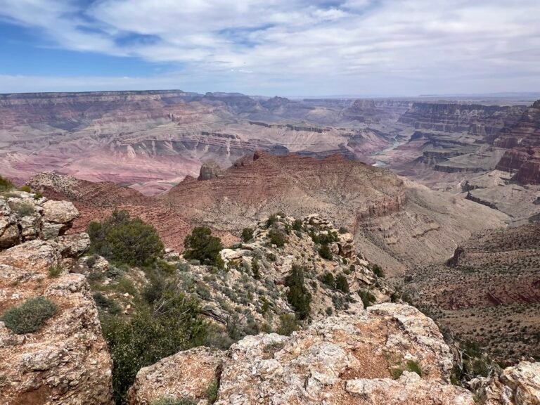
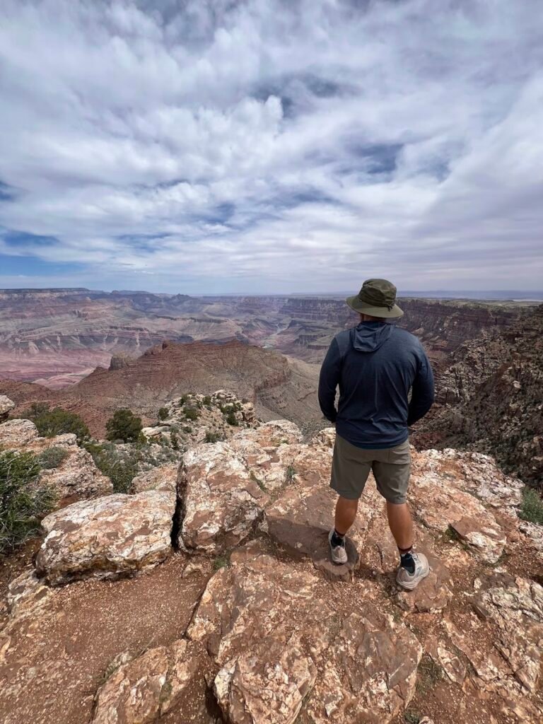
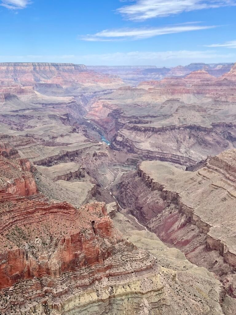
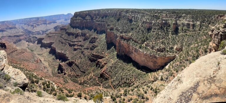
Desert View Drive
Desert View Drive is a scenic 23-mile portion of SR 64 that ends/begins near the East entrance of the park. We spent an early afternoon driving along the Desert View Drive, stopping at most of the points of interest along the way. The park website has a helpful map and description of the overlooks. We really liked Desert View, with its historic Desert View Watchtower, but Navajo Point (the highest overlook on the South Rim) was our favorite thanks to its panoramic views.
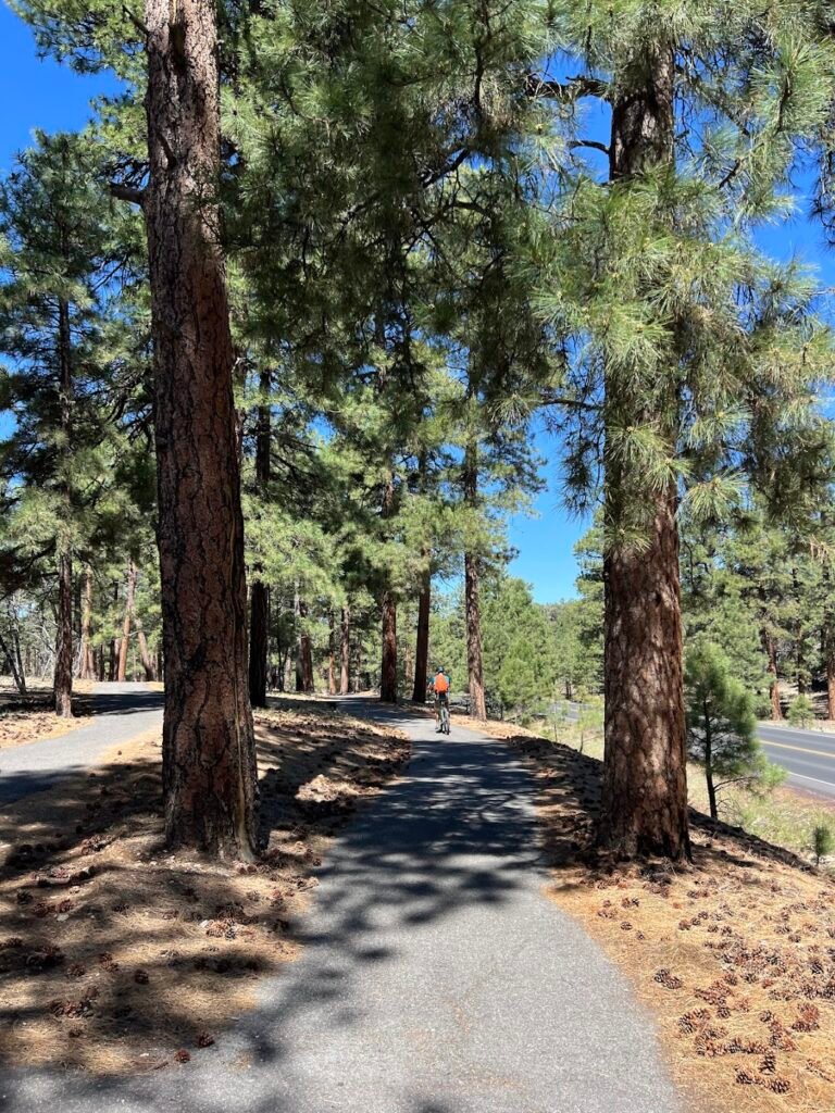
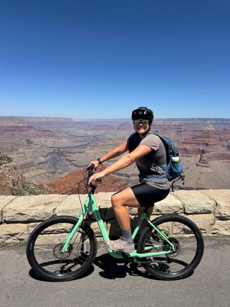
Bike Hermit Road
Hermit Road snakes its way along the canyon rim for 5.5 miles. Closed to public vehicular traffic, it is only used by park shuttles, making it the perfect place for a biking adventure. We made advance reservations (recommended) to rent 8-speed cruiser bikes for 5 hours from Canyon Adventures, located near the South Rim Visitor Center.
The first 2.5 miles of the bike ride was along a gorgeous greenway. The paved trail generally followed alongside the main park road, but was nestled along the trees. We then reached the gate for the road to Hermits Rest where we mostly traveled along the road, but occasionally there was a designated bike path.
Between our out and back we hit every single overlook along the road. Even though they were not that far apart, each provided such a different perspective. And since most people travel out here via park shuttle, if we timed it right we had a private view!
The road was surprisingly hilly and at times, we wished we had rented e-bikes! In fact, over the entire bike ride we gained 1,500 feet of elevation gain. So much for a rest day!
After 7.5 more miles of biking, we arrived at Hermits Rest. Constructed in 1914, it was built as a rest area for tourists at the end of Hermit Road. The views here are epic and after soaking it all in we turned around and pedaled our way back to the bike shop. Total mileage was about 21 miles in just over 4 hours.
Day 14 | Meteor Crater Natural Landmark + Travel to Phoenix
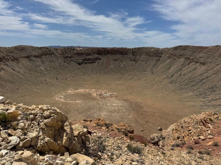
Meteor Crater Natural Landmark
The drive from the Grand Canyon to Phoenix is quite long and we found the perfect way to break it up with a visit to Meteor Crater Natural Landmark. This is the best-preserved meteorite impact site in the world. It is estimated that over 50,000 years ago a 300,00-ton meteorite hit the Earth, leaving behind a 3/4-mile-wide crater.
The sheer enormity of the site was almost hard to take in, even standing at the crater’s edge and peering down.
During our visit, we joined a 45-minute guided walk around a small portion of the crater. Our guide was very informative about the history of the site and the science behind the impact, and this was a highlight of our visit. We also watched a short film about the impact site, walked through the small museum, and went to the (kind of cheesy) 4D theater where we went on a mission to intersect an asteroid that was on a collision course with the planet.
Need to Know
Tickets: We walked right up to the crater and easily purchased tickets onsite. They can, however, be purchased on the crater website. These tickets are good for any day and never expire.
Hours & Admission Fees: Meteor Crater is open daily 8am-5pm. An adult ticket was $29 when we visited but we were able to take advantage of a small discount available to AAA members.
Directions: Meteor Crater is located off I-40 and Route 66. It was a 2-hour drive from the South Rim of the Grand Canyon, and 3 hours from Phoenix. There is a large, free parking lot.
Travel to Phoenix
It was a 3-hour drive from the Meteor Crater Natural Landmark to our hotel in Phoenix. We stayed at the Home2 Suites by Hilton Phoenix Airport North and had a great stay. The hotel seemed to be serving as a base for all kind of adventurers from hikers like us, to a group of rafters meal-prepping in advance of their run down the Colorado.
Drunk Shakespeare & Dinner
Drunk Shakespeare’s schtick is one of the nightly actors has five shots of whiskey, then attempts to perform a major role in a Shakespearean play while the remaining four sober actors try and keep the them (and the script) on track. We were laughing and laughing crying nearly the entire 90-minute performance as hilarity ensued. The show is really fun as an attendee, as the moment you enter the hidden library speakeasy you are handed a shot. You then have the opportunity to purchase a super fancy cocktail of your own. We sat back and sipped on lavender fizzes as we enjoyed the most irreverent performance of Romeo and Juliet ever to take the stage.
We had dinner at Centrico, a restaurant offering modern twists on Mexican classics. We loved our delicious cocktails and shared an appetizer of esquites (Mexican street corn) and made our own sampler platter of tacos. A perfect ending to our trip!